Umpqua, Oregon
For other uses, see Umpqua.
| Umpqua, Oregon | |
|---|---|
| Unincorporated community | |
|
Building housing the Umpqua Post Office | |
 Umpqua, Oregon | |
| Coordinates: 43°21′55″N 123°28′06″W / 43.36528°N 123.46833°WCoordinates: 43°21′55″N 123°28′06″W / 43.36528°N 123.46833°W | |
| Country | United States |
| State | Oregon |
| County | Douglas |
| Established | 1888 |
| Area | |
| • Total | 0.7 sq mi (1.9 km2) |
| • Land | 0.7 sq mi (1.8 km2) |
| • Water | 0.04 sq mi (0.1 km2) |
| Elevation | 322 ft (98 m) |
| Population (2000) | |
| • Total | 112 |
| • Density | 59.3/sq mi (13.2/km2) |
| Time zone | Pacific (UTC-8) |
| • Summer (DST) | Pacific (UTC-7) |
| ZIP code | 97486 |
| Area code(s) | 541 |
| FIPS code | 41-54000[1] |
| GNIS feature ID | 1128405[2] |
| Coordinates and elevation from Geographic Names Information System[2] | |

Umpqua is an unincorporated community in Douglas County, in the U.S. state of Oregon.[2] The population was 112 at the 2000 census.[3]
The community lies west of Sutherlin at the confluence of Calapooya Creek with the Umpqua River.[4]
The word "Umpqua" was first used by the local Native Americans to refer to the locality around the Umpqua River and came to be applied to the river as well.
References
- ↑ "American FactFinder". United States Census Bureau. Retrieved 2008-01-31.
- 1 2 3 "Umpqua". Geographic Names Information System. United States Geological Survey. November 28, 1980. Retrieved March 21, 2016.
- ↑ Summary Population and Housing Characteristics, Oregon: 2000
- ↑ "United States Topographic Map". United States Geological Survey. Retrieved March 21, 2016 – via Acme Mapper.
Municipalities and communities of Douglas County, Oregon, United States | ||
|---|---|---|
| Cities | 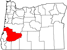 | |
| CDPs | ||
| Unincorporated communities | ||
This article is issued from Wikipedia - version of the 3/22/2016. The text is available under the Creative Commons Attribution/Share Alike but additional terms may apply for the media files.