Winston, Oregon
| Winston, Oregon | |
|---|---|
| City | |
 | |
| Motto: "Home of Wildlife Safari" | |
 Location in Oregon | |
| Coordinates: 43°7′18″N 123°25′3″W / 43.12167°N 123.41750°WCoordinates: 43°7′18″N 123°25′3″W / 43.12167°N 123.41750°W | |
| Country | United States |
| State | Oregon |
| County | Douglas |
| Incorporated | 1955 |
| Government | |
| • Mayor | Sharon Harrison |
| Area[1] | |
| • Total | 2.65 sq mi (6.86 km2) |
| • Land | 2.65 sq mi (6.86 km2) |
| • Water | 0 sq mi (0 km2) |
| Elevation | 545 ft (166 m) |
| Population (2010)[2] | |
| • Total | 5,379 |
| • Estimate (2013[3]) | 5,400 |
| • Density | 2,029.8/sq mi (783.7/km2) |
| Time zone | Pacific (UTC-8) |
| • Summer (DST) | Pacific (UTC-7) |
| ZIP code | 97496 |
| Area code(s) | 541 |
| FIPS code | 41-83400[2] |
| GNIS feature ID | 1129240[4] |
| Website | www.winstonoregon.net |
Winston is a city in Douglas County, Oregon, United States. This city is eighty miles south of Eugene. The population was 5,379 at the 2010 census. It is home to Wildlife Safari.
Geography
According to the United States Census Bureau, the city has a total area of 2.65 square miles (6.86 km2), all of it land.[1]
| Climate data for Winston, Oregon | |||||||||||||
|---|---|---|---|---|---|---|---|---|---|---|---|---|---|
| Month | Jan | Feb | Mar | Apr | May | Jun | Jul | Aug | Sep | Oct | Nov | Dec | Year |
| Record high °F (°C) | 72 (22) |
78 (26) |
85 (29) |
95 (35) |
102 (39) |
106 (41) |
109 (43) |
110 (43) |
105 (41) |
101 (38) |
78 (26) |
73 (23) |
110 (43) |
| Average high °F (°C) | 51 (11) |
55 (13) |
60 (16) |
65 (18) |
72 (22) |
78 (26) |
87 (31) |
87 (31) |
82 (28) |
69 (21) |
56 (13) |
49 (9) |
67.6 (19.9) |
| Average low °F (°C) | 36 (2) |
36 (2) |
38 (3) |
41 (5) |
46 (8) |
51 (11) |
55 (13) |
55 (13) |
50 (10) |
44 (7) |
40 (4) |
36 (2) |
44 (6.7) |
| Record low °F (°C) | 9 (−13) |
3 (−16) |
24 (−4) |
26 (−3) |
29 (−2) |
36 (2) |
41 (5) |
41 (5) |
34 (1) |
21 (−6) |
12 (−11) |
3 (−16) |
3 (−16) |
| Average precipitation inches (mm) | 4.97 (126.2) |
3.88 (98.6) |
3.53 (89.7) |
2.77 (70.4) |
2.12 (53.8) |
.97 (24.6) |
.39 (9.9) |
.43 (10.9) |
.90 (22.9) |
2.25 (57.2) |
5.44 (138.2) |
6.18 (157) |
33.83 (859.4) |
| Average snowfall inches (cm) | 0 (0) |
.30 (0.76) |
0 (0) |
0 (0) |
0 (0) |
0 (0) |
0 (0) |
0 (0) |
0 (0) |
0 (0) |
0 (0) |
.40 (1.02) |
0.7 (1.78) |
| Source #1: The Weather Channel [5] | |||||||||||||
| Source #2: Intellicast [6] | |||||||||||||
Demographics
| Historical population | |||
|---|---|---|---|
| Census | Pop. | %± | |
| 1960 | 2,395 | — | |
| 1970 | 2,468 | 3.0% | |
| 1980 | 3,359 | 36.1% | |
| 1990 | 3,773 | 12.3% | |
| 2000 | 4,613 | 22.3% | |
| 2010 | 5,379 | 16.6% | |
| Est. 2015 | 5,393 | [7] | 0.3% |
2010 census
As of the census of 2010, there were 5,379 people, 2,140 households, and 1,483 families residing in the city. The population density was 2,029.8 inhabitants per square mile (783.7/km2). There were 2,316 housing units at an average density of 874.0 per square mile (337.5/km2). The racial makeup of the city was 92.5% White, 0.3% African American, 1.6% Native American, 0.9% Asian, 0.1% Pacific Islander, 1.1% from other races, and 3.5% from two or more races. Hispanic or Latino of any race were 4.5% of the population.[2]
There were 2,140 households of which 33.8% had children under the age of 18 living with them, 48.2% were married couples living together, 14.3% had a female householder with no husband present, 6.8% had a male householder with no wife present, and 30.7% were non-families. 24.0% of all households were made up of individuals and 10.5% had someone living alone who was 65 years of age or older. The average household size was 2.50 and the average family size was 2.87.[2]
The median age in the city was 38.9 years. 24.5% of residents were under the age of 18; 8.1% were between the ages of 18 and 24; 24% were from 25 to 44; 26.2% were from 45 to 64; and 17% were 65 years of age or older. The gender makeup of the city was 48.6% male and 51.4% female.[2]
2000 census
As of the census of 2000, there were 4,613 people, 1,753 households, and 1,269 families residing in the city. The population density was 2,152.5 people per square mile (832.3/km²). There were 1,892 housing units at an average density of 882.8 per square mile (341.4/km²). The racial makeup of the city was 94.58% White, 0.15% African American, 1.37% Native American, 0.52% Asian, 0.07% Pacific Islander, 1.24% from other races, and 2.08% from two or more races. Hispanic or Latino of any race were 2.84% of the population.[2]
There were 1,753 households out of which 37.6% had children under the age of 18 living with them, 52.6% were married couples living together, 15.2% had a female householder with no husband present, and 27.6% were non-families. 21.8% of all households were made up of individuals and 9.8% had someone living alone who was 65 years of age or older. The average household size was 2.61 and the average family size was 2.99.[2]
In the city the population was spread out with 28.8% under the age of 18, 9.9% from 18 to 24, 26.6% from 25 to 44, 20.5% from 45 to 64, and 14.2% who were 65 years of age or older. The median age was 34 years. For every 100 females there were 93.2 males. For every 100 females age 18 and over, there were 87.3 males.[2]
The median income for a household in the city was $28,939, and the median income for a family was $36,006. Males had a median income of $30,909 versus $18,555 for females. The per capita income for the city was $13,299. About 13.7% of families and 16.9% of the population were below the poverty line, including 24.8% of those under age 18 and 11.8% of those age 65 or over.[2]
Education
Winston is home to the Winston-Dillard School District. The district consists of Douglas High School, Winston Middle School, Brockway Elementary, McGovern Elementary and Lookingglass Elementary. Winston is also the home of a K-12 private school, Umpqua Valley Christian School.
Notable people
- Josh Bidwell, professional football player, punter for the Green Bay Packers and Tampa Bay Buccaneers
- Troy Polamalu, professional football player, strong safety for the Pittsburgh Steelers. He played in Super Bowl XL, Super Bowl XLIII and Super Bowl XLV
Sister city
Winston has two sister cities:
References
- 1 2 "US Gazetteer files 2010". United States Census Bureau. Retrieved 2012-12-21.
- 1 2 3 4 5 6 7 8 9 "American FactFinder". United States Census Bureau. Retrieved 2012-12-21.
- ↑ "Population Estimates". United States Census Bureau. Retrieved 2013-06-02.
- ↑ "US Board on Geographic Names". United States Geological Survey. 2007-10-25. Retrieved 2008-01-31.
- ↑ "Monthly Averages for Winston, OR". The Weather Channel. Retrieved 2012-02-08.
- ↑ "Monthly Averages for Winston, OR". Retrieved 2015-08-10.
- ↑ "Annual Estimates of the Resident Population for Incorporated Places: April 1, 2010 to July 1, 2015". Retrieved July 2, 2016.
- ↑ "Census of Population and Housing". Census.gov. Retrieved June 4, 2015.
External links
 Media related to Winston, Oregon at Wikimedia Commons
- Entry for Winston in the Oregon Blue Book
Municipalities and communities of Douglas County, Oregon, United States | ||
|---|---|---|
| Cities | 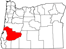 | |
| CDPs | ||
| Unincorporated communities | ||