U.S. Route 421 in North Carolina
| ||||
|---|---|---|---|---|
|
Route of US 421 in North Carolina highlighted in red | ||||
| Route information | ||||
| Maintained by NCDOT | ||||
| Length: | 328 mi[1] (528 km) | |||
| Existed: | 1931 – present | |||
| Major junctions | ||||
| South end: | Fort Fisher | |||
| ||||
| North end: |
| |||
| Location | ||||
| Counties: | New Hanover, Brunswick, Pender, Sampson, Harnett, Lee, Chatham, Randolph, Guilford, Forsyth, Yadkin, Wilkes, Watauga | |||
| Highway system | ||||
| ||||


U.S. Route 421 (US 421) traverses approximately 328 miles (528 km) across North Carolina; from Fort Fisher, on Pleasure Island between the Atlantic Ocean and Cape Fear River, to the Tennessee state line near the community of Zionville. The highway is nominally labeled "north" and "south" throughout North Carolina, though it really follows a general northwest-southeast path, and the segment from Greensboro to Boone is almost due east-west, with compass west corresponding to the signed north direction.
A majority of the highway is part of the North Carolina Strategic Highway Corridors system.[2] Because of this designation, the state has made numerous changes converting a rural two-lane highway into a major freeway/expressway with 4 or more 6 lanes. Numerous former segments of the highway named "Old U.S. Route 421" are found along the entire route.
Route description


New Hanover County
US 421 starts at a parking/dock area on the Cape Fear side of Pleasure Island; within one-quarter mile (0.40 km), the Fort Fisher Ferry Terminal is located where travelers can ride a ferry to North Carolina Highway 211 (NC 211) and Southport. Immediately after the ferry terminal is the Fort Fisher State Recreation Area, where the first and second battles of Fort Fisher took place.
The highway continues north, going through popular tourist destinations in New Hanover county: Kure Beach, and Carolina Beach. US 421 eventually enters Wilmington along the river side of the city. At Wooster Street, it goes west, overlapping with several other highways and funnels through Brunswick County before returning in northwestern New Hanover County; there it links with Interstate 140 (I-140) before continuing north towards Clinton.[1]
Down East
From about three miles (4.8 km) north of the I-140 interchange, the road remains a four-lane divided highway for another ten miles (16 km). After its intersection with NC 210, it becomes a rural two-lane highway for much of its remainder until Dunn. The exception is in Clinton, where it follows Faircloth Freeway to bypass the city, running concurrent to US 701 for about four miles (6.4 km). There is one rest area located just north of Delway.[3] Most travelers in this corridor today use I-40, which parallels US 421 ten miles (16 km) to its east.[1] Thus, it is unlikely that this section of US 421 will ever be upgraded as it has been throughout much of the state.
After crossing downtown Dunn and Erwin immediately to the east, US 421 becomes a four-lane divided highway again until reaching Lillington, with a short segment in Buies Creek containing a center lane and reduced speed limit as it crosses Campbell University. Upon reaching the junction with US 401, NC 27, and NC 210, all four routes collect onto a thoroughfare heading south over the Cape Fear River into downtown Lillington. US 421 then splits off to the west, becoming a two-lane expressway until Sanford (though speed limit never actually increases).[1]
Lee County to Randolph County
Upon reaching Sanford, US 421 formerly followed Horner Boulevard with NC 87 to cross downtown, but it is now rerouted onto the recently completed Sanford Bypass, the entirety of which is freeway. It runs concurrent with NC 87 Bypass until the US 1/US 15/US 501/NC 87 interchange, from which it continues until the end of the bypass near Cumnock.[1] The Sanford Bypass improves greatly upon the efficiency and consistency of the route between Greensboro and Fayetteville, and will alleviate heavy commercial traffic from Horner Boulevard and other major routes crossing downtown.
For the rest of its route until Greensboro, US 421 remains almost entirely free-flowing. It is an expressway from Sanford to just south of Siler City, bypassing Goldston, Bear Creek, and Siler City. From here to the Greensboro Urban Loop, US 421 becomes a freeway, bypassing Staley, Liberty, and Julian. All of these cities/places were connected by US 421's old alignment, now called some variant of Old US 421 for the majority of its route.[1]
Piedmont Triad
Near Pleasant Garden, US 421 transitions from an expressway to a freeway by overlapping with I-85; it also goes west from this point until Sugar Grove. As the modern eight-lane I-85/US 421 overlap loops south of Greensboro, it soon connects with I-73 and switches to overlap it. Another six miles (9.7 km) later, it switches again to I-40 and continues on towards Winston-Salem. Near Kernersville, US 421 switches one last time with Business Loop I-40 going into downtown Winston-Salem. The freeway section through Winston-Salem is the oldest in the Triad and will typically have some construction for either road or bridge repair; people can bypass the downtown area by staying on I-40 then taking exit 188, where US 421 meets up again.[1]
Western Piedmont and Foothills
At either exit 1 (via Business Loop I-40) or exit 188 (via I-40), US 421 separates toward Yadkinville. From Winston-Salem to Wilkesboro, US 421 continues on four-lane freeway, much of which was built between 1992-2002. This section of the highway is mostly farmland, with only Yadkinville as a viable place to stop for food and drink.[1] When the highway nears North Wilkesboro, drivers will be able to see the North Wilkesboro Speedway (access via exit 282); there is also a visitor center built in 2009 as the state's first environmentally friendly rest area, located at mile marker 283.[3] As US 421 enters Wilkesboro city limits, it downgrades to an expressway with various stores and restaurants along it.[1] Travelers should anticipate higher traffic volumes between US 421 Business junction and NC 16 junction in Wilkesboro.
The High Country
As it leaves Wilkesboro, US 421 begins a gradual climbs up the Blue Ridge Mountains, until approximately five miles (8.0 km) from Deep Gap where it climbs up significantly. Compared to US 221 and US 321 that head towards Boone, US 421 is considered the safest by being the least steep and curvy route. Access to the Blue Ridge Parkway is located at Deep Gap, as US 421 continues on towards Boone.[1]
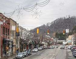
As US 421 approaches Boone, the expressway comes to an end just before an intersection with Old US 421. The road continues into Boone as four lanes, dropping down to two lanes as it reaches the intersection with US 321. US 321 north, US 421 north, and NC 194 south all run concurrent through the downtown area via King Street. Traffic is typically bumper-to-bumper, so drivers can follow the US 421 truck route to the NC 105 Bypass (SR 1107) as an alternate to avoid the downtown area. Boone is also unique in that sister routes US 221 and US 321 connect at various points in town; however only the truck Routes of US 221, US 321, and US 421 join together as they overlap with NC 105 going southwest around town. After leaving Boone, US 421 continues on as a two-lane road to the Tennessee state line, heading on to Mountain City.[1]
US 421 overlaps with two state scenic byways: the Cape Fear Historic Byway, in downtown Wilmington, and the U.S. 421 Scenic Byway, between Deep Gap and Boone.[4] Two of North Carolina's Bicycle Routes run concurrent for portions of US 421. North Carolina Bicycle Route 5 is concurrent from US 421's southern terminus at Fort Fisher to north of Snows Cut, through downtown Wilmington to Blueberry Road near Montague, North Carolina, and a short portion near Coats.[5] A small part of North Carolina Bicycle Route 3 is concurrent with US 421 in downtown Wilmington.[6]
History

- 1931 - US 421 officially appears on highway maps starting from Winston-Salem (junction with US 70/170) to Boone at King/Hardin Street intersection (junction with US 221/321). It was solely within the state of North Carolina and was completely overlapped with NC 60.[7]
- 1932 - US 421 was extended both north and south. North from Boone, it extended to Sugar Grove where it then replaced US 321 heading towards Mountain City, Tennessee; US 321 redirects towards Elizabethton, Tennessee. From Winston-Salem, the highway is routed to Wilmington following NC 60.[7]
- 1933 - Highway was realigned around Boone (using a straighter alignment) and in Greensboro (Market Street).[7]
- 1934 - NC 60 is completely removed from its original route, leaving US 421. NC 60 gets renumbered on a short highway in Cherokee county, where it continues to this day.
- 1936 - US 421 is extended south from Wilmington to Carolina Beach, Kure Beach, and Fort Fisher, replacing NC 40.[7]
- 1951-1952 - US 421 bypasses Clinton (on what would be today's Faircloth Freeway). The Wilkesboro area is realigned through town to North Wilkesboro.[7]
- 1954-1955 - US 421 is rerouted going west out of Wilmington via US 17/74/76, then north following NC 133.[7]
- 1957-1958 - US 421 is realigned onto a straighter routing between Deep Gap to Wilkesboro. US 421 is redirected out of North Wilkesboro, old routing is rebranded as US 421-A (Now US 421 Business). US 421 is placed onto one-way streets within Winston-Salem (using 4th and 5th streets), it is also rerouted in Greensboro going from Market Street to Henry Blvd Freeway. Between Erwin and Dunn, US 421 is realigned onto a new four-lane expressway.[7]
- 1962-1963 - US 421 is realigned onto a new road near Sugar Grove and Zionville, leaving the communities of Amantha and Mabel. Between Yadkinville and Winston-Salem, US 421 is given its current alignment, expanding to a freeway after the Yadkin River to I-40; it then overlaps with I-40 through downtown Winston-Salem. In Harnett county, US 421 is moved north, avoiding the community of Mamers, and enters Lillington via Front Street. US 421 is straighten out through Harrells.[7]
- 1964-1968 - US 421 becomes one-way streets through downtown Greensboro (Market Street and Madison/Gaston Avenues). US 421 is rerouted onto the new Faircloth Freeway in Clinton.[7]
- 1969-1970 - US 421 is rerouted onto the new Cape Fear Bridge in Wilmington. US 421 is realigned around Bonlee and Bear Creek.[7]
- 1971-1984 - US 421 completes its bypass around Wilkesboro. Between Greensboro and Staley is upgraded to expressway standards (Joseph M. Hunt Jr Expressway) and bypasses the communities of Pleasant Garden, Climax, Julian, and Liberty. US 421 is rerouted in Sanford, avoiding the community of Broadway.[7]
- 1987-1990 - The Siler City bypass is completed. US 421 is rerouted going north around Greensboro then going south on Henry Boulevard (US 29).[7]
- 1994-1999 - US 421 is removed from all surface roads from Kernersville to Greensboro, follows I-40 to Joseph M. Hunt Jr Expressway.[7]
- 2000-2003 - US 421 is realigned and widen to 4-lane freeway between Yadkinville to Wilkesboro and a 4-lane expressway between Wilkesboro to Boone (though some parts already pre-existed for before 2000). This completes US 421 as a 4-lane (or more) highway from Sanford to Boone.
- 2008 - US 421 is realigned in Greensboro to follow the new southern loop, overlapping with I-73 and I-85 to Joseph M. Hunt Jr Expressway. This was done to give drivers a route direction to Winston-Salem after I-40 returned to its original routing after one year on the southern loop.
- 2012 - In Boone, a 1.1-mile (1.8 km) section, known as King Street, was widened to four to six lanes with a raised concrete median from US 321 (Hardin Street) to east of NC 194 (Jefferson Road). The project cost $16.2 million.[8]
Future
In Kernersville, the roadway improvements and extension of Macy Grove Road will include the construction of a new interchange with I-40 Business/US 421. Property acquisition is to begin in 2012.[9][10]
In Winston-Salem, shared with I-40 Business, a 1-mile (1.6 km) section from west of Fourth Street to east of Church Street has begun project development studies to completely upgrade and streamline. The project includes removing the existing pavement and replacing it with new concrete pavement, upgrade and modernize entrance and exit ramps, and replace most of the bridges on and over the freeway. No cost or time frame has been given at this time.[11][12]
In New Hanover and Brunswick counties, the Cape Fear Skyway has begun its project development studies (since 2007) to build a toll road and bridge that will bypass Wilmington. Early estimates range from $950 million to $1.1 billion. The environmental impact study is expected to be completed in 2014, a record of decision and a complete financial feasibility will be done in 2015.[13][14]
Junction list
| County | Location | mi[1] | km | Exit | Destinations | Notes | |
|---|---|---|---|---|---|---|---|
| New Hanover | Fort Fisher | 0.2 | 0.32 | US 421 begins .2 miles (0.32 km) south of terminal; Fort Fisher-Southport Ferry | |||
| Myrtle Grove | 13.5 | 21.7 | Southern terminus of NC 132 | ||||
| Wilmington | 15 | 24 | |||||
| 18 | 29 | East end of US 76 overlap, north end of US 17 Business overlap | |||||
| 19 | 31 | Front Street | Partial interchange | ||||
| Brunswick | | 21 | 34 | South end of US 17/US 17 Business/NC 133 overlap, west end of US 74/76 overlap | |||
| New Hanover | | 22 | 35 | U.S.S. North Carolina Road/Battleship Road | To the N.C. Battleship | ||
| | 24 | 39 | East end of US 74 overlap, north end of NC 133 overlap | ||||
| | 25.5 | 41.0 | North end of US 17 overlap | ||||
| Pender | Long Creek | 38.5 | 62.0 | Also to Moores Creek National Battlefield on west NC 210 | |||
| Malpass Corner | 44 | 71 | South end of NC 11 overlap | ||||
| | 52 | 84 | North end of NC 11 overlap | ||||
| Sampson | Harrells | 60 | 97 | ||||
| Delway | 65 | 105 | |||||
| Clinton | 79 | 127 | South end of US 701 overlap | ||||
| 80 | 130 | ||||||
| 81 | 130 | Southbound entrance and northbound exit, east end of NC 24 overlap | |||||
| 82 | 132 | West end of NC 24 overlap | |||||
| 83 | 134 | North end of US 701 overlap | |||||
| | 95 | 153 | South end of NC 242 overlap | ||||
| Spivey's Corner | 99 | 159 | |||||
| 100 | 160 | North end of NC 242 overlap | |||||
| Harnett | Dunn | 109 | 175 | East end of NC 55 overlap | |||
| 110 | 180 | ||||||
| Erwin | 114 | 183 | West end of NC 55 overlap | ||||
| | 119 | 192 | East end of NC 27 overlap; Harnett County Airport at intersection | ||||
| Lillington | 124 | 200 | North end of US 401 and NC 210 overlap | ||||
| 125 | 201 | South end of US 401/NC 210 overlap, east end of NC 27 overlap | |||||
| Lee | Sanford | 143 | 230 | South end of NC 87 Bypass overlap | |||
| 144 | 232 | 144 | |||||
| 145 | 233 | 145 | Kelly Drive | ||||
| 148 | 238 | 148 | Colon Road | ||||
| | 149 | 240 | 149 | Signed as exits 149A (north) and 149B (south); north end of NC 87 Bypass overlap | |||
| | 153 | 246 | 153 | ||||
| Chatham | Goldston | 159 | 256 | 159 | Pittsboro-Goldston Road | ||
| | 163 | 262 | |||||
| | 168 | 270 | 168 | Sam Fields Road – Siler City | |||
| Siler City | 171 | 275 | 171 | ||||
| | 174 | 280 | 174 | Piney Grove Church Road | |||
| Randolph | Staley | 180 | 290 | 180 | Old US Highway 421 – Liberty, Staley | ||
| Liberty | 181 | 291 | 181 | ||||
| 184 | 296 | Old Liberty Road – Liberty | |||||
| Guilford | Julian | 190 | 310 | 192 | |||
| | 194.3 | 312.7 | 194 | Woody Mill Road / Company Mill Road – Climax | |||
| | 196 | 315 | 196 | Neeley Road / Williams Dairy Road – Climax | |||
| | 197 | 317 | 197 | North end of I-85 overlap | |||
| US 421 overlaps with Interstate 85 (exits 126 to 121), Interstate 73 (exits 97 to 103), Interstate 40 (exits 212 to 206), and Interstate 40 Business (exits 16 to 1). | |||||||
| Forsyth | Winston-Salem | 234 | 377 | 238 | West end of Interstate 40 Business overlap | ||
| 235 | 378 | 239 | Jonestown Road | ||||
| 236 | 380 | 240 | Peace Haven Road | ||||
| Lewisville | 238 | 383 | 242 | Lewisville-Clemmons Road – Lewisville, Clemmons | |||
| 240 | 390 | 244 | Williams Road – Lewisville | ||||
| | 242 | 389 | 246 | Shallowford Road | |||
| Yadkin | | 245 | 394 | 249 | Dinkins Bottoms Road/Baltimore Road | ||
| | 247 | 398 | 251 | Spear Bridge Road | |||
| | 249 | 401 | 253 | Shacktown Road/Old Stage Road | |||
| | 252 | 406 | 256 | Unifi Industrial Road | |||
| Yadkinville | 253 | 407 | 257 | ||||
| | 255 | 410 | 259 | Reavis Road | |||
| Brooks Crossroads | 259 | 417 | 263 | ||||
| 260 | 420 | 264 | Asbury Church Road | ||||
| | 262 | 422 | 265 | Northbound is exit 265A, southbound is exit 265B | |||
| | 264 | 425 | 267 | Windsor Road/Oak Grove Church Road | |||
| Wilkes | | 267 | 430 | 270 | Dennyville Road | ||
| | 269 | 433 | 272 | ||||
| | 273 | 439 | 276 | ||||
| | 274 | 441 | 277 | Windy Gap Road/Speedway Road | |||
| | 279 | 449 | 282 | ||||
| Wilkesboro | 282 | 454 | 285 | Brushy Mountain Road – Wilkesboro | |||
| 283 | 455 | 286A | South end of NC 16 overlap | ||||
| 283.5 | 456.2 | 286B | |||||
| 284 | 457 | ||||||
| 287 | 462 | North end of NC 16 overlap | |||||
| Watauga | Deep Gap | 304 | 489 | Blue Ridge Parkway | |||
| 305 | 491 | North end of US 221 overlap | |||||
| Boone | 313 | 504 | North end of NC 194 overlap | ||||
| 314 | 505 | South end of US 221 overlap | |||||
| 314.5 | 506.1 | South end of US 321 overlap | |||||
| Vilas | 320 | 510 | South end of NC 194 overlap | ||||
| Sugar Grove | 321 | 517 | North end of US 321 overlap | ||||
| | 328 | 528 | Continuation into Tennessee | ||||
1.000 mi = 1.609 km; 1.000 km = 0.621 mi
| |||||||
Note – Exit numbers west of Winston-Salem are aligned when US 421 went north around Greensboro in late-1980s/early-1990s. As a result, from realignments in Greensboro, the actual mileage vs. exit number mileage is off by an average of 3.5 miles (5.6 km).
Alternate names
Though the highway is commonly known as "421" throughout the state, the highway does have other known names it uses locally in areas.
- Burnett Boulevard - Road name briefly used in Wilmington, between Carolina Beach Road and 3rd Street.
- Carolina Beach Road - Road name from Seabreeze to Burnett Boulevard in Wilmington.
- Cornelius Harnett Boulevard - Road name from Main Street to Lillington city limit.
- Cumberland Street - Road name within Dunn city limits.
- Delway Highway - Road name between Harrells to Delway in Sampson county.
- Doc and Merle Watson Highway - Official name of highway between the Wilkes/Watauga county line to Boone.[15]
- Faircloth Freeway - Road name within Clinton city limits.
- Fort Fisher Boulevard - Road name from Kure Beach to south terminus of US 421.
- Front Street - Road name from main street to Lillington city limit.
- King Street - Road name within Boone city limits.
- Lake Park Boulevard - Road name within Carolina Beach city limits.
- Jackson Boulevard - Road name within Erwin city limits.
- Joseph M. Hunt Jr Expressway - Road name from Randolph/Guilford county line to I-85; expressway continues on into Greensboro, which was an old US 421 alignment.
- Paul Green Memorial Highway - Road Name from Erwin to Lillington.
- Plain View Highway - Road name from US 13 in Spivey's Corner to I-95 near Dunn.
- Main Street - Road name between Cornelius Harnett Boulevard and Front Street in Lillington.
- Northwest Boulevard - Road name from Clinton to Kitty Fork.
- Spivey's Corner Highway - Road name from Kitty Fork to US 13 in Spivey's Corner.
- Taylors Bridge Highway - Road name from Delway to Clinton.
- Watson Brame Expressway - Road name throughout Wilkes county.
- Wilmington Highway - Road name from the Sampson/Pender county line to Harrells.
See also
References
- 1 2 3 4 5 6 7 8 9 10 11 12 Google (January 31, 2011). "US 421 in NC" (Map). Google Maps. Google. Retrieved January 31, 2011.
- ↑ "NCDOT: Strategic Highway Corridors". Retrieved October 28, 2010.
- 1 2 "NCDOT: North Carolina Rest Area System". Retrieved 2011-01-27.
- ↑ "NCDOT: Scenic Byways". Retrieved January 7, 2011.
- ↑ "NC 5 - Cape Fear Run". North Carolina Bike Routes Beta. Walk Bike North Carolina Bicycle Routes. Retrieved June 6, 2016.
- ↑ "NC 3 - Ports of Call". North Carolina Bike Routes Beta. Walk Bike North Carolina Bicycle Routes. Retrieved June 6, 2016.
- 1 2 3 4 5 6 7 8 9 10 11 12 13 "NCRoads.com: U.S. 421". Retrieved January 27, 2013.
- ↑ http://www2.wataugademocrat.com/News/story/421-widening-project-nearly-done-id-007879
- ↑ "NCDOT: Macy Grove Road Improvements Project". Retrieved November 24, 2011.
- ↑ "NCDOT: Macy Grove Road Improvements Project Map" (PDF). Retrieved November 24, 2011.
- ↑ "NCDOT: Business 40". Retrieved November 24, 2011.
- ↑ "NCDOT: Business 40 Project Vicinity and Study Area Map" (PDF). Retrieved November 24, 2011.
- ↑ "NCDOT: Cape Fear Skyway". Retrieved November 24, 2011.
- ↑ "NCDOT: Cape Fear Skyway Project Map" (PDF). Retrieved November 24, 2011.
- ↑ http://www.ncdot.gov/doh/preconstruct/traffic/teppl/Topics/N-01/Sorted%20by%20County.pdf
External links
 Media related to U.S. Route 421 in North Carolina at Wikimedia Commons
| Previous state: Terminus |
North Carolina | Next state: Tennessee |