Lillington, North Carolina
| Lillington | |
|---|---|
| Town | |
| Lillington, North Carolina | |
|
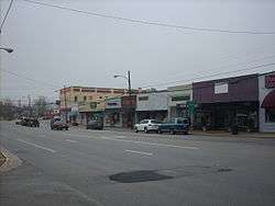
Downtown Lillington | |
| Motto: "Welcome to the Heart of Harnett County" | |
 Location of Lillington, North Carolina | |
| Coordinates: 35°23′55″N 78°48′49″W / 35.39861°N 78.81361°WCoordinates: 35°23′55″N 78°48′49″W / 35.39861°N 78.81361°W | |
| Country | United States |
| State | North Carolina |
| County | Harnett |
| Government | |
| • Type | Board of Commissioners |
| • Mayor | Glenn McFadden |
| Area | |
| • Total | 4.0 sq mi (10.4 km2) |
| • Land | 4.0 sq mi (10.3 km2) |
| • Water | 0.0 sq mi (0.1 km2) |
| Elevation | 197 ft (60 m) |
| Population (2010)[1] | |
| • Total | 3,194 |
| • Estimate (2013)[2] | 3,408 |
| • Density | 730.5/sq mi (282.1/km2) |
| Time zone | Eastern (EST) (UTC-5) |
| • Summer (DST) | EDT (UTC-4) |
| ZIP code | 27546 |
| Area code(s) | 910 |
| FIPS code | 37-38220[3] |
| GNIS feature ID | 1021150[4] |
| Website | Town Website |
Lillington is a town in Harnett County, North Carolina, United States. The population was 3,194 at the 2010 census. It is the county seat of Harnett County.[5] Lillington is a part of the Dunn Micropolitan Area, which is also a part of the greater Raleigh–Durham–Cary Combined Statistical Area (CSA) as defined by the United States Census Bureau.
Geography
Lillington is located at 35°23′55″N 78°48′49″W / 35.39861°N 78.81361°W (35.398586, -78.813497).[6]
According to the United States Census Bureau, the town has a total area of 4.0 square miles (10 km2), of which, 4.0 square miles (10 km2) of it is land and 0.04 square miles (0.10 km2) of it (0.99%) is water.
History
A post office called Lillington has been in operation since 1874.[7] The town of Lillington is named for John Alexander Lillington (c. 1725–1786), aka Alexander John Lillington, who was a Patriot officer from North Carolina in the American Revolutionary War who notably fought in the Battle of Moore's Creek Bridge in 1776 and served as brigadier general in the state militia.[8]
The Summer Villa and the McKay-Salmon House and Summerville Presbyterian Church and Cemetery are listed on the National Register of Historic Places.[9]
Demographics
| Historical population | |||
|---|---|---|---|
| Census | Pop. | %± | |
| 1880 | 98 | — | |
| 1900 | 65 | — | |
| 1910 | 380 | 484.6% | |
| 1920 | 593 | 56.1% | |
| 1930 | 752 | 26.8% | |
| 1940 | 914 | 21.5% | |
| 1950 | 1,061 | 16.1% | |
| 1960 | 1,242 | 17.1% | |
| 1970 | 1,155 | −7.0% | |
| 1980 | 1,948 | 68.7% | |
| 1990 | 2,048 | 5.1% | |
| 2000 | 2,915 | 42.3% | |
| 2010 | 3,194 | 9.6% | |
| Est. 2015 | 3,476 | [10] | 8.8% |
| U.S. Decennial Census[11] 2013 Estimate[2] | |||
As of the census of 2000, there were 2,915 people, 799 households, and 484 families residing in the town. The population density was 730.5 people per square mile (282.1/km²). There were 894 housing units at an average density of 224.0 per square mile (86.5/km²). The racial makeup of the town was 54.75% White, 40.55% African American, 0.79% Native American, 0.45% Asian, 0.10% Pacific Islander, 2.16% from other races, and 1.20% from two or more races. Hispanic or Latino of any race were 4.08% of the population.
There were 799 households out of which 25.8% had children under the age of 18 living with them, 39.5% were married couples living together, 18.0% had a female householder with no husband present, and 39.4% were non-families. 33.9% of all households were made up of individuals and 17.6% had someone living alone who was 65 years of age or older. The average household size was 2.26 and the average family size was 2.88.
In the town the population was spread out with 15.2% under the age of 18, 8.9% from 18 to 24, 40.4% from 25 to 44, 17.5% from 45 to 64, and 17.9% who were 65 years of age or older. The median age was 37 years. For every 100 females there were 141.9 males. For every 100 females age 18 and over, there were 154.1 males.
The median income for a household in the town was $30,670, and the median income for a family was $42,366. Males had a median income of $30,305 versus $23,214 for females. The per capita income for the town was $13,664. About 12.4% of families and 20.3% of the population were below the poverty line, including 31.2% of those under age 18 and 20.4% of those age 65 or over.
See also
References
- ↑ "American FactFinder". United States Census Bureau. Retrieved 2014-10-17.
- 1 2 "Population Estimates". United States Census Bureau. Retrieved 2014-10-17.
- ↑ "American FactFinder". United States Census Bureau. Retrieved 2008-01-31.
- ↑ "US Board on Geographic Names". United States Geological Survey. 2007-10-25. Retrieved 2008-01-31.
- ↑ "Find a County". National Association of Counties. Retrieved 2011-06-07.
- ↑ "US Gazetteer files: 2010, 2000, and 1990". United States Census Bureau. 2011-02-12. Retrieved 2011-04-23.
- ↑ "Harnett County". Jim Forte Postal History. Retrieved 16 June 2015.
- ↑ Gannett, Henry (1905). The Origin of Certain Place Names in the United States. U.S. Government Printing Office. p. 186.
- ↑ National Park Service (2010-07-09). "National Register Information System". National Register of Historic Places. National Park Service.
- ↑ "Annual Estimates of the Resident Population for Incorporated Places: April 1, 2010 to July 1, 2015". Retrieved July 2, 2016.
- ↑ United States Census Bureau. "Census of Population and Housing". Retrieved October 17, 2014.
External links
Municipalities and communities of Harnett County, North Carolina, United States | ||
|---|---|---|
| City |  | |
| Towns | ||
| CDPs | ||
| Unincorporated communities | ||
| Footnotes | ‡This populated place also has portions in an adjacent county or counties | |