Tumu, Ghana
For the border checkpoint in Libya, see Tumu, Libya.
| Tumu | |
|---|---|
| District Capital | |
 Tumu Location of Tumu in Upper West region | |
| Coordinates: 10°53′N 1°59′W / 10.883°N 1.983°W | |
| Region | Upper West Region |
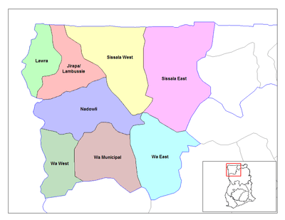
| District | Sissala East District |
| Elevation | 1,033 ft (315 m) |
| Population (2013) | |
| • Total | — |
Tumu is a small town and is the capital of Sissala East district, a district in the Upper West Region of north Ghana.[1] Tumu is connected by road to the town of Navrongo.
References
| Municipal |
|  |
|---|---|---|
| District |
| |
Coordinates: 10°53′N 1°59′W / 10.883°N 1.983°W
This article is issued from Wikipedia - version of the 2/9/2016. The text is available under the Creative Commons Attribution/Share Alike but additional terms may apply for the media files.