Triumph, Louisiana
| Triumph, Louisiana | |
|---|---|
| Census-designated place & Unincorporated community | |
|
The Three Crosses Community Prayer Center, Triumph | |
 Triumph, Louisiana  Triumph, Louisiana | |
| Coordinates: 29°20′22″N 89°28′36″W / 29.33944°N 89.47667°WCoordinates: 29°20′22″N 89°28′36″W / 29.33944°N 89.47667°W | |
| Country | United States |
| State | Louisiana |
| Parish | Plaquemines |
| Area[1] | |
| • Total | 4.024 sq mi (10.42 km2) |
| • Land | 2.784 sq mi (7.21 km2) |
| • Water | 1.240 sq mi (3.21 km2) |
| Elevation | 7 ft (2 m) |
| Population (2010)[2] | |
| • Total | 216 |
| • Density | 54/sq mi (21/km2) |
| Time zone | Central (CST) (UTC-6) |
| • Summer (DST) | CDT (UTC-5) |
| Area code(s) | 504 |
| GNIS feature ID | 558335[3] |

Triumph (French: Ville de Triomphe) is an unincorporated community and census-designated place in Plaquemines Parish, Louisiana, United States. It is located on the south bank of the Mississippi River. As of the 2010 census, its population was 216.[2]
It is the closest town to two National Historic Landmarks: Fort Jackson (down river from the town; though due to a bend in the river to the north east) and (across the river) Fort St. Philip.
The 1960 U.S Census listed Triumph as having a population of 900. Until 2010, the Census did not count Triumph as a separate community, including it as part of the census-designated place (CDP) of Buras-Triumph.
Like most of Plaquemines Parish, Triumph was severely damaged by the massive storm surge from Hurricane Katrina in 2005.
Education
Plaquemines Parish School Board operates the public schools of the parish.
It is served by South Plaquemines High School in Buras. Prior to 2005 Buras Middle School and Buras High School served the community, but Hurricane Katrina damaged the buildings.[4]
References
- ↑ "US Gazetteer files: 2010, 2000, and 1990". United States Census Bureau. 2011-02-12. Retrieved 2011-04-23.
- 1 2 "American FactFinder". United States Census Bureau. Retrieved 2011-05-14.
- ↑ "Triumph". Geographic Names Information System. United States Geological Survey.
- ↑ "Plaquemines Parish Comprehensive Master Plan 8. Public Facilities and Services." Plaquemines Parish. p. 9/34. Retrieved on December 3, 2016.
Municipalities and communities of Plaquemines Parish, Louisiana, United States | ||
|---|---|---|
| CDPs | 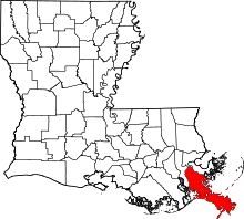 | |
| Unincorporated communities |
| |
| Ghost towns | ||