Empire, Louisiana
| Empire | |
| Census-designated place | |
| Country | United States |
|---|---|
| State | Louisiana |
| Parish | Plaquemines |
| Elevation | 3 ft (0.9 m) |
| Coordinates | 29°23′55″N 89°36′31″W / 29.39861°N 89.60861°WCoordinates: 29°23′55″N 89°36′31″W / 29.39861°N 89.60861°W |
| Area | 7.6 sq mi (19.7 km2) |
| - land | 5.2 sq mi (13 km2) |
| - water | 2.4 sq mi (6 km2), 31.58% |
| Population | 993 (2010) |
| Density | 130.7/sq mi (50.5/km2) |
| Timezone | CST (UTC-6) |
| - summer (DST) | CDT (UTC-5) |
| ZIP code | 70050 |
| Area code | 504 |
|
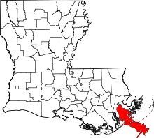
Location of Empire in Louisiana | |
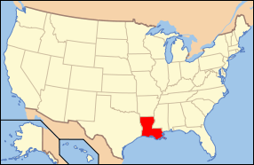
 Location of Louisiana in the United States | |
Empire is a census-designated place (CDP) in Plaquemines Parish, Louisiana, United States. The population was 993 at the 2010 census.[1]
Seafood Production
Empire, along with Venice, is the third biggest seafood port in the United States by weight. Some two thousand boats home port from Empire. Species landed include oysters, shrimp, menhaden, and other types of fin fish. During the BP oil spill seafood landings came to a halt. Oyster landings did not resume for an entire year. Under the Coast 2050 plan a 50,000 cfs freshwater diversion is proposed at Empire which threatens the livelihood of the fishermen and the supporting businesses by drastically altering the salinity in the surrounding marshes.
Hurricane Katrina

During the afternoon of August 28, 2005, Hurricane Katrina approached the northern coastline of the Gulf of Mexico, generating tropical force winds along coastal areas of Florida, Alabama, Mississippi and Louisiana. At 6:10 a.m., on August 29, 2005, Katrina made landfall just a few miles southeast of Empire, at Buras-Triumph, LA. Many shrimp and oyster boats were grounded along the roads and levees near Empire. On the morning of August 29, 2005, the eye of the storm passed over Empire. The area was entirely flooded causing dozens of boats that had popped their moorings to settle near the southern foot of the Empire High Rise Bridge. As a result, all traffic coming in to or out of southern Plaquemines Parish was routed over the draw bridge on Highway 11. Many notable businesses such as Tom's Place Oyster Bar and The Delta Marina were destroyed.
Geography
Empire is located at 29°23′55″N 89°36′31″W / 29.39861°N 89.60861°W (29.398586, -89.608501)[2] and has an elevation of 3 feet (0.9 m).[3]
According to the United States Census Bureau, the CDP has a total area of 7.6 square miles (20 km2), of which, 5.2 square miles (13 km2) of it is land and 2.4 square miles (6.2 km2) of it (31.49%) is water.
Demographics
As of the census[4] of 2000, there were 2,211 people, 771 households, and 573 families residing in the CDP. The population density was 415.4 people per square mile (160.5/km²). There were 923 housing units at an average density of 173.4/square mile (67.0/km²). The racial makeup of the CDP was 60.79% White, 33.79% African American, 0.41% Native American, 2.76% Asian, 0.90% from other races, and 1.36% from two or more races. Hispanic or Latino of any race were 1.18% of the population.
As of the census of 2010, there were 993 people, 391 households, and 257 families residing in the CDP. The racial makeup was 63.64% White, 37.46% African American, 7.96% Asian, and some other race 1.51%. Hispanic or Latino of any race was 1.51%.
There were 771 household, out of which 36.4% had children under the age of 18 living with them; 51.6% were married couples living together, 16.1% had a female householder with no husband present, and 25.6% were non-families. 20.5% of all households were made up of individuals, and 7.3% had someone living alone who was 65 years of age or older. The average household size was 2.87 and the average family size was 3.30.
In the CDP the population was spread out with 29.5% under the age of 18, 10.1% from 18 to 24, 27.2% from 25 to 44, 22.6% from 45 to 64 and 10.7% who were 65 years of age or older. The median age was 34 years. For every 100 females, there were 101.0 males. For every 100 females age 18 and over, there were 101.7 males.
The median income for a household in the CDP was $27,208, and the median income for a family was $35,035. Males had a median income of $30,357 versus $20,096 for females. The per capita income for the CDP was $12,960. About 24.1% of families and 27.9% of the population were below the poverty line, including 33.5% of those under age 18 and 28.2% of those age 65 or older.
References
- ↑ "American FactFinder". United States Census Bureau. Retrieved 2011-05-14.
- ↑ "US Gazetteer files: 2010, 2000, and 1990". United States Census Bureau. 2011-02-12. Retrieved 2011-04-23.
- ↑ "US Board on Geographic Names". United States Geological Survey. 2007-10-25. Retrieved 2008-01-31.
- ↑ "American FactFinder". United States Census Bureau. Retrieved 2008-01-31.
External links
- Louisiana road map of major roads: LA-roadmap.
