Tongdao Dong Autonomous County
| Tongdao Dong Autonomous County 通道侗族自治县 | |
|---|---|
| County | |
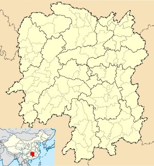 Tongdao Location in Hunan | |
| Coordinates: 26°09′25″N 109°47′02″E / 26.157°N 109.784°ECoordinates: 26°09′25″N 109°47′02″E / 26.157°N 109.784°E[1] | |
| Country | People's Republic of China |
| Province | Hunan |
| Prefecture-level city | Huaihua |
| Area[2] | |
| • Total | 2,225.36 km2 (859.22 sq mi) |
| Population (2010)[3] | |
| • Total | 206,650 |
| • Density | 93/km2 (240/sq mi) |
| Time zone | China Standard (UTC+8) |
| Postal code | 4185XX |
Tongdao Dong Autonomous County (simplified Chinese: 通道侗族自治县; traditional Chinese: 通道侗族自治縣; pinyin: Tōngdào Dòngzú Zìzhìxiàn) is under the administration of Huaihua, Hunan province, China. The southernmost, least populous, and least densely populated county-level division of Huaihua City,[3] it borders the prefecture-level divisions of Shaoyang to the east, Liuzhou and Guilin (both Guangxi) to the south, Qiandongnan (Guizhou) to the west.
There are two Miao subgroups in Tongdao County, namely Hua Miao 花苗 (mjiu55 ken35) and Cao Miao 草苗 (mjiu55). Despite being officially classified by the Chinese government as ethnic Miao, Cao Miao is actually a Kam-Sui language.[4]
References
- www.xzqh.org (Chinese)
- ↑ Google (2014-07-02). "Tongdao" (Map). Google Maps. Google. Retrieved 2014-07-02.
- ↑ Huaihua City Land Use Plan (2006–20)/《怀化市土地利用总体规划(2006-2020年)》.(Chinese) Accessed 8 July 2014.
- 1 2 "怀化市2010年第六次全国人口普查主要数据公报" (in Chinese). Huaihua Statistical Bureau/怀化市统计局. Retrieved 9 July 2014.
- ↑ Tongdao Dong Autonomous County Ethnic Gazetteer 通道侗族自治县民族志 (2004).
External links
This article is issued from Wikipedia - version of the 4/17/2016. The text is available under the Creative Commons Attribution/Share Alike but additional terms may apply for the media files.