Longshan County
| Longshan County 龙山县 | |
|---|---|
| County | |
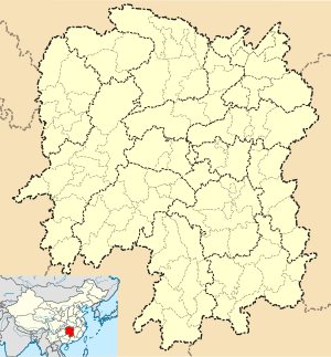 Longshan Location in Hunan | |
| Coordinates: 29°12′04″N 109°31′37″E / 29.201°N 109.527°ECoordinates: 29°12′04″N 109°31′37″E / 29.201°N 109.527°E[1] | |
| Country | People's Republic of China |
| Province | Hunan |
| Autonomous prefecture | Xiangxi |
| Area[2] | |
| • Total | 3,127.16 km2 (1,207.40 sq mi) |
| Population (2010)[3] | |
| • Total | 502,227 |
| • Density | 160/km2 (420/sq mi) |
| Time zone | China Standard (UTC+8) |
| Postal code | 4168XX |
| Website |
xxls |
Longshan County (simplified Chinese: 龙山县; traditional Chinese: 龍山縣; pinyin: Lóngshān Xiàn; literally: "dragon mountain") is under the administration of Xiangxi Tujia and Miao Autonomous Prefecture, Hunan province, China. It borders Zhangjiajie to the northeast, Hubei's Enshi Tujia and Miao Autonomous Prefecture to the north and west and Chongqing's Qianjiang District to the southwest. It has an area of 3,131 square kilometres (1,209 sq mi) and a population of 541,700.[4]
Administrative divisions
Longshan has 3 subdistricts, 11 towns, and 20 townships:[5]
- Subdistricts:
- Min'an (民安街道)
- Huatang (华塘街道)
- Xincheng (新城街道)
- Towns:
- Shigao (石羔镇)
- Ciyantang (茨岩塘镇)
- Hongyanxi (红岩溪镇)
- Xichehe (洗车河镇)
- Miartan (苗儿滩镇)
- Longtou (隆头镇)
- Liye (里耶镇)
- Zhaoshi (召市镇)
- Guitang (桂塘镇)
- Shipai (石牌镇)
- Dianfang (靛房镇)
- Townships:
Transportation
References
- ↑ Google (2014-07-02). "Longshan" (Map). Google Maps. Google. Retrieved 2014-07-02.
- ↑ Xiangxi Tujia and Miao Autonomous Prefecture Land Use Plan (2006–20)/《湘西土家族苗族自治州土地利用总体规划(2006-2020年)》.(Chinese) Accessed 8 July 2014.
- ↑ 湘西自治州2010年第六次全国人口普查主要数据公报 (in Chinese). Xiangxi Prefecture People's Government. Retrieved 9 July 2014.
- ↑ "Profile of Longshan County" (in Chinese). Official website of Longshan County Government. 2008-04-07. Retrieved 2008-09-25.
- ↑ "Profile of Longshan" (in Chinese). Archived from the original on January 1, 2009. Retrieved 2008-09-25.
External links
This article is issued from Wikipedia - version of the 11/27/2016. The text is available under the Creative Commons Attribution/Share Alike but additional terms may apply for the media files.