Texas State Highway 285
| ||||
|---|---|---|---|---|
 | ||||
| Route information | ||||
| Maintained by TxDOT | ||||
| Length: | 56.866 mi[1] (91.517 km) | |||
| Existed: | by 1939 – present | |||
| Major junctions | ||||
| West end: |
| |||
|
| ||||
| East end: |
| |||
| Highway system | ||||
| ||||

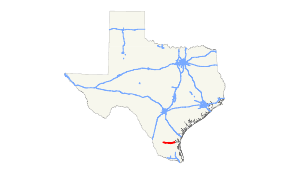
State Highway 285 or SH 285 is a state highway that runs from Riviera in southern Texas, near Corpus Christi, west to Hebbronville.
Route description
Beginning at a junction with US 77 (Future I-69E) at Riviera in Kleberg County, SH 285 runs southwest and west to a junction with US 281 (Future I-69C) at Falfurrias in Brooks County. In Riviera the highway is known as Olive Avenue; in Falfurrias it is known as Rice Street. SH 285 continues northwest and west to a junction with SH 339 and then to its final junction with SH 16 at Hebbronville in Jim Hogg County, where the route is known as Fal Street.
The route is essentially unchanged from its original designation in 1939 as part of a general redescription of the state highway system. Most of the terrain covered by SH 285 is lightly populated ranch and oil country.
Junction list
| County | Location | mi | km | Destinations | Notes |
|---|---|---|---|---|---|
| Jim Hogg | | ||||
| | |||||
| Brooks | | ||||
| | |||||
| | |||||
| | |||||
| Falfurrias | |||||
| Future I-69C | |||||
| | |||||
| | |||||
| Kleberg | | Future I-69E | |||
| 1.000 mi = 1.609 km; 1.000 km = 0.621 mi | |||||
References
- ↑ Transportation Planning and Programming Division (n.d.). "State Highway No. 285". Highway Designation Files. Texas Department of Transportation. Retrieved 2007-01-22.
External links
- Texas official travel map at the Texas Department of Transportation (Adobe Acrobat format, magnification required for legibility)
- Satellite image of junction of SH 285 with US 281 at Google Maps