Terlton, Oklahoma
| Terlton, Oklahoma | |
|---|---|
| Town | |
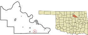 Location of Terlton, Oklahoma | |
| Coordinates: 36°11′16″N 96°29′28″W / 36.18778°N 96.49111°WCoordinates: 36°11′16″N 96°29′28″W / 36.18778°N 96.49111°W | |
| Country | United States |
| State | Oklahoma |
| County | Pawnee |
| Area | |
| • Total | 0.2 sq mi (0.6 km2) |
| • Land | 0.2 sq mi (0.6 km2) |
| • Water | 0.0 sq mi (0.0 km2) |
| Elevation | 787 ft (240 m) |
| Population (2010) | |
| • Total | 106 |
| • Density | 344.3/sq mi (132.9/km2) |
| Time zone | Central (CST) (UTC-6) |
| • Summer (DST) | CDT (UTC-5) |
| ZIP code | 74081 |
| Area code(s) | 539/918 |
| FIPS code | 40-72850[1] |
| GNIS feature ID | 1098811[2] |
Terlton is a town in Pawnee County, Oklahoma, United States. The population was 106 at the 2010 census, a gain of 24.7 percent from 85 at the 2000 census.[3]
Geography
Terlton is located at 36°11′16″N 96°29′28″W / 36.187748°N 96.491109°W.[4] According to the United States Census Bureau, the town has a total area of 0.2 square miles (0.52 km2), all of it land.
Demographics
| Historical population | |||
|---|---|---|---|
| Census | Pop. | %± | |
| 1930 | 234 | — | |
| 1940 | 245 | 4.7% | |
| 1950 | 122 | −50.2% | |
| 1960 | 90 | −26.2% | |
| 1970 | 111 | 23.3% | |
| 1980 | 155 | 39.6% | |
| 1990 | 121 | −21.9% | |
| 2000 | 1,146 | 847.1% | |
| 2010 | 106 | −90.8% | |
| Est. 2015 | 107 | [5] | 0.9% |
As of the census[1] of 2000, there were 85 people, 30 households, and 21 families residing in the town. The population density was 344.3 people per square mile (131.3/km2). There were 37 housing units at an average density of 149.9 per square mile (57.1/km2). The racial makeup of the town was 97.65% White, 1.18% Native American, and 1.18% from two or more races. Hispanic or Latino of any race were 2.35% of the population.
There of which 53.3% have children under the age of 18 living with them, 60.0% were married couples living together, 13.3% had a female householder with no husband present, and 26.7% were non-families. 26.7% of all households were made up of individuals and 10.0% had someone living alone who was 65 years of age or older. The average household size was 2.83 and the average family size was 3.50.
In the town the population was spread out with 41.2% under the age of 18, 8.2% from 18 to 24, 28.2% from 25 to 44, 17.6% from 45 to 64, and 4.7% who were 65 years of age or older. The median age was 26 years. For every 100 females there were 97.7 males. For every 100 females age 18 and over, there were 92.3 males.
The median income for a household in the town was $22,917, and the median income for a family was $30,536. Males had a median income of $31,458 versus $20,000 for females. The per capita income for the town was $7,862. There were 17.4% of families and 15.1% of the population living below the poverty line, including no under eighteens and 25.0% of those over 64.
References
- 1 2 "American FactFinder". United States Census Bureau. Retrieved 2008-01-31.
- ↑ "US Board on Geographic Names". United States Geological Survey. 2007-10-25. Retrieved 2008-01-31.
- ↑ CensusViewer: Population of the City of Terlton, Oklahoma. Retrieved March 21, 2012.
- ↑ "US Gazetteer files: 2010, 2000, and 1990". United States Census Bureau. 2011-02-12. Retrieved 2011-04-23.
- ↑ "Annual Estimates of the Resident Population for Incorporated Places: April 1, 2010 to July 1, 2015". Retrieved July 2, 2016.
- ↑ "Census of Population and Housing". Census.gov. Retrieved June 4, 2015.
Municipalities and communities of Pawnee County, Oklahoma, United States | ||
|---|---|---|
| Cities | 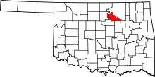 | |
| Towns | ||
| Unincorporated communities |
| |
| Footnotes | ‡This populated place also has portions in an adjacent county or counties | |