Pawnee County, Oklahoma
| Pawnee County, Oklahoma | |
|---|---|
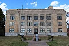 Pawnee County Courthouse, 2014 | |
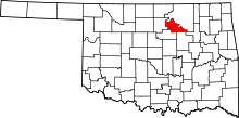 Location in the U.S. state of Oklahoma | |
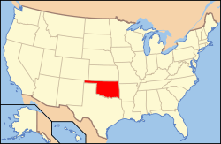 Oklahoma's location in the U.S. | |
| Founded | 1893 |
| Named for | Pawnee Tribe |
| Seat | Pawnee |
| Largest city | Cleveland |
| Area | |
| • Total | 595 sq mi (1,541 km2) |
| • Land | 568 sq mi (1,471 km2) |
| • Water | 27 sq mi (70 km2), 4.5% |
| Population (est.) | |
| • (2013) | 16,513 |
| • Density | 29/sq mi (11/km²) |
| Congressional district | 3rd |
| Website |
www |
Pawnee County is a county located in the U.S. state of Oklahoma. As of the 2010 census, the population was 16,577.[1] Its county seat is Pawnee.[2] The county is named after the Pawnee Tribe.[3]
Pawnee County is included in the Tulsa, OK Metropolitan Statistical Area.
History
The Osage Tribe used the area that contains present day Pawnee County as buffalo hunting grounds. In 1825, The Osage ceded parts of present-day Missouri, Arkansas and most of the future state of Oklahoma to the federal government.
After their forced removal from the Southeastern United States, the Cherokee received land in Eastern Oklahoma as well as the Cherokee Outlet in 1828, which included present-day Pawnee County. After the Civil War, the Cherokee agreed to allow other American Indians to settle in the eastern portion of the Outlet. In 1873, the federal government began to relocate the Pawnee Tribe from Nebraska to a reservation here.
In 1891, the Pawnee agreed to take land allotments from the reservation, and the remaining land was opened to non-Indian settlers in 1893 during the Cherokee Outlet opening. Pawnee County was organized as County Q, and the future town of Pawnee, Townsite Number 13, was designated the county seat.[3] In 1894, the voters chose the name Pawnee County over the name Platte County.[3]
The female bandit, Little Britches, companion in crime with Cattle Annie, lived for a time at Sinnett, site of the Creek Nation in Pawnee County.[4]
Geography
According to the U.S. Census Bureau, the county has a total area of 595 square miles (1,540 km2), of which 568 square miles (1,470 km2) is land and 27 square miles (70 km2) (4.5%) is water.[5]
The western third of the county is part of the Red Bed plains, while the remainder is in the Sandstone Hills region. The Cimarron and Arkansas Rivers drain the county.[3] Black Bear Creek also extends through the county. Lone Chimney Lake dam is also in Pawnee County, while the lake extends into Payne County.[6]
Adjacent counties
- Osage County (northeast)
- Tulsa County (southeast)
- Creek County (south)
- Payne County (southwest)
- Noble County (west)
Earthquake
A magnitude 5.8 earthquake struck near the city of Pawnee, just after 7 A. M. (CST) on September 3, 2016. This was Oklahoma's strongest quake in history, exceeding the 5.7-magnitude quake near Prague on November 5, 2011.[7][8] Buildings in Pawnee were damaged, but there were no reports of deaths.[9] A Pawnee resident was injured while shielding his child from debris falling from a chimney.[10] State regulators in Oklahoma ordered 37 petroleum production wastewater disposal wells in the vicinity of the earthquake (see map in citation) to be rapidly closed while assessments were made.[11]
Demographics
| Historical population | |||
|---|---|---|---|
| Census | Pop. | %± | |
| 1900 | 12,366 | — | |
| 1910 | 17,332 | 40.2% | |
| 1920 | 19,126 | 10.4% | |
| 1930 | 19,882 | 4.0% | |
| 1940 | 17,395 | −12.5% | |
| 1950 | 13,616 | −21.7% | |
| 1960 | 10,884 | −20.1% | |
| 1970 | 11,338 | 4.2% | |
| 1980 | 15,310 | 35.0% | |
| 1990 | 15,575 | 1.7% | |
| 2000 | 16,612 | 6.7% | |
| 2010 | 16,577 | −0.2% | |
| Est. 2015 | 16,436 | [12] | −0.9% |
| U.S. Decennial Census[13] 1790-1960[14] 1900-1990[15] 1990-2000[16] 2010-2013[1] | |||
As of the census[17] of 2000, there were 16,612 people, 6,383 households, and 4,748 families residing in the county. The population density was 11/km² (29/mi²). There were 7,464 housing units at an average density of 5/km² (13/mi²). The racial makeup of the county was 82.27% White, 0.69% Black or African American, 12.13% Native American, 0.20% Asian, 0.05% Pacific Islander, 0.24% from other races, and 4.42% from two or more races. 1.16% of the population were Hispanic or Latino of any race.
There were 6,383 households out of which 32.60% had children under the age of 18 living with them, 61.60% were married couples living together, 9.00% had a female householder with no husband present, and 25.60% were non-families. 22.80% of all households were made up of individuals and 11.00% had someone living alone who was 65 years of age or older. The average household size was 2.58 and the average family size was 3.02.
In the county, the population was spread out with 26.50% under the age of 18, 7.30% from 18 to 24, 26.20% from 25 to 44, 25.20% from 45 to 64, and 14.80% who were 65 years of age or older. The median age was 38 years. For every 100 females there were 97.40 males. For every 100 females age 18 and over, there were 94.40 males.
The median income for a household in the county was $31,661, and the median income for a family was $37,274. Males had a median income of $29,946 versus $21,069 for females. The per capita income for the county was $15,261. About 9.60% of families and 13.00% of the population were below the poverty line, including 16.60% of those under age 18 and 13.80% of those age 65 or over.
Politics
| Voter Registration and Party Enrollment as of July 2, 2016[18] | |||||
|---|---|---|---|---|---|
| Party | Number of Voters | Percentage | |||
| Democratic | 3,762 | 42.63% | |||
| Republican | 3,976 | 45.06% | |||
| Unaffiliated | 1,080 | 12.24% | |||
| Total | 8,493 | 100% | |||
| Year | Republican | Democrat |
|---|---|---|
| 2008 | 68.72% 4,533 | 31.28% 2,063 |
| 2004 | 63.25% 4,412 | 36.75% 2,564 |
| 2000 | 57.15% 3,386 | 41.10% 2,435 |
Communities
NRHP sites
The following sites in Pawnee County are listed on the National Register of Historic Places:
- Arkansas Valley National Bank, Pawnee
- Blackburn Methodist Church, Blackburn
- Blue Hawk Peak Ranch, Pawnee
- Corliss Steam Engine, Pawnee
- First State Bank of Maramec, Maramec
- Mullendore Mansion, Cleveland
- Pawnee Agency and Boarding School Historic District, Pawnee
- Pawnee Armory, Pawnee
- Pawnee County Courthouse, Pawnee
- Pawnee Indian Agency, Pawnee
- Pawnee Municipal Swimming Pool and Bathhouse, Pawnee
- Ralston Opera House, Ralston
References
- 1 2 "State & County QuickFacts". United States Census Bureau. Retrieved November 12, 2013.
- ↑ "Find a County". National Association of Counties. Archived from the original on May 31, 2011. Retrieved 2011-06-07.
- 1 2 3 4 Wilson, Linda D. "Pawnee County," Encyclopedia of Oklahoma History and Culture, Oklahoma Historical Society, 2009. Accessed April 4, 2015.
- ↑ "Cattle Annie & Little Britches, taken from Lee Paul [http://www.theoutlaws.com]". ranchdivaoutfitters.com. Retrieved December 27, 2012. External link in
|title=(help) - ↑ "2010 Census Gazetteer Files". United States Census Bureau. August 22, 2012. Retrieved February 22, 2015.
- ↑ "Lone Chimney Lake, Oklahoma." OutdoorsOK. Accessed September 5, 2015.
- ↑ "M5.8 - 15km NW of Pawnee, Oklahoma". United States Geological Survey. September 7, 2016. Retrieved September 7, 2016.
- ↑ "Magnitudes for Oklahoma Earthquakes Shift Upward". United States Geological Survey. September 7, 2016. Retrieved September 7, 2016.
- ↑ Campbell, Andy. "5.6 Magnitude Earthquake Rattles Oklahoma." Huffington Post. September 3, 2016. Accessed September 3, 2016.
- ↑ Duren, Dee. "Pawnee Man Injured Protecting Child In Earthquake". Retrieved September 7, 2016.
- ↑ "USGS: 5.6 magnitude earthquake shakes Oklahoma". KFOR-TV. September 3, 2016. Retrieved September 7, 2016.
- ↑ "County Totals Dataset: Population, Population Change and Estimated Components of Population Change: April 1, 2010 to July 1, 2015". Retrieved July 2, 2016.
- ↑ "U.S. Decennial Census". United States Census Bureau. Archived from the original on May 11, 2015. Retrieved February 22, 2015.
- ↑ "Historical Census Browser". University of Virginia Library. Retrieved February 22, 2015.
- ↑ Forstall, Richard L., ed. (March 27, 1995). "Population of Counties by Decennial Census: 1900 to 1990". United States Census Bureau. Retrieved February 22, 2015.
- ↑ "Census 2000 PHC-T-4. Ranking Tables for Counties: 1990 and 2000" (PDF). United States Census Bureau. April 2, 2001. Retrieved February 22, 2015.
- ↑ "American FactFinder". United States Census Bureau. Retrieved 2008-01-31.
- ↑ https://www.ok.gov/elections/documents/20160115%20-%20Registration%20By%20County%20%28vr2420%29.pdf
- ↑ "Dave Leip's Atlas of U.S. Presidential Elections". Retrieved 2011-06-11.
 |
Osage County | | ||
| Noble County | |
|||
| ||||
| | ||||
| Payne County | Creek County | Tulsa County |
Municipalities and communities of Pawnee County, Oklahoma, United States | ||
|---|---|---|
| Cities | | |
| Towns | ||
| Unincorporated communities |
| |
| Footnotes | ‡This populated place also has portions in an adjacent county or counties | |
| Counties |  | |
|---|---|---|
| Principal city | ||
| Cities over 20k | ||
| Cities 10k-20k | ||
| Cities 5k-10k | ||
| Cities and towns 1k-5k | ||
Coordinates: 36°19′N 96°42′W / 36.31°N 96.70°W