Tennessee State Route 95
| ||||
|---|---|---|---|---|
| Route information | ||||
| Maintained by TDOT | ||||
| Length: | 42.3 mi[1] (68.1 km) | |||
| Major junctions | ||||
| South end: |
| |||
| ||||
| North end: |
| |||
| Location | ||||
| Counties: | Loudon, Roane, Anderson | |||
| Highway system | ||||
| ||||


Tennessee State Route 95 (SR 95) is a state route in the U.S. state of Tennessee. It serves to connect Lenoir City with Greenback and Oak Ridge, via U.S. Route 321.
Route description
SR 95 serves as a secondary in Loudon County and a primary in Roane and Anderson counties.
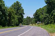
SR 95 begins at US 411 (SR 33), in Greenback, and goes northwest predominantly along Lenoir City Road. Curving through the Red Knobs, it passes through the communities of Centersville and Glendale, before reaching US 321 (SR 73). This section of SR 95 is two-lane throughout, with no shoulders and minimum allowable lane widths. The next 12.8 miles (20.6 km), SR 95 is a hidden overlap of US 321, as it traverses through Lenoir City.[2]
At the I-40 interchange, US 321 (SR 73) ends and SR 95 reemerges to continue the route towards Oak Ridge. Crossing the Clinch River, via the Charles Vaden Bulck Bridge, SR 95 enters Roane County and land controlled by the Department of Energy/Oak Ridge National Laboratory. The highway curves along the various ridges, most access roads are controlled or blocked off. As SR 95 approaches SR 58, the highway widens to four-lane before the interchange. After the interchange, it continues north along Oak Ridge Turnpike as a four-lane limited-access road. It exits the Department of Energy's boundary near the Roane/Anderson county line, soon after neighborhoods begins to appear just off the road and bike lanes are along the shoulders.[3]
In Anderson County, SR 95 serves as the main highway through Oak Ridge, with commercial businesses along its shoulders and neighborhoods connected by access roads. At the center of Oak Ridge, SR 95 connects with SR 62, which continues to Oliver Springs and Knoxville. Northeast of Oak Ridge, towards Clinton, SR 95 ends at the intersection of SR 61 (Oliver Springs Highway).[4]
Junction list
| County | Location | mi[1] | km | Destinations | Notes |
|---|---|---|---|---|---|
| Loudon | Greenback | 0.0 | 0.0 | ||
| | 9.9 | 15.9 | North end of US 321/SR 73 overlap | ||
| | 13.6 | 21.9 | |||
| Tennessee River | 14.2 | 22.9 | J. Carmichael Greer Bridge | ||
| Lenoir City | 15.4 | 24.8 | |||
| 18.0 | 29.0 | ||||
| 18.9 | 30.4 | ||||
| 22.7 | 36.5 | South end of US 321/SR 73 overlap;northern terminus of US 321/SR73 | |||
| Roane | | 29.4 | 47.3 | ||
| Anderson | Oak Ridge | 36.8 | 59.2 | ||
| | 42.3 | 68.1 | |||
| 1.000 mi = 1.609 km; 1.000 km = 0.621 mi | |||||
References
- 1 2 Google (July 11, 2014). "Tennessee State Route 95" (Map). Google Maps. Google. Retrieved July 11, 2014.
- ↑ General Highway Map, Loudon County, Tennessee (PDF) (Map). Tennessee Department of Transportation. 2003. Retrieved July 12, 2014.
- ↑ General Highway Map, Roane County, Tennessee (PDF) (Map). Tennessee Department of Transportation. 2006. Retrieved July 12, 2014.
- ↑ General Highway Map, Anderson County, Tennessee (PDF) (Map). Tennessee Department of Transportation. 2004. Retrieved July 12, 2014.
External links
-
 Media related to Tennessee State Route 95 at Wikimedia Commons