Interstate 75 in Tennessee
| ||||
|---|---|---|---|---|
_map.svg.png) | ||||
| Route information | ||||
| Maintained by TDOT | ||||
| Length: | 161.86 mi[1] (260.49 km) | |||
| Existed: | 1963[2] – present | |||
| Major junctions | ||||
| South end: |
| |||
|
| ||||
| North end: |
| |||
| Location | ||||
| Counties: | Hamilton, Bradley, McMinn, Monroe, Loudon, Knox, Anderson, Campbell | |||
| Highway system | ||||
| ||||
In the U.S. state of Tennessee, Interstate 75 (I-75) runs from Chattanooga to Jellico by way of Knoxville. Interstate 75 enters the East Tennessee region following the Tennessee Valley from Georgia, all the way through Knoxville to near Rocky Top, then climbs into the Cumberland Mountains before crossing over into Kentucky at Jellico.
Route description
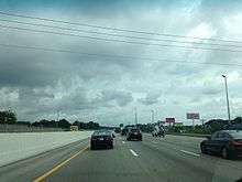
Interstate 75 enters Tennessee at the southern edge of Chattanooga. It then angles northeasterly past Cleveland, Athens, and Sweetwater. On the far western edge of Knoxville, it becomes concurrent with Interstate 40, and the two routes continue northeasterly through western Knoxville before Interstate 75 departs, bypassing downtown Knoxville before turning to the north again and continuing through largely rural mountain terrain into Kentucky.
History
Interstate 75 originally continued into downtown Knoxville then turned to the north at Malfunction Junction, following what is now signed as Interstate 275. When the western section of Interstate 640 was completed in 1982, Interstate 75 was moved to overlap the auxiliary route to divert through traffic away from downtown in preparation for the 1982 World's Fair. This concurrency is somewhat unusual in that the exit numbers and mile markers follow the auxiliary route I-640 instead of Interstate 75 mileage.
On December 11, 1990, a 99 vehicle accident occurred in dense fog outside Calhoun that resulted in 12 deaths and 56 injuries.[3] The accident was later profiled on the show Forensic Files.
In March 2005, the southbound lanes of Interstate 75 were shut down between mile marker 141 to 143 in Campbell County due to a rockslide below the roadway that caused the pavement to partially collapse.[4]
On May 1, 2008 I-75 Northbound traffic was re-routed back along its original path in downtown Knoxville along Interstate 275 as part of SmartFix 40, a major construction project that includes closing a portion of I-40. Traffic was re-routed along I-275 as the ramp from I-640 Eastbound/I-75 Northbound to I-75 Northbound is only one lane which causes traffic delays at peak times.
In March 2012, the southbound lanes of the interstate were again closed to traffic between mile markers 141 and 143 in Campbell County, Tennessee due to a slide beneath the roadway.[5] This was later followed by a second slide in early May 2012[6] that caused a portion of the roadway to collapse and forced the detour lanes to be closed.
In February 2016, a rock slide closed I-75 near Caryville, Tennessee.
Exit list
| County | Location | mi | km | Exit | Destinations | Notes |
|---|---|---|---|---|---|---|
| Hamilton | East Ridge | 0.00 | 0.00 | Georgia state line | ||
| 0.52 | 0.84 | 1 | Signed as exits 1A (south) and 1B (north) northbound | |||
| Chattanooga | 1.3 | 2.1 | 2 | South end of US-74 overlap, left exit northbound; I-24 exits 185A-B | ||
| 3.4 | 5.5 | 3 | Signed as exits 3A (east) and 3B (west) northbound | |||
| 4 | 6.4 | 4 | ||||
| 4.2 | 6.8 | 4A | Hamilton Place Boulevard | Northbound exit and southbound entrance; access to Hamilton Place Mall | ||
| 5.5 | 8.9 | 5 | Shallowford Road | |||
| Standifer Gap Road | Removed c. 1970 | |||||
| 7.7 | 12.4 | 7 | South end of US-11/US-64/SR-2 overlap; signed as exits 7A (SR-317 east) and 7B (SR-317 west) northbound | |||
| 9.1 | 14.6 | 9 | Serves Volkswagen Chattanooga Assembly Plant | |||
| 11.7 | 18.8 | 11 | North end of US-11/US-64/SR-2 overlap | |||
| Bradley | Cleveland | 20.4 | 32.8 | 20 | North end of US-74 overlap | |
| 25 | 40 | 25 | ||||
| 26.7 | 43.0 | 27 | Sgt. Paul B. Huff Parkway - Cleveland | |||
| | 32.8 | 52.8 | 33 | |||
| McMinn | | 35.8 | 57.6 | 36 | ||
| | 42.1 | 67.8 | 42 | |||
| Athens | 48.7 | 78.4 | 49 | |||
| | 52.1 | 83.8 | 52 | |||
| | 56 | 90 | 56 | |||
| Monroe | Sweetwater | 60.6 | 97.5 | 60 | ||
| 62.7 | 100.9 | 62 | ||||
| Loudon | | 68.7 | 110.6 | 68 | ||
| Loudon | 72.1 | 116.0 | 72 | |||
| | 76.7 | 123.4 | 76 | |||
| Lenoir City | 81.4 | 131.0 | 81 | |||
| | 84.3 | 135.7 | 84B | South end of I-40 overlap; no exit number southbound; concurrency uses I-40 exit numbers; I-40 west exit 368 | ||
| Knox | Farragut | 369 | Watt Road | |||
| 373 | Campbell Station Road – Farragut | |||||
| Knoxville | 374 | |||||
| 376 | Signed as exits 376A (north) and 376B (east) on collector/distributor lanes; I-140 west exits 1C-D | |||||
| 378 | Cedar Bluff Road | Signed as exits 378A (south) and 378B (north) southbound; southbound exit 378B also serves Executive Park Drive | ||||
| 379 | Bridgewater Road, Walker Springs Road, Gallaher View Road | Signed as exits 379 (Bridgewater Road, Walker Springs Road) and 379A (Gallaher View Road) southbound | ||||
| 380 | Also access to Montvue Road | |||||
| 383 | Complete access to Northshore Drive and Papermill Road; southbound exit and entrance only for Weisgarber Road; Northshore Drive signed northbound only | |||||
| 385 | North end of I-40 overlap; south end of I-640 overlap; concurrency uses I-640 exit numbers | |||||
| 1 | Northbound split into separate unnumbered exits for eastbound and westbound exits on collector/distributor lanes | |||||
| 3B | Northbound exit only | |||||
| 3 | North end of I-640 overlap; no exit number northbound; no exits from I-75 to US-25W northbound | |||||
| 3 | No exit number southbound | |||||
| 108 | Merchants Drive | Southbound access to northbound US-25W | ||||
| 110 | Callahan Drive | |||||
| 112 | ||||||
| | 117 | |||||
| Anderson | | 122 | ||||
| Rocky Top | 128 | |||||
| 129 | South end of US-25W/SR-9 overlap | |||||
| Campbell | Caryville | 134 | North end of US-25W/SR-9 overlap; South end of SR-63 overlap | |||
| 141 | North end of SR-63 overlap | |||||
| | 144 | Stinking Creek Road | ||||
| | 156 | Rarity Mountain Road | ||||
| Jellico | 160 | |||||
| 161.86 | 260.49 | Kentucky state line | ||||
1.000 mi = 1.609 km; 1.000 km = 0.621 mi
| ||||||
See also
 Tennessee portal
 U.S. Roads portal
References
- ↑ "FHWA Route Log". Retrieved 4 October 2014.
- ↑ Interstate 50th Anniversary (TDOT)
- ↑ National Transportation Safety Board (1992-09-28). "Multiple-vehicle collisions and fire during limited visibility (fog) on Interstate 75 near Calhoun, Tennessee December 11, 1990". Retrieved 2011-12-22.
- ↑ TDOT news release
- ↑ Governor Bill Haslam (2012-03-09). "Slide Forces TDOT to Close I-75 South in Campbell County | TN.gov Newsroom". News.tn.gov. Retrieved 2013-01-29.
- ↑ "Campbell County fretful after latest I-75 slide » Knoxville News Sentinel". Knoxnews.com. Retrieved 2013-01-29.
| Previous state: Georgia |
Tennessee | Next state: Kentucky |