Syracuse, Indiana
| Syracuse, Indiana | |
|---|---|
| Town | |
|
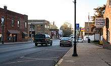
Downtown, looking north. | |
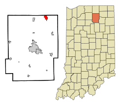 Location of Syracuse in the state of Indiana | |
| Coordinates: 41°25′24″N 85°45′0″W / 41.42333°N 85.75000°WCoordinates: 41°25′24″N 85°45′0″W / 41.42333°N 85.75000°W | |
| Country | United States |
| State | Indiana |
| County | Kosciusko |
| Township | Turkey Creek |
| Area[1] | |
| • Total | 2.16 sq mi (5.59 km2) |
| • Land | 1.79 sq mi (4.64 km2) |
| • Water | 0.37 sq mi (0.96 km2) |
| Elevation | 886 ft (270 m) |
| Population (2010)[2] | |
| • Total | 2,810 |
| • Estimate (2012[3]) | 2,854 |
| • Density | 1,569.8/sq mi (606.1/km2) |
| Time zone | Eastern (EST) (UTC-5) |
| • Summer (DST) | EDT (UTC-4) |
| ZIP code | 46567 |
| Area code(s) | 574 |
| FIPS code | 18-74744[4] |
| GNIS feature ID | 0444529[5] |
| Website | http://www.syracusein.org |


Syracuse is a town in Turkey Creek Township, Kosciusko County, Indiana, United States. The population was 2,810 at the 2010 census.
Syracuse is the location of Lake Syracuse and the nearby, larger Lake Wawasee, in addition to several other lakes in the region. The National Weather Service operates a Weather Forecast Office in the town.
History
Syracuse was laid out in 1837.[6] It was likely named after the city of Syracuse, New York.[7] The Syracuse post office was established in 1837.[8]
Geography
Syracuse is located at 41°25′24″N 85°45′0″W / 41.42333°N 85.75000°W (41.423389, -85.749887).[9]
According to the 2010 census, Syracuse has a total area of 2.156 square miles (5.58 km2), of which 1.79 square miles (4.64 km2) (or 83.02%) is land and 0.366 square miles (0.95 km2) (or 16.98%) is water.[1]
Demographics
| Historical population | |||
|---|---|---|---|
| Census | Pop. | %± | |
| 1860 | 182 | — | |
| 1870 | 227 | 24.7% | |
| 1880 | 491 | 116.3% | |
| 1890 | 518 | 5.5% | |
| 1900 | 928 | 79.2% | |
| 1910 | 1,379 | 48.6% | |
| 1920 | 1,171 | −15.1% | |
| 1930 | 1,190 | 1.6% | |
| 1940 | 1,346 | 13.1% | |
| 1950 | 1,453 | 7.9% | |
| 1960 | 1,595 | 9.8% | |
| 1970 | 1,546 | −3.1% | |
| 1980 | 2,579 | 66.8% | |
| 1990 | 2,729 | 5.8% | |
| 2000 | 3,038 | 11.3% | |
| 2010 | 2,810 | −7.5% | |
| Est. 2015 | 2,877 | [10] | 2.4% |
2010 census
At the 2010 census,[2] there were 2,810 people, 1,158 households and 729 families residing in the town. The population density was 1,569.8 inhabitants per square mile (606.1/km2). There were 1,492 housing units at an average density of 833.5 per square mile (321.8/km2). The racial makeup of the town was 95.7% White, 0.6% African American, 0.1% Native American, 0.7% Asian, 1.6% from other races, and 1.3% from two or more races. Hispanic or Latino of any race were 5.2% of the population.
There were 1,158 households of which 31.8% had children under the age of 18 living with them, 42.6% were married couples living together, 13.2% had a female householder with no husband present, 7.2% had a male householder with no wife present, and 37.0% were non-families. 30.1% of all households were made up of individuals and 11.1% had someone living alone who was 65 years of age or older. The average household size was 2.43 and the average family size was 2.98.
The median age in the town was 37.4 years. 25.1% of residents were under the age of 18; 8.1% were between the ages of 18 and 24; 26.4% were from 25 to 44; 27.2% were from 45 to 64; and 13.1% were 65 years of age or older. The gender makeup of the town was 50.4% male and 49.6% female.
2000 census
At the 2000 census,[4] there were 3,038 people, 1,236 households and 779 families residing in the town. The population density was 1,888.5 per square mile (728.6/km²). There were 1,380 housing units at an average density of 857.8 per square mile (330.9/km²). The racial makeup of the town was 93.75% White, 0.86% African American, 0.36% Native American, 0.56% Asian, 0.03% Pacific Islander, 2.67% from other races, and 1.78% from two or more races. Hispanic or Latino of any race were 4.64% of the population.
There were 1,236 households of which 31.4% had children under the age of 18, 46.1% were married couples living together, 11.6% had a female householder with no husband present, and 36.9% were non-families. Of all households, 30.1% were made up of individuals and 11.4% had someone living alone who was 65 years of age or older. The average household size was 2.41 and the average family size was 2.98.
26.4% of the population were under the age of 18, 9.5% from 18 to 24, 27.9% from 25 to 44, 22.0% from 45 to 64, and 14.3% who were 65 years of age or older. The median age was 35 years. For every 100 females there were 95.2 males. For every 100 females age 18 and over, there were 90.5 males.
The median household income was $40,000 and the median family income was $45,968. Males had a median income of $34,526 compared with $22,820 for females. The per capita income for the town was $18,822. About 3.2% of families and 5.7% of the population were below the poverty line, including 6.9% of those under age 18 and 4.1% of those age 65 or over.

Education
Syracuse is the headquarters of the Wawasee School Corporation teaching students in K-12. It is the location of Administration, Wawasee High School, Syracuse Elementary,[12] and Wawasee Middle School. Other schools in the corporation are located in the towns of Milford and North Webster.
References
- 1 2 "G001 - Geographic Identifiers - 2010 Census Summary File 1". United States Census Bureau. Retrieved 2015-07-25.
- 1 2 "American FactFinder". United States Census Bureau. Retrieved December 11, 2012.
- ↑ "Population Estimates". United States Census Bureau. Retrieved June 25, 2013.
- 1 2 "American FactFinder". United States Census Bureau. Retrieved 2008-01-31.
- ↑ "US Board on Geographic Names". United States Geological Survey. 2007-10-25. Retrieved 2008-01-31.
- ↑ Biographical and Historical Record of Kosciusko County, Indiana. Lewis Publishing Company. 1887. p. 710.
- ↑ Baker, Ronald L. (October 1995). From Needmore to Prosperity: Hoosier Place Names in Folklore and History. Indiana University Press. p. 319. ISBN 978-0-253-32866-3.
...probably named for Syracuse, New York.
- ↑ "Kosciusko County". Jim Forte Postal History. Retrieved 25 November 2014.
- ↑ "US Gazetteer files: 2010, 2000, and 1990". United States Census Bureau. 2011-02-12. Retrieved 2011-04-23.
- ↑ "Annual Estimates of the Resident Population for Incorporated Places: April 1, 2010 to July 1, 2015". Retrieved July 2, 2016.
- ↑ "Census of Population and Housing". Census.gov. Retrieved June 4, 2015.
- ↑ Syracuse Elementary webpage
External links
Municipalities and communities of Kosciusko County, Indiana, United States | ||
|---|---|---|
| Cities | ||
| Towns | ||
| Townships | ||
| Unincorporated communities |
| |
| Footnotes | ‡This populated place also has portions in an adjacent county or counties | |