Sugarcreek, Ohio
| Sugarcreek, Ohio | |
|---|---|
| Village | |
|
Park and street scene | |
| Nickname(s): The Little Switzerland of Ohio | |
 Location of Sugarcreek, Ohio | |
 Location of Sugarcreek in Tuscarawas County | |
| Coordinates: 40°30′24″N 81°38′30″W / 40.50667°N 81.64167°WCoordinates: 40°30′24″N 81°38′30″W / 40.50667°N 81.64167°W | |
| Country | United States |
| State | Ohio |
| County | Tuscarawas |
| Township | Sugar Creek |
| Government | |
| • Type | Village |
| • Mayor | Clayton Weller |
| • Administrator | Bill Theiss |
| Area[1] | |
| • Total | 3.79 sq mi (9.82 km2) |
| • Land | 3.79 sq mi (9.82 km2) |
| • Water | 0 sq mi (0 km2) |
| Elevation[2] | 1,004 ft (306 m) |
| Population (2010)[3] | |
| • Total | 2,220 |
| • Estimate (2012[4]) | 2,217 |
| • Density | 585.8/sq mi (226.2/km2) |
| Time zone | Eastern (EST) (UTC-5) |
| • Summer (DST) | EDT (UTC-4) |
| ZIP code | 44681 |
| Area code(s) | 330 |
| FIPS code | 39-75210[5] |
| GNIS feature ID | 1062554[2] |
| Website | http://www.villageofsugarcreek.com/ |

Sugarcreek is a village in Tuscarawas County, Ohio, United States. It includes the community formerly known as Shanesville. The population was 2,220 at the 2010 census. It is known as "The Little Switzerland of Ohio."[6] In the center of town stands one of the world's largest cuckoo clocks, which was previously featured on the cover of the Guinness Book of World Records in 1977.[7]
History
The village of Shanesville was founded in 1814 by Abraham Shane at the intersection of two Indian trails (currently Ohio State Routes 39 and 93). This village was surpassed in size and stature by Sugarcreek (then known as East Shanesville) when the railroads came in the mid-19th century. Shanesville was administratively merged with Sugarcreek in 1969, and took up the current name for the village.
Geography
Sugarcreek is located at 40°30′24″N 81°38′30″W / 40.50667°N 81.64167°W (40.506637, -81.641728),[8] along the South Fork of Sugar Creek.[9]
According to the United States Census Bureau, the village has a total area of 3.79 square miles (9.82 km2), all land.[1]
Demographics
| Historical population | |||
|---|---|---|---|
| Census | Pop. | %± | |
| 1900 | 243 | — | |
| 1910 | 389 | 60.1% | |
| 1920 | 618 | 58.9% | |
| 1930 | 895 | 44.8% | |
| 1940 | 836 | −6.6% | |
| 1950 | 889 | 6.3% | |
| 1960 | 982 | 10.5% | |
| 1970 | 1,771 | 80.3% | |
| 1980 | 1,966 | 11.0% | |
| 1990 | 2,062 | 4.9% | |
| 2000 | 2,174 | 5.4% | |
| 2010 | 2,220 | 2.1% | |
| Est. 2015 | 2,234 | [10] | 0.6% |
| Source:[11] | |||
The town has a notable Amish community which supports a tourism industry.
86.6% spoke English, 11.4% German (including Pennsylvania German), and 2.0% Dutch.[12]
2010 census
As of the census[3] of 2010, there were 2,220 people, 904 households, and 652 families residing in the village. The population density was 585.8 inhabitants per square mile (226.2/km2). There were 967 housing units at an average density of 255.1 per square mile (98.5/km2). The racial makeup of the village was 97.8% White, 0.1% African American, 0.1% Native American, 0.1% Asian, 0.7% from other races, and 1.2% from two or more races. Hispanic or Latino of any race were 1.5% of the population.
There were 904 households of which 28.8% had children under the age of 18 living with them, 62.2% were married couples living together, 6.2% had a female householder with no husband present, 3.8% had a male householder with no wife present, and 27.9% were non-families. 25.9% of all households were made up of individuals and 12.9% had someone living alone who was 65 years of age or older. The average household size was 2.46 and the average family size was 2.95.
The median age in the village was 40 years. 22.3% of residents were under the age of 18; 8.5% were between the ages of 18 and 24; 25% were from 25 to 44; 26.2% were from 45 to 64; and 17.9% were 65 years of age or older. The gender makeup of the village was 49.6% male and 50.4% female.
2000 census
As of the census[5] of 2000, there were 2,174 people, 873 households, and 639 families residing in the village. The population density was 572.2 people per square mile (220.9/km²). There were 923 housing units at an average density of 242.9 per square mile (93.8/km²). The racial makeup of the village was 99.13% White, 0.14% African American, 0.05% Native American, 0.46% Asian, 0.05% from other races, and 0.18% from two or more races. Hispanic or Latino of any race were 0.05% of the population.
There were 873 households out of which 33.4% had children under the age of 18 living with them, 66.0% were married couples living together, 4.9% had a female householder with no husband present, and 26.8% were non-families. 25.5% of all households were made up of individuals and 15.0% had someone living alone who was 65 years of age or older. The average household size was 2.49 and the average family size was 3.00.
In the village the population was spread out with 25.2% under the age of 18, 8.7% from 18 to 24, 27.0% from 25 to 44, 21.2% from 45 to 64, and 17.8% who were 65 years of age or older. The median age was 38 years. For every 100 females there were 95.3 males. For every 100 women age 18 and over, there were 91.0 men.
The median income for a household in the village was $36,360, and the median income for a family was $43,707. Males had a median income of $32,068 versus $19,792 for females. The per capita income for the village was $16,107. About 6.8% of families and 7.2% of the population were below the poverty line, including 9.3% of those under age 18 and 10.2% of those age 65 or over.
Education
Sugarcreek is home to the Garaway High School and Junior High. The mascot of the high school is the Pirates. Sugarcreek is also home to Miller Avenue Elementary School. This is one of the four elementary schools that make up the Garaway School district. The other schools are Ragersville, Baltic, and Dundee elementaries.
Sugarcreek is served by a branch of the Tuscarawas County Public Library.[13][14]
References
- 1 2 "US Gazetteer files 2010". United States Census Bureau. Retrieved 2013-01-06.
- 1 2 "US Board on Geographic Names". United States Geological Survey. 2007-10-25. Retrieved 2008-01-31.
- 1 2 "American FactFinder". United States Census Bureau. Retrieved 2013-01-06.
- ↑ "Population Estimates". United States Census Bureau. Retrieved 2013-06-17.
- 1 2 "American FactFinder". United States Census Bureau. Retrieved 2008-01-31.
- ↑ www.villageofsugarcreek.com
- ↑ Broken Trust in God’s Country, by Diana Heriques, New York Times, 25 February 2012
- ↑ "US Gazetteer files: 2010, 2000, and 1990". United States Census Bureau. 2011-02-12. Retrieved 2011-04-23.
- ↑ DeLorme (1991). Ohio Atlas & Gazetteer. Yarmouth, Maine: DeLorme. p. 51. ISBN 0-89933-233-1.
- ↑ "Annual Estimates of the Resident Population for Incorporated Places: April 1, 2010 to July 1, 2015". Retrieved July 2, 2016.
- ↑ "Census of Population and Housing". United States Census Bureau. Retrieved 2013-12-25.
- ↑ http://www.mla.org/map_data_results&state_id=39&place_id=75210&cty_id=
- ↑ "Sugarcreek". Tuscarawas County Public Library. Retrieved 11 August 2014.
- ↑ http://www.tusclibrary.org/sugarcreek
Municipalities and communities of Tuscarawas County, Ohio, United States | ||
|---|---|---|
| Cities | 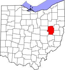 | |
| Villages | ||
| Townships | ||
| CDPs | ||
| Unincorporated communities | ||
| Ghost town | ||
| Footnotes | ‡This populated place also has portions in an adjacent county or counties | |