Newcomerstown, Ohio
| Newcomerstown, Ohio | |
|---|---|
| Village | |
|
Newcomerstown Middle School | |
| Motto: "Hometown Archive of Memories" | |
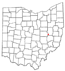 Location of Newcomerstown, Ohio | |
 Location of Newcomerstown in Tuscarawas County | |
| Coordinates: 40°16′28″N 81°36′9″W / 40.27444°N 81.60250°WCoordinates: 40°16′28″N 81°36′9″W / 40.27444°N 81.60250°W | |
| Country | United States |
| State | Ohio |
| County | Tuscarawas |
| Townships | Oxford, Salem |
| Government | |
| • Mayor | Patrick Cadle |
| Area[1] | |
| • Total | 2.94 sq mi (7.61 km2) |
| • Land | 2.84 sq mi (7.36 km2) |
| • Water | 0.10 sq mi (0.26 km2) |
| Elevation[2] | 810 ft (247 m) |
| Population (2010)[3] | |
| • Total | 3,822 |
| • Estimate (2012[4]) | 3,797 |
| • Density | 1,345.8/sq mi (519.6/km2) |
| Time zone | Eastern (EST) (UTC-5) |
| • Summer (DST) | EDT (UTC-4) |
| ZIP code | 43832 |
| Area code(s) | 740 |
| FIPS code | 39-54432[5] |
| GNIS feature ID | 1066860[2] |
| Website | http://www.newcomerstownoh.com/ |
.JPG)
Newcomerstown is a village in Tuscarawas County, Ohio, United States, 85 miles (137 km) east-northeast of Columbus. In the late 1770s, this was the largest Delaware Indian village on the Tuscarawas River, with 700 residents. Chief Newcomer (Netawatwes) was the leader of the western Delawares here, and they called the village Gekelmukpechunk. Early French traders and English settlers named the village Newcomerstown after the chief.[6] Soon after the start of the American Revolutionary War, the Delawares moved west to Coshocton, about halfway through what is now the next county.[7]
According to some accounts, Newcomerstown was named after an incident that occurred between a Delaware chief and his wife Mary Harris. Chief Eagle Feather grew tired of his wife. He abducted a younger squaw/white woman captive[?] as a second wife and tried to have Harris accept her in her wigwam. Harris allegedly killed Chief Eagle Feather and told the warriors of the village that the young squaw ran away. The warriors hunted the young woman down and killed her. The settlement was thenceforth known as "Newcomerstown", after the squaw.[8]In fact although a white woman captive had been killed December 26, 1750[9]Mary Harris {an assimilated captive of the 1704 Deerfield, Massacre} had nothing to do with it [10] and was in fact still married-not a widow![11]
In 1900, 2,659 people lived in Newcomerstown; in 1910, 2,943. The population was 3,822 at the 2010 census.
Geography
Newcomerstown is located at 40°16′28″N 81°36′9″W / 40.27444°N 81.60250°W (40.274350, -81.602482),[12] along the Tuscarawas River.[13]
According to the United States Census Bureau, the village has a total area of 2.94 square miles (7.61 km2), of which 2.84 square miles (7.36 km2) is land and 0.10 square miles (0.26 km2) is water.[1]
Demographics
| Historical population | |||
|---|---|---|---|
| Census | Pop. | %± | |
| 1850 | 476 | — | |
| 1860 | 577 | 21.2% | |
| 1870 | 791 | 37.1% | |
| 1880 | 926 | 17.1% | |
| 1890 | 1,251 | 35.1% | |
| 1900 | 2,659 | 112.5% | |
| 1910 | 2,943 | 10.7% | |
| 1920 | 3,389 | 15.2% | |
| 1930 | 4,265 | 25.8% | |
| 1940 | 4,564 | 7.0% | |
| 1950 | 4,514 | −1.1% | |
| 1960 | 4,273 | −5.3% | |
| 1970 | 4,155 | −2.8% | |
| 1980 | 3,986 | −4.1% | |
| 1990 | 4,012 | 0.7% | |
| 2000 | 4,008 | −0.1% | |
| 2010 | 3,822 | −4.6% | |
| Est. 2015 | 3,794 | [14] | −0.7% |
2010 census
As of the census[3] of 2010, there were 3,822 people, 1,598 households, and 982 families residing in the village. The population density was 1,345.8 inhabitants per square mile (519.6/km2). There were 1,798 housing units at an average density of 633.1 per square mile (244.4/km2). The racial makeup of the village was 95.6% White, 1.6% African American, 0.2% Native American, 0.3% Asian, 0.5% from other races, and 1.8% from two or more races. Hispanic or Latino of any race were 1.2% of the population.
There were 1,598 households of which 30.0% had children under the age of 18 living with them, 42.3% were married couples living together, 13.5% had a female householder with no husband present, 5.7% had a male householder with no wife present, and 38.5% were non-families. 33.7% of all households were made up of individuals and 16.3% had someone living alone who was 65 years of age or older. The average household size was 2.35 and the average family size was 2.98.
The median age in the village was 40.3 years. 24.1% of residents were under the age of 18; 8.7% were between the ages of 18 and 24; 23.2% were from 25 to 44; 26.4% were from 45 to 64; and 17.6% were 65 years of age or older. The gender makeup of the village was 47.4% male and 52.6% female.
2000 census
As of the census[5] of 2000, there were 4,008 people, 1,654 households, and 1,063 families residing in the village. The population density was 1,619.7 people per square mile (626.5/km²). There were 1,817 housing units at an average density of 734.3 per square mile (284.0/km²). The racial makeup of the village was 95.83% White, 2.57% African American, 0.25% Native American, 0.07% Asian, 0.20% from other races, and 1.07% from two or more races. Hispanic or Latino of any race were 0.72% of the population.
There were 1,654 households out of which 31.4% had children under the age of 18 living with them, 46.8% were married couples living together, 13.2% had a female householder with no husband present, and 35.7% were non-families. 31.0% of all households were made up of individuals and 16.0% had someone living alone who was 65 years of age or older. The average household size was 2.37 and the average family size was 2.96.
In the village the population was spread out with 26.1% under the age of 18, 7.8% from 18 to 24, 26.9% from 25 to 44, 21.2% from 45 to 64, and 17.9% who were 65 years of age or older. The median age was 38 years. For every 100 females there were 86.9 males. For every 100 females age 18 and over, there were 81.8 males.
The median income for a household in the village was $27,414, and the median income for a family was $34,464. Males had a median income of $26,703 versus $18,375 for females. The per capita income for the village was $15,946. About 12.0% of families and 16.0% of the population were below the poverty line, including 26.2% of those under age 18 and 11.4% of those age 65 or over.
Notable people
- Norman Bel Geddes, theatrical and industrial designer
- Woody Hayes, legendary Ohio State Buckeyes football coach
- Chief Newcomer (Netawatwes), western Delaware chief
- Cy Young - Hall of Fame pitcher who is honored by baseball's Cy Young Award
References
- 1 2 "US Gazetteer files 2010". United States Census Bureau. Retrieved 2013-01-06.
- 1 2 "US Board on Geographic Names". United States Geological Survey. 2007-10-25. Retrieved 2008-01-31.
- 1 2 "American FactFinder". United States Census Bureau. Retrieved 2013-01-06.
- ↑ "Population Estimates". United States Census Bureau. Retrieved 2013-06-17.
- 1 2 "American FactFinder". United States Census Bureau. Retrieved 2008-01-31.
- ↑ "Newcomerstown, Ohio - Ohio History Central". ohiohistorycentral.org. Retrieved 9 December 2014.
- ↑ History of Newcomerstown, Ohio, Ohio History, accessed 19 Mar 2010
- ↑ "Incident Among Indians Gave Community Name"], Newcomerstown website
- ↑ Christopher Gist Journal p.39
- ↑ Christopher Gist Journal .p.41
- ↑ Christopher Gist Journal .p.115
- ↑ "US Gazetteer files: 2010, 2000, and 1990". United States Census Bureau. 2011-02-12. Retrieved 2011-04-23.
- ↑ DeLorme (1991). Ohio Atlas & Gazetteer. Yarmouth, Maine: DeLorme. ISBN 0-89933-233-1.
- ↑ "Annual Estimates of the Resident Population for Incorporated Places: April 1, 2010 to July 1, 2015". Retrieved July 2, 2016.
- ↑ "Census of Population and Housing". Census.gov. Retrieved June 4, 2015.
External links
- Village website
- Newcomerstown Exempted Village Schools
- Newcomerstown Public Library
- Newcomerstown Historical Society
Municipalities and communities of Tuscarawas County, Ohio, United States | ||
|---|---|---|
| Cities | 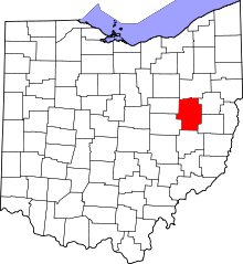 | |
| Villages | ||
| Townships | ||
| CDPs | ||
| Unincorporated communities | ||
| Ghost town | ||
| Footnotes | ‡This populated place also has portions in an adjacent county or counties | |