Dover, Ohio
| Dover, Ohio | |
|---|---|
| City | |
|
West Third Street in downtown Dover in 2006 | |
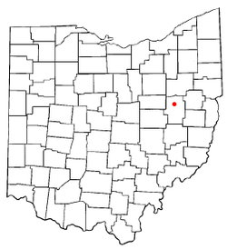 Location of Dover, Ohio | |
 Location of Dover in Tuscarawas County | |
| Coordinates: 40°31′36″N 81°28′40″W / 40.52667°N 81.47778°WCoordinates: 40°31′36″N 81°28′40″W / 40.52667°N 81.47778°W | |
| Country | United States |
| State | Ohio |
| County | Tuscarawas |
| Government | |
| • Mayor | Richard P. Homrighausen |
| Area[1] | |
| • Total | 5.79 sq mi (15.00 km2) |
| • Land | 5.69 sq mi (14.74 km2) |
| • Water | 0.10 sq mi (0.26 km2) |
| Elevation[2] | 879 ft (268 m) |
| Population (2010)[3] | |
| • Total | 12,826 |
| • Estimate (2012[4]) | 12,795 |
| • Density | 2,254.1/sq mi (870.3/km2) |
| Time zone | Eastern (EST) (UTC-5) |
| • Summer (DST) | EDT (UTC-4) |
| ZIP code | 44622 |
| Area code | 330 |
| FIPS code | 39-22456[5] |
| GNIS feature ID | 1039763[2] |
| Website | http://www.doverohio.com/ |

Dover is a city in Tuscarawas County, Ohio, United States. The population was 12,210 at the 2000 census.
History
Dover was platted in 1807, and most likely was named after the local Dover family.[6] A post office has been in operation at Dover since 1815.[7]
Geography
Dover is located at 40°31′36″N 81°28′40″W / 40.52667°N 81.47778°W (40.526545, -81.477769),[8] along the Tuscarawas River, near the mouth of Sugar Creek.[9]
According to the United States Census Bureau, the city has a total area of 5.79 square miles (15.00 km2), of which 5.69 square miles (14.74 km2) is land and 0.10 square miles (0.26 km2) is water.[1]
Demographics
| Historical population | |||
|---|---|---|---|
| Census | Pop. | %± | |
| 1840 | 598 | — | |
| 1860 | 1,343 | — | |
| 1870 | 1,593 | 18.6% | |
| 1880 | 2,208 | 38.6% | |
| 1890 | 3,470 | 57.2% | |
| 1900 | 5,422 | 56.3% | |
| 1910 | 6,621 | 22.1% | |
| 1920 | 8,101 | 22.4% | |
| 1930 | 9,716 | 19.9% | |
| 1940 | 9,691 | −0.3% | |
| 1950 | 9,852 | 1.7% | |
| 1960 | 11,300 | 14.7% | |
| 1970 | 11,516 | 1.9% | |
| 1980 | 11,500 | −0.1% | |
| 1990 | 11,329 | −1.5% | |
| 2000 | 12,210 | 7.8% | |
| 2010 | 12,826 | 5.0% | |
| Est. 2015 | 12,899 | [10] | 0.6% |
| Sources:[5][11][12][13] | |||
2010 census
As of the census[3] of 2010, there were 12,826 people, 5,181 households, and 3,297 families residing in the city. The population density was 2,254.1 inhabitants per square mile (870.3/km2). There were 5,578 housing units at an average density of 980.3 per square mile (378.5/km2). The racial makeup of the city was 94.1% White, 1.1% African American, 0.6% Native American, 0.5% Asian, 0.7% Pacific Islander, 1.7% from other races, and 1.4% from two or more races. Hispanic or Latino of any race were 4.1% of the population.
There were 5,181 households of which 28.5% had children under the age of 18 living with them, 49.7% were married couples living together, 9.8% had a female householder with no husband present, 4.1% had a male householder with no wife present, and 36.4% were non-families. 31.6% of all households were made up of individuals and 15.6% had someone living alone who was 65 years of age or older. The average household size was 2.37 and the average family size was 2.96.
The median age in the city was 42.9 years. 22.3% of residents were under the age of 18; 7.3% were between the ages of 18 and 24; 22.9% were from 25 to 44; 25.6% were from 45 to 64; and 22% were 65 years of age or older. The gender makeup of the city was 47.4% male and 52.6% female.
2000 census
As of the census[5] of 2000, there were 12,210 people, 4,996 households, and 3,362 families residing in the city. The population density was 2,319.6 people per square mile (896.3/km²). There were 5,233 housing units at an average density of 994.2 per square mile (384.1/km²). The racial makeup of the city was 97.09% White, 1.27% African American, 0.25% Native American, 0.51% Asian, 0.02% Pacific Islander, 0.20% from other races, and 0.66% from two or more races. Hispanic or Latino of any race were 0.60% of the population.
There were 4,996 households out of which 30.2% had children under the age of 18 living with them, 54.4% were married couples living together, 10.0% had a female householder with no husband present, and 32.7% were non-families. 28.8% of all households were made up of individuals and 14.9% had someone living alone who was 65 years of age or older. The average household size was 2.39 and the average family size was 2.94.
In the city the population was spread out with 24.1% under the age of 18, 6.7% from 18 to 24, 26.8% from 25 to 44, 22.5% from 45 to 64, and 19.9% who were 65 years of age or older. The median age was 40 years. For every 100 females there were 86.9 males. For every 100 females age 18 and over, there were 83.1 males.
The median income for a household in the city was $36,665, and the median income for a family was $44,604. Males had a median income of $34,579 versus $22,397 for females. The per capita income for the city was $18,928. About 7.5% of families and 9.2% of the population were below the poverty line, including 11.1% of those under age 18 and 9.7% of those age 65 or over.
Arts and culture
Dover is adjacent to New Philadelphia, the county seat of Tuscarawas County, with the two cities considered twin cities. Each year, the "Tornadoes" of Dover High School play the rival "Quakers" of New Philadelphia in a football game that has been played annually for more than a century—the third longest-running football rivalry in the state of Ohio.[14] Additionally, the city of Dover hosts the Tuscawaras County Italian-American Festival every summer.[15]
Notable people
- Brett Hutchison, "Back in Ohio"
- Elwyn Berlekamp, mathematician
- James R. Black, American actor and former professional football player
- Frank Ellwood, former head football coach of Marshall University and Georgia Southern University
- Percival "Perci" Garner, III, Major League Baseball player for the Cleveland Indians [16]
- Vic Gilliam, American politician and part-time actor
- Ernie Godfrey, college football coach, College Football Hall of Fame
- Theophil Hildebrandt, mathematician
- Joseph C. Hisrich, educator and member of the Wisconsin State Assembly[17]
- Al Landis, member of the Ohio House of Representatives
- Al Mays, 19th-century Major League Baseball pitcher
- Ray Mears, college basketball coach
- Elliott Nugent, playwright, producer and actor
- Bob Peterson, animator, screenwriter, director, Pixar
- William Quantrill, guerrilla fighter, American Civil War
- Trevor J. Rees, former Kent State Golden Flashes head football coach and athletic director
- Allan Sayre, former member from the 96th district of the Ohio House of Representatives
- Mark Dean Schwab, child rapist and murderer
- Zack Space, U.S. Representative, Ohio's 18th congressional district
- Al Veigel, Major League Baseball played for the Boston Bees during the 1939 season
- Stan White, former National Football League player for the Baltimore Colts and Detroit Lions.
- Johnny Wilson, former National Football League player for the Cleveland Rams
References
- 1 2 "US Gazetteer files 2010". United States Census Bureau. Retrieved 2013-01-06.
- 1 2 "US Board on Geographic Names". United States Geological Survey. 2007-10-25. Retrieved 2008-01-31.
- 1 2 "American FactFinder". United States Census Bureau. Retrieved 2013-01-06.
- ↑ "Population Estimates". United States Census Bureau. Retrieved 2013-06-17.
- 1 2 3 "American FactFinder". United States Census Bureau. Retrieved 2008-01-31.
- ↑ Overman, William Daniel (1958). Ohio Town Names. Akron, OH: Atlantic Press. p. 38.
- ↑ "Post offices". Jim Forte Postal History. Retrieved 9 June 2016.
- ↑ "US Gazetteer files: 2010, 2000, and 1990". United States Census Bureau. 2011-02-12. Retrieved 2011-04-23.
- ↑ DeLorme (1991). Ohio Atlas & Gazetteer. Yarmouth, Maine: DeLorme. ISBN 0-89933-233-1.
- ↑ "Annual Estimates of the Resident Population for Incorporated Places: April 1, 2010 to July 1, 2015". Retrieved July 2, 2016.
- ↑ "Number of Inhabitants: Ohio" (PDF). 18th Census of the United States. U.S. Census Bureau. Retrieved 22 November 2013.
- ↑ "Ohio: Population and Housing Unit Counts" (PDF). U.S. Census Bureau. Retrieved 22 November 2013.
- ↑ "Incorporated Places and Minor Civil Divisions Datasets: Subcounty Population Estimates: April 1, 2010 to July 1, 2012". U.S. Census Bureau. Retrieved 25 November 2013.
- ↑ "Dover, New Philadelphia fans prepare for big game during Spirit Week". Retrieved 22 March 2016.
- ↑ "Tuscawaras County Italian-American Festival". Retrieved 13 February 2015.
- ↑ Meisel, Zack. "Cleveland Indians rookie reliever Perci Garner 'is already leading the American League in smiles'". Cleveland.com. Retrieved 2016-09-01.
- ↑ 'Wisconsin Blue Book 1991,' Biographical Sketch of Joseph C. Hisrich, pg. 83
External links
| Wikimedia Commons has media related to Dover, Ohio. |
| Wikisource has the text of the 1911 Encyclopædia Britannica article Canal Dover. |
| Wikisource has the text of a 1921 Collier's Encyclopedia article about Dover, Ohio. |
- City of Dover
- Tuscarawas County History
- Northeast Ohio Travel - History of Dover
- Dover Public Library
Municipalities and communities of Tuscarawas County, Ohio, United States | ||
|---|---|---|
| Cities | 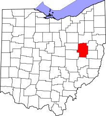 | |
| Villages | ||
| Townships | ||
| CDPs | ||
| Unincorporated communities | ||
| Ghost town | ||
| Footnotes | ‡This populated place also has portions in an adjacent county or counties | |