Strattanville, Pennsylvania
| Strattanville, Pennsylvania | |
|---|---|
| Borough | |
|
Houses on Main Street | |
 Map showing Strattanville in Clarion County | |
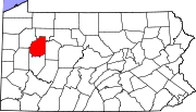 Map showing Clarion County in Pennsylvania | |
 Strattanville Map showing Strattanville in Clarion County | |
| Coordinates: 41°12′09″N 79°19′44″W / 41.20250°N 79.32889°WCoordinates: 41°12′09″N 79°19′44″W / 41.20250°N 79.32889°W | |
| Country | United States |
| State | Pennsylvania |
| County | Clarion |
| Settled | 1828 |
| Incorporated | 1850 |
| Government | |
| • Type | Borough Council |
| Area | |
| • Total | 0.51 sq mi (1.31 km2) |
| • Land | 0.51 sq mi (1.31 km2) |
| • Water | 0.0 sq mi (0.0 km2) |
| Elevation | 1,531 ft (467 m) |
| Population (2010) | |
| • Total | 550 |
| • Density | 1,089/sq mi (420.5/km2) |
| Time zone | Eastern (EST) (UTC-5) |
| • Summer (DST) | EDT (UTC-4) |
| ZIP code | 16258 |

Strattanville is a borough in Clarion County, Pennsylvania, United States. The population was 550 at the 2010 census.[1]
Geography
Strattanville is located in eastern Clarion County at 41°12′9″N 79°19′44″W / 41.20250°N 79.32889°W (41.202482, -79.328934).[2] U.S. Route 322 passes through the borough, leading west 3 miles (5 km) to Clarion, the county seat, and east 4.5 miles (7.2 km) to Interstate 80. Exit 64 on I-80 is 3 miles (5 km) southwest of Strattanville via secondary roads.
According to the United States Census Bureau, the borough has a total area of 0.51 square miles (1.31 km2), all of it land.[1]
Fire department
The borough is home to the Strattanville Volunteer Fire Company Number 1. The company was established in 1928, and covered a large amount of Clarion County. Over time more companies were added to the surrounding townships and boroughs. Strattanville donated one engine to nearby Millcreek Township (590), in order to better serve the surrounding area. Today, the coverage area is 25 square miles (65 km2) comprising Strattanville Borough and eastern Clarion Township. SVFC often responds to assist the surrounding services of Clarion (520), Corsica (Jefferson County 3), Limestone (580), and Millcreek.
Until recently all Clarion County companies responded under their respective names (i.e. Strattanville respond for a structure fire, Strattanville Borough). After 9/11, Clarion County adopted station numbers for the companies based on alphabetical order. Strattanville is station 660 locally and 16-660 nationally. Currently Strattanville has five apparatuses, two engines, one tanker/tender, one brush/wildland, and one heavy rescue. 43 men and women volunteer for the company.
Demographics
| Historical population | |||
|---|---|---|---|
| Census | Pop. | %± | |
| 1860 | 323 | — | |
| 1870 | 356 | 10.2% | |
| 1880 | 317 | −11.0% | |
| 1890 | 331 | 4.4% | |
| 1900 | 262 | −20.8% | |
| 1910 | 376 | 43.5% | |
| 1920 | 461 | 22.6% | |
| 1930 | 487 | 5.6% | |
| 1940 | 604 | 24.0% | |
| 1950 | 562 | −7.0% | |
| 1960 | 547 | −2.7% | |
| 1970 | 559 | 2.2% | |
| 1980 | 555 | −0.7% | |
| 1990 | 490 | −11.7% | |
| 2000 | 542 | 10.6% | |
| 2010 | 550 | 1.5% | |
| Est. 2015 | 525 | [3] | −4.5% |
| Sources:[4][5][6] | |||
As of the census[5] of 2000, there were 542 people, 243 households, and 150 families residing in the borough. The population density was 1,013.6 people per square mile (394.8/km²). There were 254 housing units at an average density of 475.0 per square mile (185.0/km²). The racial makeup of the borough was 97.79% White, 0.92% African American, 0.37% Asian, and 0.92% from two or more races.
There were 243 households, out of which 29.6% had children under the age of 18 living with them, 43.2% were married couples living together, 12.8% had a female householder with no husband present, and 37.9% were non-families. 29.6% of all households were made up of individuals, and 9.9% had someone living alone who was 65 years of age or older. The average household size was 2.22 and the average family size was 2.73.
In the borough the population was spread out, with 23.2% under the age of 18, 9.6% from 18 to 24, 33.0% from 25 to 44, 19.4% from 45 to 64, and 14.8% who were 65 years of age or older. The median age was 36 years. For every 100 females there were 88.2 males. For every 100 females age 18 and over, there were 81.7 males.
The median income for a household in the borough was $25,833, and the median income for a family was $31,125. Males had a median income of $28,125 versus $18,929 for females. The per capita income for the borough was $14,506. About 11.3% of families and 15.8% of the population were below the poverty line, including 34.8% of those under age 18 and 5.4% of those age 65 or over.
References
- 1 2 "Geographic Identifiers: 2010 Census Summary File 1 (G001): Strattanville borough, Pennsylvania". U.S. Census Bureau, American Factfinder. Retrieved April 24, 2015.
- ↑ "US Gazetteer files: 2010, 2000, and 1990". United States Census Bureau. 2011-02-12. Retrieved 2011-04-23.
- ↑ "Annual Estimates of the Resident Population for Incorporated Places: April 1, 2010 to July 1, 2015". Retrieved July 2, 2016.
- ↑ "Census of Population and Housing". U.S. Census Bureau. Retrieved 11 December 2013.
- 1 2 "American FactFinder". United States Census Bureau. Retrieved 2008-01-31.
- ↑ "Incorporated Places and Minor Civil Divisions Datasets: Subcounty Resident Population Estimates: April 1, 2010 to July 1, 2012". Population Estimates. U.S. Census Bureau. Retrieved 11 December 2013.
Municipalities and communities of Clarion County, Pennsylvania, United States | ||
|---|---|---|
| Boroughs | | |
| Townships | ||
| CDPs | ||
| Unincorporated communities | ||
| Footnotes | ‡This populated place also has portions in an adjacent county or counties | |