Clarion, Pennsylvania
| Clarion, Pennsylvania | |
|---|---|
| Borough | |
|
The Clarion County Courthouse downtown | |
 Map showing Clarion in Clarion County | |
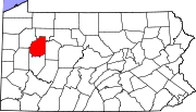 Map showing Clarion County in Pennsylvania | |
 Clarion Location in Pennsylvania | |
| Coordinates: 41°12′42″N 79°23′02″W / 41.21167°N 79.38389°WCoordinates: 41°12′42″N 79°23′02″W / 41.21167°N 79.38389°W | |
| Country | United States |
| State | Pennsylvania |
| County | Clarion |
| Settled | 1839 |
| Incorporated | 1841 |
| Government | |
| • Type | Borough council |
| • Mayor | J. David Walters |
| Area | |
| • Total | 1.62 sq mi (4.19 km2) |
| • Land | 1.58 sq mi (4.08 km2) |
| • Water | 0.04 sq mi (0.11 km2) |
| Elevation | 1,491 ft (454 m) |
| Population (2010) | |
| • Total | 5,276 |
| • Density | 3,351/sq mi (1,293.9/km2) |
| Time zone | Eastern (EST) (UTC-5) |
| • Summer (DST) | EDT (UTC-4) |
| ZIP code | 16214 |
| Area code(s) | 814 |
| Website |
www |
.jpg)
Clarion is a borough in and the county seat of Clarion County, Pennsylvania, United States.[1] It is located 77 miles (124 km) north-northeast of Pittsburgh and is part of the Pittsburgh DMA. Clarion was settled in 1839 and incorporated in 1841. In the past, the surrounding area produced natural gas, oil, lumber and coal. The population was 2,004 in 1900, 2,864 in 1910, and 5,276 at the 2010 census.[2] It is home to the annual Autumn Leaf Festival and Clarion University of Pennsylvania. The county courthouse was added to the National Register of Historic Places in 1979.
Geography
Clarion is located slightly northeast of the center of Clarion County at 41°12′42″N 79°23′2″W / 41.21167°N 79.38389°W (41.211791, -79.384005),[3] in the Allegheny Plateau region of western Pennsylvania. The main part of the borough sits at an elevation of 1,400 to 1,500 feet (430 to 460 m) above sea level, overlooking the 400-foot-deep (120 m) valley of the Clarion River, a tributary of the Allegheny River.
U.S. Route 322 passes through the borough as Main Street, leading northwest 28 miles (45 km) to Franklin and southeast 16 miles (26 km) to Brookville. Pennsylvania Route 68 (Fifth Avenue) leads south from the center of Clarion, 2 miles (3 km) to Exit 62 of Interstate 80 and 11 miles (18 km) to Sligo.
According to the United States Census Bureau, the borough has a total area of 1.62 square miles (4.19 km2), of which 1.58 square miles (4.08 km2) is land and 0.04 square miles (0.11 km2), or 2.70%, is water.[2]
Demographics
| Historical population | |||
|---|---|---|---|
| Census | Pop. | %± | |
| 1850 | 719 | — | |
| 1860 | 648 | −9.9% | |
| 1870 | 709 | 9.4% | |
| 1880 | 1,169 | 64.9% | |
| 1890 | 2,164 | 85.1% | |
| 1900 | 2,004 | −7.4% | |
| 1910 | 2,612 | 30.3% | |
| 1920 | 2,793 | 6.9% | |
| 1930 | 3,201 | 14.6% | |
| 1940 | 3,798 | 18.7% | |
| 1950 | 4,409 | 16.1% | |
| 1960 | 4,958 | 12.5% | |
| 1970 | 6,095 | 22.9% | |
| 1980 | 6,198 | 1.7% | |
| 1990 | 6,457 | 4.2% | |
| 2000 | 6,185 | −4.2% | |
| 2010 | 5,276 | −14.7% | |
| Est. 2015 | 6,089 | [4] | 15.4% |
| Sources:[5][6][7] | |||
As of the census[6] of 2000, there were 6,185 people, 2,000 households, and 718 families residing in the borough. The population density was 4,142.8 people per square mile (1,602.7/km²). There were 2,192 housing units at an average density of 1,468.2 per square mile (568.0/km²). The racial makeup of the borough was 94.55% White, 3.48% African American, 0.08% Native American, 0.99% Asian, 0.15% from other races, and 0.76% from two or more races. Hispanic or Latino of any race were 0.82% of the population.
There were 2,000 households, out of which 15.0% had children under the age of 18 living with them, 25.3% were married couples living together, 8.6% had a female householder with no husband present, and 64.1% were non-families. 38.6% of all households were made up of individuals, and 11.7% had someone living alone who was 65 years of age or older. The average household size was 2.17 and the average family size was 2.75. versus $20,214 for females. The per capita income for the borough was $10,832. About 18.8% of families and 41.2% of the population were below the poverty line, including 27.1% of those under age 18 and 7.2% of those age 65 or over.
Borough council
Clarion is governed by an elected, seven member Borough Council. Current council members include President Carol Lapinto, Vice President Brenda Sanders Dede, President Pro Tem Earl Zerfoss, Charles Bartley, Jason Noto, Rachel Roberts, and Benjamin Aaron. J. David Walters is Mayor.
Notable people
- Ernest M. Skinner, pipe organ builder
References
- ↑ "Find a County". National Association of Counties. Archived from the original on 2011-05-31. Retrieved 2011-06-07.
- 1 2 "Geographic Identifiers: 2010 Census Summary File 1 (G001): Clarion borough, Pennsylvania". U.S. Census Bureau, American Factfinder. Retrieved April 22, 2015.
- ↑ "US Gazetteer files: 2010, 2000, and 1990". United States Census Bureau. 2011-02-12. Retrieved 2011-04-23.
- ↑ "Annual Estimates of the Resident Population for Incorporated Places: April 1, 2010 to July 1, 2015". Retrieved July 2, 2016.
- ↑ "Census of Population and Housing". U.S. Census Bureau. Archived from the original on 11 May 2015. Retrieved 11 December 2013.
- 1 2 "American FactFinder". United States Census Bureau. Archived from the original on 2013-09-11. Retrieved 2008-01-31.
- ↑ "Incorporated Places and Minor Civil Divisions Datasets: Subcounty Resident Population Estimates: April 1, 2010 to July 1, 2012". Population Estimates. U.S. Census Bureau. Archived from the original on 17 June 2013. Retrieved 11 December 2013.
External links
![]() Media related to Clarion, Pennsylvania at Wikimedia Commons
Media related to Clarion, Pennsylvania at Wikimedia Commons
- Clarion Borough official website
- Clarion Area Chamber of Business & Industry
- ExploreClarion.com, guide to Clarion County
Municipalities and communities of Clarion County, Pennsylvania, United States | ||
|---|---|---|
| Boroughs | | |
| Townships | ||
| CDPs | ||
| Unincorporated communities | ||
| Footnotes | ‡This populated place also has portions in an adjacent county or counties | |