Stratford, California
| Stratford, California | |
|---|---|
| census-designated place | |
|
Stratford, California | |
 Location in Kings County and the state of California | |
| Coordinates: 36°11′22″N 119°49′23″W / 36.18944°N 119.82306°WCoordinates: 36°11′22″N 119°49′23″W / 36.18944°N 119.82306°W | |
| Country |
|
| State |
|
| County | Kings |
| Founded | 1901 (as Stratton) |
| Area[1] | |
| • Total | 0.683 sq mi (1.769 km2) |
| • Land | 0.683 sq mi (1.769 km2) |
| • Water | 0 sq mi (0 km2) 0% |
| Elevation[2] | 203 ft (62 m) |
| Population (2010) | |
| • Total | 1,277 |
| • Estimate (2014) | 900[3] |
| • Density | 1,900/sq mi (720/km2) |
| Time zone | Pacific (PST) (UTC-8) |
| • Summer (DST) | PDT (UTC-7) |
| ZIP code | 93266 |
| Area code(s) | 559 |
| FIPS code | 06-75252 |
| GNIS feature ID | 1661510 |
| U.S. Geological Survey Geographic Names Information System: Stratford, California | |

Stratford (formerly, Stratton)[2] is a census-designated place (CDP) in Kings County, California, United States. Stratford is located 14 miles (23 km) southwest of Hanford,[4] at an elevation of 203 feet (62 m).[2] It is part of the Hanford–Corcoran Metropolitan Statistical Area. The population was 1,277 at the 2010 census, up from 1,264 at the 2000 census.
Geography
Stratford lies near the historic shoreline of Tulare Lake. The Kings River flows through an artificial channel into the normally dry Tulare Lake bed about ten miles (16 km) south of Stratford.[5]
According to the United States Census Bureau, Stratford has a total area of 0.7 square miles (1.8 km2), all of it land. Stratford is located at 36°11′22″N 119°49′23″W / 36.18944°N 119.82306°W.[2]
History
The town was originally named Stratton in 1901 for William Stratton of the Empire Land and Water Company. The name was changed to Stratford in 1906 due to the efforts of the local women's club. The first post office at Stratford opened in 1910.[6] From the 1930s through the 1970s, Stratford was the home of Irigaray's, a restaurant run by Mariana Irigaray and her daughter Alice, pioneering a Basque-inspired version on what would later be called California cuisine.[7][8]
Many local residents are employed in agriculture, affected by the Great Recession and, as of March 2016 and the California drought.
In January 2016, the unemployment rate was estimated at 16.0%.[9]
Transportation
Kings Area Rural Transit (KART) operates regularly scheduled fixed route bus service, vanpool service for commuters and Dial-A-Ride (demand response) services throughout Kings County as well as to Fresno.[10]
![]() Highway 41 runs north-northeast on the west side of town, connecting it with Kettleman City on the south and Lemoore on the north.
Highway 41 runs north-northeast on the west side of town, connecting it with Kettleman City on the south and Lemoore on the north.
Education
Stratford Elementary School is within the Central Union School District.[3][11]
Politics
In the state legislature, Stratford is located in the 16th Senate District, which is represented by Republican Andy Vidak, and in the 32nd Assembly District, represented by Democrat Rudy Salas. Federally, Hanford is located in California's 21st congressional district and is represented by Republican David Valadao.
Stratford is represented on the Kings County Board of Supervisors by Joe Neves, a Stratford resident.
Demographics
2010
The 2010 United States Census[12] reported that Stratford had a population of 1,277. The population density was 1,870.0 people per square mile (722.0/km²). Hispanic or Latino of any race were 1,069 persons (83.7%). The racial makeup of Stratford was 574 (44.9%) White, 19 (1.5%) Asian, 17 (1.3%) Native American, 16 (1.3%) African American, 1 (0.1%) Pacific Islander, 617 (48.3%) from other races, and 33 (2.6%) from two or more races.
The Census reported that 1,277 people (100% of the population) lived in households. There were 312 households, of which 184 (59.0%) had children under the age of 18 living in them, 206 (66.0%) were opposite-sex married couples living together, 44 (14.1%) had a female householder with no husband present, 22 (7.1%) had a male householder with no wife present. There were 18 (5.8%) unmarried opposite-sex partnerships, and 4 (1.3%) same-sex married couples or partnerships. 31 households (9.9%) were made up of individuals and 13 (4.2%) had someone living alone who was 65 years of age or older. The average household size was 4.09. There were 272 families (87.2% of all households); the average family size was 4.33.
433 people (33.9%) were under the age of 18, 143 people (11.2%) aged 18 to 24, 332 people (26.0%) aged 25 to 44, 277 people (21.7%) aged 45 to 64, and 92 people (7.2%) who were 65 years of age or older. The median age was 27.6 years. For every 100 females there were 101.4 males. For every 100 females age 18 and over, there were 99.5 males.
There were 328 housing units at an average density of 480.3 per square mile (185.4/km²), of which 206 (66.0%) were owner-occupied, and 106 (34.0%) were occupied by renters. The homeowner vacancy rate was 1.9%; the rental vacancy rate was 2.7%. 827 people (64.8% of the population) lived in owner-occupied housing units and 450 people (35.2%) lived in rental housing units.
2000
At the 2000 United States Census,[13] there were 1,264 people, 292 households and 259 families residing in the CDP. The population density was 1,816.9 per square mile (697.2/km²). There were 311 housing units at an average density of 447.0 per square mile (171.5/km²). The racial makeup of the CDP was 33.47% White, 1.19% African American, 1.98% Native American, 1.74% Asian, 0.55% Pacific Islander, 54.83% from other races, and 6.25% from two or more races. Hispanic or Latino of any race were 75.95% of the population.
There were 292 households of which 64.4% had children under the age of 18 living with them, 74.3% were married couples living together, 9.9% had a female householder with no husband present, and 11.0% were non-families. 8.2% of all households were made up of individuals and 4.5% had someone living alone who was 65 years of age or older. The average household size was 4.33 and the average family size was 4.57.
40.8% of the population were under the age of 18, 11.7% from 18 to 24, 26.4% from 25 to 44, 15.7% from 45 to 64, and 5.3% who were 65 years of age or older. The median age was 24 years. For every 100 females there were 103.9 males. For every 100 females age 18 and over, there were 106.6 males.
The median household income was $29,205 and the median family income was $35,481. Males had a median income of $33,750 versus $28,125 for females. The per capita income for the CDP was $9,790. About 20.2% of families and 24.8% of the population were below the poverty line, including 28.1% of those under age 18 and 6.9% of those age 65 or over.
References
- ↑ U.S. Census
- 1 2 3 4 U.S. Geological Survey Geographic Names Information System: Stratford, California
- 1 2 Marcum, Diana (October 24, 2014). "A parched farm town is sinking, and so are its residents' hearts". Los Angeles Times. Retrieved 2014-10-24.
- ↑ Durham, David L. (1998). California's Geographic Names: A Gazetteer of Historic and Modern Names of the State. Clovis, Calif.: Word Dancer Press. p. 1111. ISBN 1-884995-14-4.
- ↑ Durham, David L. (2001). Place-Names of Central California. Clovis, CA: Word Dancer Press. p. 146. ISBN 1-884995-33-0.
- ↑ Durham, David L. (2001). Place-Names of Central California. Clovis, CA: Word Dancer Press. pp. 266–267. ISBN 1-884995-33-0.
- ↑ Zubiri, Nancy (2006). A Travel Guide to Basque America. University of Nevada Press. p. 150. ISBN 0874176328. Retrieved 2014-10-24.
Although Basque families live in the suburbs and towns around Fresno, none of the latter have a restaurant. But in nearby Stratford, Mariana Irigaray is famous to this day for the Basque meals she once served at her home....From the 1930s through the 1960s Mariana and her daughter Alice Irigaray were serving California cuisine before the term was ever invented.
- ↑ Milwaukee Journal, June 13, 1979, https://news.google.com/newspapers?nid=1499&dat=19790613&id=8J8oAAAAIBAJ&sjid=pykEAAAAIBAJ&pg=1982,1554075 accessed May 20, 2012
- ↑ http://www.labormarketinfo.edd.ca.gov/county/kings.html#AA accessed March 6, 2016
- ↑ "Transit". Kings County Association of Governments. Retrieved 2014-10-24.
- ↑ http://stratford.central.k12.ca.us
- ↑ "2010 Census Interactive Population Search: CA - Stratford CDP". U.S. Census Bureau. Retrieved July 12, 2014.
- ↑ "American FactFinder". United States Census Bureau. Retrieved 2008-01-31.
External links
- Marcum, Diana (October 24, 2014). "A parched farm town is sinking, and so are its residents' hearts". Los Angeles Times., a profile of the community
- When a Town Goes Dry, The Atlantic, May 2016, http://www.theatlantic.com/video/index/483120/when-a-town-runs-dry
Municipalities and communities of Kings County, California, United States | ||
|---|---|---|
| Cities | 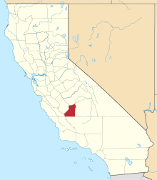 | |
| CDPs | ||
| Unincorporated communities | ||
| Ghost towns | ||