Stourpaine
| Stourpaine | |
 Stourpaine viewed from Hod Hill |
|
 Stourpaine |
|
| Population | 617 |
|---|---|
| OS grid reference | ST861093 |
| Civil parish | Stourpaine |
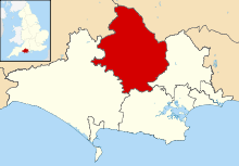
| District | North Dorset |
| Shire county | Dorset |
| Region | South West |
| Country | England |
| Sovereign state | United Kingdom |
| Post town | BLANDFORD FORUM |
| Postcode district | DT11 |
| Dialling code | 01258 |
| Police | Dorset |
| Fire | Dorset and Wiltshire |
| Ambulance | South Western |
| EU Parliament | South West England |
| UK Parliament | North Dorset |
Coordinates: 50°53′05″N 2°11′53″W / 50.8847°N 2.198°W
Stourpaine (/staʊərˈpeɪn/ stowr-PAYN) is a village and civil parish in the county of Dorset in southern England. It is situated in the valley of the River Stour in the North Dorset administrative district, 3 miles (4.8 km) northwest of Blandford Forum. The A350 road, which connects Blandford to Shaftesbury to the north, passes through the village. The chalk hills of Cranborne Chase and the Dorset Downs lie immediately to the north-east and south-west respectively. In the 2011 census the civil parish had 277 dwellings,[1] 265 households and a population of 617.[2]
References
- ↑ "Area: Stourpaine (Parish). Dwellings, Household Spaces and Accommodation Type, 2011 (KS401EW)". Neighbourhood Statistics. Office for National Statistics. Retrieved 6 February 2015.
- ↑ "Area: Stourpaine (Parish). Key Figures for 2011 Census: Key Statistics". Neighbourhood Statistics. Office for National Statistics. Retrieved 6 February 2015.
External links
![]() Media related to Stourpaine at Wikimedia Commons
Media related to Stourpaine at Wikimedia Commons
This article is issued from Wikipedia - version of the 9/30/2016. The text is available under the Creative Commons Attribution/Share Alike but additional terms may apply for the media files.