North Dorset
| North Dorset District | |
|---|---|
| Non-metropolitan district | |
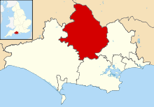 North Dorset shown within Dorset | |
| Sovereign state | United Kingdom |
| Constituent country | England |
| Region | South West England |
| Non-metropolitan county | Dorset |
| Status | Non-metropolitan district |
| Admin HQ | Blandford Forum |
| Incorporated | 1 April 1974 |
| Government | |
| • Type | Non-metropolitan district council |
| • Body | North Dorset District Council |
| • Leadership | Leader and Cabinet (Conservative) |
| • MPs | Simon Hoare |
| Area | |
| • Total | 235.2 sq mi (609.2 km2) |
| Area rank | 69th (of 326) |
| Population (mid-2014 est.) | |
| • Total | 70,043 |
| • Rank | 300th (of 326) |
| • Density | 300/sq mi (110/km2) |
| • Ethnicity | 98.6% White |
| Time zone | GMT (UTC0) |
| • Summer (DST) | BST (UTC+1) |
| ONS code |
19UE (ONS) E07000050 (GSS) |
| OS grid reference | ST8862706885 |
| Website |
www |
North Dorset is a local government district in Dorset, England. It is largely rural, but includes the towns of Blandford Forum, Gillingham, Shaftesbury, Stalbridge and Sturminster Newton. Much of North Dorset is in the River Stour valley and is called the Blackmore Vale. The economy of North Dorset is largely dairy agriculture based.
The district was formed on 1 April 1974, under the Local Government Act 1972, from the municipal boroughs of Blandford Forum, Shaftesbury, Blandford Rural District, Shaftesbury Rural District and Sturminster Rural District.
At the 2001 UK census North Dorset had a population of 61,905, a rise of 8,300 from 1991, with 25,248 households.
North Dorset is home to North Dorset Rugby Football Club
Settlements
- Towns with a population over 2,500 are in bold.
- Anderson, Ashmore
- Belchalwell, Blandford Forum, Bourton, Bryanston, Buckhorn Weston
- Cann, Charlton Marshall, Chettle, Child Okeford, Compton Abbas
- Durweston
- East Orchard, East Stour
- Farnham, Fifehead Magdalen, Fifehead Neville, Fontmell Magna
- Gillingham, Glanvilles Wootton
- Hammoon, Hazelbury Bryan, Hilton, Hinton St Mary
- Ibberton, Iwerne Courtney, Iwerne Minster
- Kington Magna
- Langton Long Blandford, Lydlinch
- Manston, Mappowder, Margaret Marsh, Marnhull, Melbury Abbas, Milborne St Andrew, Milton Abbas, Motcombe
- Okeford Fitzpaine
- Pimperne, Pulham
- Shaftesbury, Shillingstone, Silton, Spetisbury, Stalbridge, Stoke Wake, Stourpaine, Stour Provost, Stourton Caundle, Stour Row, Sturminster Newton, Sutton Waldron
- Tarrant Crawford, Tarrant Gunville, Tarrant Hinton, Tarrant Keyneston, Tarrant Launceston, Tarrant Monkton, Tarrant Rawston, Tarrant Rushton, Todber, Turnworth
- West Orchard, West Stour, Winterborne Clenston, Winterborne Houghton, Winterborne Kingston, Winterborne Stickland, Winterborne Whitechurch, Winterborne Zelston, Woolland
External links
Dorset Portal | |
| Unitary authorities | |
| Boroughs or districts | |
| Major settlements | |
| Rivers | |
| Topics | |
Coordinates: 50°51′38.92″N 2°9′41.77″W / 50.8608111°N 2.1616028°W