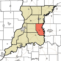
Steen Township, Knox County, Indiana
| Steen Township | |
|---|---|
| Township | |
|
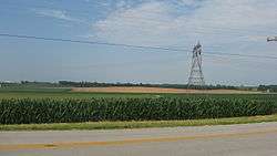
Fields northwest of Wheatland | |
 | |
| Coordinates: 38°40′02″N 87°17′59″W / 38.66722°N 87.29972°WCoordinates: 38°40′02″N 87°17′59″W / 38.66722°N 87.29972°W | |
| Country | United States |
| State | Indiana |
| County | Knox |
| Government | |
| • Type | Indiana township |
| Area | |
| • Total | 36.91 sq mi (95.6 km2) |
| • Land | 36.5 sq mi (95 km2) |
| • Water | 0.42 sq mi (1.1 km2) |
| Elevation[1] | 479 ft (146 m) |
| Population (2010) | |
| • Total | 900 |
| • Density | 24.7/sq mi (9.5/km2) |
| FIPS code | 18-72908[2] |
| GNIS feature ID | 453872 |
Steen Township is one of ten townships in Knox County, Indiana. As of the 2010 census, its population was 900 and it contained 394 housing units.[3]
History
Steen Township was founded in 1857. It was named for Richard Steen, a pioneer settler.[4]
Andrew Nicholson Farmstead was added to the National Register of Historic Places in 2005.[5]
Geography
According to the 2010 census, the township has a total area of 36.91 square miles (95.6 km2), of which 36.5 square miles (95 km2) (or 98.89%) is land and 0.42 square miles (1.1 km2) (or 1.14%) is water.[3]
References
- ↑ "US Board on Geographic Names". United States Geological Survey. 2007-10-25. Retrieved 2008-01-31.
- ↑ "American FactFinder". United States Census Bureau. Retrieved 2008-01-31.
- 1 2 "Population, Housing Units, Area, and Density: 2010 - County -- County Subdivision and Place -- 2010 Census Summary File 1". United States Census. Retrieved 2013-05-10.
- ↑ History of Knox and Daviess County, Indiana: From the Earliest Time to the Present. Goodspeed. 1886. p. 87.
- ↑ National Park Service (2010-07-09). "National Register Information System". National Register of Historic Places. National Park Service.
External links
Municipalities and communities of Knox County, Indiana, United States | ||
|---|---|---|
| Cities | ||
| Towns | ||
| Townships | ||
| CDPs | ||
| Other unincorporated communities |
| |
This article is issued from Wikipedia - version of the 10/16/2016. The text is available under the Creative Commons Attribution/Share Alike but additional terms may apply for the media files.