Harrison Township, Knox County, Indiana
| Harrison Township | |
|---|---|
| Township | |
 | |
| Coordinates: 38°35′21″N 87°21′10″W / 38.58917°N 87.35278°WCoordinates: 38°35′21″N 87°21′10″W / 38.58917°N 87.35278°W | |
| Country | United States |
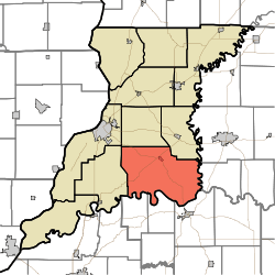
| State | Indiana |
| County | Knox |
| Government | |
| • Type | Indiana township |
| Area | |
| • Total | 80.36 sq mi (208.1 km2) |
| • Land | 79.11 sq mi (204.9 km2) |
| • Water | 1.25 sq mi (3.2 km2) |
| Elevation[1] | 459 ft (140 m) |
| Population (2010) | |
| • Total | 1,916 |
| • Density | 24.2/sq mi (9.3/km2) |
| FIPS code | 18-31864[2] |
| GNIS feature ID | 453390 |
Harrison Township is one of ten townships in Knox County, Indiana. As of the 2010 census, its population was 1,916 and it contained 812 housing units.[3]
History
Harrison Township was founded in 1801. It was named for General William Henry Harrison, an American military officer and ninth President of the United States.[4]
Geography
According to the 2010 census, the township has a total area of 80.36 square miles (208.1 km2), of which 79.11 square miles (204.9 km2) (or 98.44%) is land and 1.25 square miles (3.2 km2) (or 1.56%) is water.[3]
References
- ↑ "US Board on Geographic Names". United States Geological Survey. 2007-10-25. Retrieved 2008-01-31.
- ↑ "American FactFinder". United States Census Bureau. Retrieved 2008-01-31.
- 1 2 "Population, Housing Units, Area, and Density: 2010 - County -- County Subdivision and Place -- 2010 Census Summary File 1". United States Census. Retrieved 2013-05-10.
- ↑ History of Knox and Daviess County, Indiana: From the Earliest Time to the Present. Goodspeed. 1886. p. 77.
External links
Municipalities and communities of Knox County, Indiana, United States | ||
|---|---|---|
| Cities | ||
| Towns | ||
| Townships | ||
| CDPs | ||
| Other unincorporated communities |
| |
This article is issued from Wikipedia - version of the 10/15/2016. The text is available under the Creative Commons Attribution/Share Alike but additional terms may apply for the media files.