St. Clair County International Airport
For the airport in Alabama, see St. Clair County Airport.
| St. Clair County International Airport | |||||||||||||||
|---|---|---|---|---|---|---|---|---|---|---|---|---|---|---|---|
| IATA: PHN – ICAO: KPHN – FAA LID: PHN | |||||||||||||||
| Summary | |||||||||||||||
| Airport type | Public | ||||||||||||||
| Operator | St. Clair County | ||||||||||||||
| Serves | Port Huron, Michigan | ||||||||||||||
| Location | Kimball Township, Michigan | ||||||||||||||
| Elevation AMSL | 650 ft / 198.1 m | ||||||||||||||
| Coordinates | 42°54′39″N 82°31′44″W / 42.91083°N 82.52889°WCoordinates: 42°54′39″N 82°31′44″W / 42.91083°N 82.52889°W | ||||||||||||||
| Map | |||||||||||||||
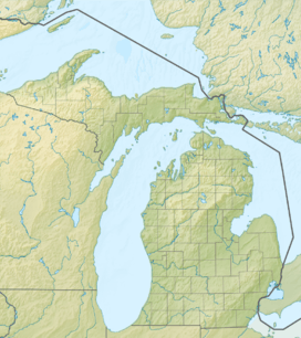 PHN  PHN Location of airport in Michigan/United States | |||||||||||||||
| Runways | |||||||||||||||
| |||||||||||||||
St. Clair County International Airport (IATA: PHN, ICAO: KPHN, FAA LID: PHN) is a public airport owned by the government of St. Clair County, Michigan, United States. It is located in Kimball Township, five miles (8 km) southwest of the central business district (CBD) of Port Huron. It is included in the Federal Aviation Administration (FAA) National Plan of Integrated Airport Systems for 2017–2021, in which it is categorized as a regional reliever airport facility.[1]
Facilities
St. Clair County International Airport covers 1,135 acres (459 ha) and has two runways:
- Runway 4/22: 5,103 x 100 ft. (1,555 x 30 m), Surface: Asphalt
- Runway 10/28: 4,001 x 75 ft. (1,220 x 23 m), Surface: Asphalt
Additional information
- Adjacent to the airport is an 80-acre (32 ha) Michigan Certified Business Air Industrial Park.
- Agents for U.S. Customs and Border Protection and the Department of Agriculture are available 24 hours a day for customs and international flights into the United States.
References
- ↑ "List of NPIAS Airports" (PDF). FAA.gov. Federal Aviation Administration. 21 October 2016. Retrieved 25 November 2016.
- FAA Airport Master Record for PHN (Form 5010 PDF)
- Michigan Airport Directory: St. Clair County International Airport (PDF)
- St. Clair County International Airport (St. Clair County web site)
External links
- Resources for this airport:
- FAA airport information for PHN
- AirNav airport information for KPHN
- ASN accident history for PHN
- FlightAware airport information and live flight tracker
- NOAA/NWS latest weather observations
- SkyVector aeronautical chart, Terminal Procedures
| Topics |  | |
|---|---|---|
| Detroit | ||
| Municipalities over 80,000 | ||
| Municipalities 40,000 to 80,000 | ||
| Cultural enclaves | ||
| Satellite cities | ||
| Counties in MSA | ||
| Counties in CSA | ||
This article is issued from Wikipedia - version of the 12/4/2016. The text is available under the Creative Commons Attribution/Share Alike but additional terms may apply for the media files.