South Barre, Vermont
| South Barre, Vermont | |
|---|---|
| CDP | |
 Location in Washington County and the state of Vermont | |
| Coordinates: 44°10′0″N 72°30′9″W / 44.16667°N 72.50250°W | |
| Country | United States |
| State | Vermont |
| County | Washington |
| Area | |
| • Total | 2.1 sq mi (5.4 km2) |
| • Land | 2.1 sq mi (5.4 km2) |
| • Water | 0.0 sq mi (0.0 km2) |
| Elevation | 738 ft (225 m) |
| Population (2000) | |
| • Total | 1,242 |
| • Density | 593.3/sq mi (229.1/km2) |
| Time zone | Eastern (EST) (UTC-5) |
| • Summer (DST) | EDT (UTC-4) |
| ZIP code | 05670 |
| Area code(s) | 802 |
| FIPS code | 50-66025[1] |
| GNIS feature ID | 1459567[2] |
South Barre is a census-designated place (CDP) in the town of Barre in Washington County, Vermont, United States. The population was 1,242 at the 2000 census.
Geography
According to the United States Census Bureau, the CDP has a total area of 5.4 km² (2.1 mi²), all land.
Demographics
As of the census[1] of 2000, there were 1,242 people, 534 households, and 367 families residing in the CDP. The population density was 229.4/km² (593.3/mi²). There were 553 housing units at an average density of 102.2/km² (264.1/mi²). The racial makeup of the CDP was 98.87% White, 0.24% African American, 0.24% Asian, 0.08% from other races, and 0.56% from two or more races. Hispanic or Latino of any race were 2.74% of the population.
There were 534 households out of which 28.5% had children under the age of 18 living with them, 57.7% were married couples living together, 7.9% had a female householder with no husband present, and 31.1% were non-families. 26.8% of all households were made up of individuals and 10.3% had someone living alone who was 65 years of age or older. The average household size was 2.33 and the average family size was 2.78.
In the CDP the population was spread out with 21.7% under the age of 18, 6.6% from 18 to 24, 26.0% from 25 to 44, 30.3% from 45 to 64, and 15.5% who were 65 years of age or older. The median age was 42 years. For every 100 females there were 93.5 males. For every 100 females age 18 and over, there were 91.5 males.
The median income for a household in the CDP was $38,750, and the median income for a family was $50,625. Males had a median income of $32,167 versus $22,974 for females. The per capita income for the CDP was $23,480. About 2.9% of families and 5.7% of the population were below the poverty line, including 4.8% of those under age 18 and 3.1% of those age 65 or over.
Climate
This climatic region is typified by large seasonal temperature differences, with warm to hot (and often humid) summers and cold (sometimes severely cold) winters. According to the Köppen Climate Classification system, South Barre has a humid continental climate, abbreviated "Dfb" on climate maps.[3]
References
- 1 2 "American FactFinder". United States Census Bureau. Retrieved 2008-01-31.
- ↑ "US Board on Geographic Names". United States Geological Survey. 2007-10-25. Retrieved 2008-01-31.
- ↑ Climate Summary for South Barre, Vermont
Municipalities and communities of Washington County, Vermont, United States | ||
|---|---|---|
| Cities | 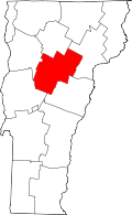 | |
| Towns | ||
| Villages | ||
| CDPs | ||
| Other communities | ||
Coordinates: 44°10′37″N 72°30′20″W / 44.17694°N 72.50556°W