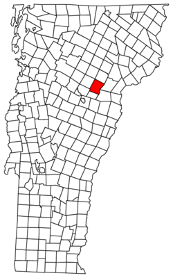
Marshfield (town), Vermont
| Marshfield, Vermont | |
|---|---|
| Town | |
 Marshfield, Vermont | |
| Country | United States |
| State | Vermont |
| County | Washington |
| Area | |
| • Total | 43.4 sq mi (112.4 km2) |
| • Land | 43.4 sq mi (112.4 km2) |
| • Water | 0.1 sq mi (0.3 km2) |
| Population (2000) | |
| • Total | 1,402 |
| • Density | 90/sq mi (34.7/km2) |
| Time zone | Eastern (EST) (UTC-5) |
| • Summer (DST) | EDT (UTC-4) |
| ZIP code | 05658 |
| Area code(s) | 802 |
| Website | http://www.town.marshfield.vt.us/ |
Marshfield is a town in Washington County, Vermont, United States. The population was 1,588 at the 2010 census.[1]
History
The town was named for Captain Isaac Marsh, who bought the original town site from the Indians.[2]
Geography
According to the United States Census Bureau, the town has a total area of 43.4 square miles (112.4 km2), of which 43.1 square miles (111.6 km2, 99.29%) is land and 0.3 square miles (0.8 km2, 0.71%) is water.
Demographics
| Historical population | |||
|---|---|---|---|
| Census | Pop. | %± | |
| 1800 | 172 | — | |
| 1810 | 513 | 198.3% | |
| 1820 | 710 | 38.4% | |
| 1830 | 1,271 | 79.0% | |
| 1840 | 1,156 | −9.0% | |
| 1850 | 1,102 | −4.7% | |
| 1860 | 1,160 | 5.3% | |
| 1870 | 1,072 | −7.6% | |
| 1880 | 1,102 | 2.8% | |
| 1890 | 1,121 | 1.7% | |
| 1900 | 1,032 | −7.9% | |
| 1910 | 1,011 | −2.0% | |
| 1920 | 898 | −11.2% | |
| 1930 | 872 | −2.9% | |
| 1940 | 901 | 3.3% | |
| 1950 | 830 | −7.9% | |
| 1960 | 891 | 7.3% | |
| 1970 | 1,033 | 15.9% | |
| 1980 | 1,267 | 22.7% | |
| 1990 | 1,331 | 5.1% | |
| 2000 | 1,496 | 12.4% | |
| 2010 | 1,588 | 6.1% | |
| Est. 2015 | 1,579 | [3] | −0.6% |
As of the census[6] of 2000, there were 1,496 people, 575 households, and 416 families residing in the town. The population density was 34.7 people per square mile (13.4/km2). There were 686 housing units at an average density of 15.9 per square mile (6.1/km2). The racial makeup of the town was 96.86% White, 0.74% Black or African American, 0.13% Native American, 0.40% Asian, 0.20% from other races, and 1.67% from two or more races. Hispanic or Latino of any race were 0.67% of the population.
There were 575 households out of which 39.5% had children under the age of 18 living with them, 56.5% were couples living together and joined in either marriage or civil union, 9.6% had a female householder with no husband present, and 27.5% were non-families. 20.9% of all households were made up of individuals and 5.0% had someone living alone who was 65 years of age or older. The average household size was 2.60 and the average family size was 3.01.
In the town the population was spread out with 27.9% under the age of 18, 6.6% from 18 to 24, 30.4% from 25 to 44, 26.1% from 45 to 64, and 9.0% who were 65 years of age or older. The median age was 38 years. For every 100 females there were 102.4 males. For every 100 females age 18 and over, there were 102.6 males.
The median income for a household in the town was $40,603, and the median income for a family was $44,063. Males had a median income of $30,852 versus $25,823 for females. The per capita income for the town was $18,649. About 8.0% of families and 9.1% of the population were below the poverty line, including 14.1% of those under age 18 and 5.8% of those age 65 or over.
Notable people
- Levi P. Powers, Wisconsin legislator and judge, was born in the town.[7]
- Dave Rogers, NASCAR Crew Chief leader for Carl Edwards.
Movie
Portions of the 1983 film adaptation of Robert Cormier's novel I Am the Cheese were filmed in Marshfield.[8]
References
- ↑ "Profile of General Population and Housing Characteristics: 2010 Demographic Profile Data (DP-1): Marshfield town, Washington County, Vermont". U.S. Census Bureau, American Factfinder. Retrieved September 18, 2012.
- ↑ Gannett, Henry (1905). The Origin of Certain Place Names in the United States. U.S. Government Printing Office. p. 200.
- ↑ "Annual Estimates of the Resident Population for Incorporated Places: April 1, 2010 to July 1, 2015". Retrieved July 2, 2016.
- ↑ "Census of Population and Housing". Census.gov. Retrieved June 4, 2015.
- ↑ "Vermont History Explorer". Retrieved August 7, 2015.
- ↑ "American FactFinder". United States Census Bureau. Retrieved 2008-01-31.
- ↑ 'History of Wood County, Wisconsin,' George O. Jones, H.C. Cooper Company & Cooper, 1923, Biographical Sketch of Levi P. Powers, pg. 339
- ↑ I Am the Cheese at the Internet Movie Database
External links
Coordinates: 44°18′45″N 72°22′03″W / 44.31250°N 72.36750°W
Municipalities and communities of Washington County, Vermont, United States | ||
|---|---|---|
| Cities | 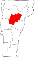 | |
| Towns | ||
| Villages | ||
| CDPs | ||
| Other communities | ||