Moretown, Vermont
| Moretown, Vermont | |
|---|---|
| Town | |
 Location in Washington County and the state of Vermont | |
 Moretown, Vermont Location in the United States | |
| Coordinates: 44°15′59″N 72°43′32″W / 44.26639°N 72.72556°WCoordinates: 44°15′59″N 72°43′32″W / 44.26639°N 72.72556°W | |
| Country | United States |
| State | Vermont |
| County | Washington |
| Area | |
| • Total | 40.2 sq mi (104.2 km2) |
| • Land | 39.9 sq mi (103.3 km2) |
| • Water | 0.3 sq mi (0.8 km2) |
| Elevation | 1,083 ft (330 m) |
| Population (2010) | |
| • Total | 1,658 |
| • Density | 41/sq mi (16/km2) |
| Time zone | Eastern (EST) (UTC-5) |
| • Summer (DST) | EDT (UTC-4) |
| ZIP code | 05660 |
| Area code(s) | 802 |
| FIPS code | 50-46225[1] |
| GNIS feature ID | 1462153[2] |
| Website |
www |
Moretown is a town in Washington County, Vermont, United States. The population was 1,658 at the 2010 census.[3]
History
Moretown Village was devastated in 2011 by Hurricane Irene. More than 60 homes and buildings flooded, including the post office, the town offices, the church, the school and the fire station.[4]

In 1913, 125 acres were purchased in North Moretown, Vermont and a talc processing facility was built. To this day, the old structure remains a town landmark in disrepair.
Geography
According to the United States Census Bureau, the town has a total area of 40.2 square miles (104.2 km2), of which 39.9 square miles (103.3 km2) is land and 0.31 square miles (0.8 km2), or 0.81%, is water.[5]
Demographics
| Historical population | |||
|---|---|---|---|
| Census | Pop. | %± | |
| 1800 | 191 | — | |
| 1810 | 405 | 112.0% | |
| 1820 | 593 | 46.4% | |
| 1830 | 816 | 37.6% | |
| 1840 | 1,128 | 38.2% | |
| 1850 | 1,335 | 18.4% | |
| 1860 | 1,410 | 5.6% | |
| 1870 | 1,263 | −10.4% | |
| 1880 | 1,180 | −6.6% | |
| 1890 | 956 | −19.0% | |
| 1900 | 902 | −5.6% | |
| 1910 | 686 | −23.9% | |
| 1920 | 930 | 35.6% | |
| 1930 | 889 | −4.4% | |
| 1940 | 675 | −24.1% | |
| 1950 | 883 | 30.8% | |
| 1960 | 788 | −10.8% | |
| 1970 | 904 | 14.7% | |
| 1980 | 1,221 | 35.1% | |
| 1990 | 1,415 | 15.9% | |
| 2000 | 1,653 | 16.8% | |
| 2010 | 1,658 | 0.3% | |
| Est. 2014 | 1,664 | [6] | 0.4% |
As of the census[1] of 2000, there were 1,653 people, 650 households, and 436 families residing in the town. The population density was 41.2 people per square mile (15.9/km2). There were 727 housing units at an average density of 18.1 per square mile (7.0/km2). The racial makeup of the town was 98.19% White, 0.12% Native American, 0.79% Asian, 0.12% from other races, and 0.79% from two or more races. Hispanic or Latino of any race were 0.67% of the population.
There were 650 households out of which 35.7% had children under the age of 18 living with them, 55.1% were married couples living together, 8.6% had a female householder with no husband present, and 32.8% were non-families. 22.3% of all households were made up of individuals and 7.7% had someone living alone who was 65 years of age or older. The average household size was 2.54 and the average family size was 3.01.
In the town the population was spread out with 26.6% under the age of 18, 5.2% from 18 to 24, 31.8% from 25 to 44, 27.0% from 45 to 64, and 9.4% who were 65 years of age or older. The median age was 38 years. For every 100 females there were 99.6 males. For every 100 females age 18 and over, there were 97.2 males.
The median income for a household in the town was $47,750, and the median income for a family was $52,202. Males had a median income of $35,270 versus $26,719 for females. The per capita income for the town was $20,283. About 5.4% of families and 6.6% of the population were below the poverty line, including 5.6% of those under age 18 and 7.9% of those age 65 or over.
Economy
Moretown has only one retail store, The Moretown General Store which serves as a gas station, convenience store, and a deli. The Moretown general store is the center of the town which often serves as a meeting place and is in many ways a community center.
Moretown is also home to many successful entrepreneurs in fields such as Real Estate, Carpentry, Baking, Plumbing, and other trades. However most people living in Moretown commute to work in other towns with larger economies such as Montpelier and Burlington.
Moretown also has several small farms, three churches, one elementary school, a small library, and a town hall.
Notable people
- Matthew H. Carpenter, US senator from Wisconsin
- Harvey Clapp, member of the Wisconsin State Assembly, was born in Moretown.[9]
References
- 1 2 "American FactFinder". United States Census Bureau. Retrieved 2008-01-31.
- ↑ "US Board on Geographic Names". United States Geological Survey. 2007-10-25. Retrieved 2008-01-31.
- ↑ "Profile of General Population and Housing Characteristics: 2010 Demographic Profile Data (DP-1): Moretown town, Washington County, Vermont". U.S. Census Bureau, American Factfinder. Retrieved September 18, 2012.
- ↑ VR. "PHOTOS: TS Irene hits Moretown Vermont". Retrieved 2016-10-01.
- ↑ "Geographic Identifiers: 2010 Demographic Profile Data (G001): Moretown town, Washington County, Vermont". U.S. Census Bureau, American Factfinder. Retrieved September 18, 2012.
- ↑ "Annual Estimates of the Resident Population for Incorporated Places: April 1, 2010 to July 1, 2014". Retrieved June 4, 2015.
- ↑ "Census of Population and Housing". Census.gov. Retrieved June 4, 2015.
- ↑ "Vermont History Explorer". Retrieved August 7, 2015.
- ↑ 'Wisconsin Blue Book 1874,' Biographical Sketch of Harvey Clapp, pg. 467
External links
Municipalities and communities of Washington County, Vermont, United States | ||
|---|---|---|
| Cities | 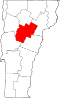 | |
| Towns | ||
| Villages | ||
| CDPs | ||
| Other communities | ||