Skyline, Minnesota
| Skyline, Minnesota | |
|---|---|
| City | |
 Location of Skyline, Minnesota | |
| Coordinates: 44°8′27″N 94°2′1″W / 44.14083°N 94.03361°W | |
| Country | United States |
| State | Minnesota |
| County | Blue Earth |
| Government | |
| • Type | Mayor - Council |
| • Mayor | Travis Javens[1][2] |
| Area[3] | |
| • Total | 0.17 sq mi (0.44 km2) |
| • Land | 0.17 sq mi (0.44 km2) |
| • Water | 0 sq mi (0 km2) |
| Elevation | 984 ft (300 m) |
| Population (2010)[4] | |
| • Total | 289 |
| • Estimate (2013[5]) | 296 |
| • Density | 1,700.0/sq mi (656.4/km2) |
| Time zone | Central (CST) (UTC-6) |
| • Summer (DST) | CDT (UTC-5) |
| FIPS code | 27-60754 |
| GNIS feature ID | 0652140[6] |
Skyline is a city in Blue Earth County, Minnesota, United States. The population was 289 at the 2010 census.[7] However, the population was estimated to be 291 in 2011. It is completely surrounded by the city of Mankato and is part of the Mankato–North Mankato Metropolitan Statistical Area.
Geography
According to the United States Census Bureau, the city has a total area of 0.17 square miles (0.44 km2), all of it land.[3] Its elevation is 980 feet above sea-level.
Minnesota State Highway 66 serves as a main route for the community.
U.S. Route 169 / Minnesota State Highway 60 (co-signed) is nearby.
Demographics
| Historical population | |||
|---|---|---|---|
| Census | Pop. | %± | |
| 1960 | 354 | — | |
| 1970 | 400 | 13.0% | |
| 1980 | 399 | −0.2% | |
| 1990 | 272 | −31.8% | |
| 2000 | 330 | 21.3% | |
| 2010 | 289 | −12.4% | |
| Est. 2015 | 293 | [8] | 1.4% |
| U.S. Decennial Census[9] 2013 Estimate[5] | |||
2010 census
As of the census[4] of 2010, there were 289 people, 113 households, and 90 families residing in the city. The population density was 1,700.0 inhabitants per square mile (656.4/km2). There were 118 housing units at an average density of 694.1 per square mile (268.0/km2). The racial makeup of the city was 98.6% White, 0.3% Asian, 0.7% from other races, and 0.3% from two or more races. Hispanic or Latino of any race were 3.1% of the population.
There were 113 households of which 24.8% had children under the age of 18 living with them, 73.5% were married couples living together, 2.7% had a female householder with no husband present, 3.5% had a male householder with no wife present, and 20.4% were non-families. 18.6% of all households were made up of individuals and 15% had someone living alone who was 65 years of age or older. The average household size was 2.49 and the average family size was 2.78.
The median age in the city was 52.2 years. 19.7% of residents were under the age of 18; 6.3% were between the ages of 18 and 24; 13.5% were from 25 to 44; 34.7% were from 45 to 64; and 26% were 65 years of age or older. The gender makeup of the city was 47.8% male and 52.2% female.
2000 census
As of the census of 2000, there were 330 people, 124 households, and 105 families residing in the city. The population density was 1,752.5 people per square mile (670.6/km²). There were 125 housing units at an average density of 663.8 per square mile (254.0/km²). The racial makeup of the city was 97.58% White, 0.91% Native American, 1.21% Asian, and 0.30% from two or more races. Hispanic or Latino of any race were 0.30% of the population.
There were 124 households out of which 32.3% had children under the age of 18 living with them, 82.3% were married couples living together, 2.4% had a female householder with no husband present, and 15.3% were non-families. 14.5% of all households were made up of individuals and 11.3% had someone living alone who was 65 years of age or older. The average household size was 2.63 and the average family size was 2.90.
In the city the population was spread out with 24.5% under the age of 18, 4.8% from 18 to 24, 23.0% from 25 to 44, 27.6% from 45 to 64, and 20.0% who were 65 years of age or older. The median age was 44 years. For every 100 females there were 93.0 males. For every 100 females age 18 and over, there were 93.0 males.
The median income for a household in the city was $59,583, and the median income for a family was $104,063. Males had a median income of $65,625 versus $50,972 for females. The per capita income for the city was $25,778. None of the families and 0.3% of the population were living below the poverty line, including no under eighteens and none of those over 64.
References
- ↑ Fischenich, Mark (11 February 2015). "Skyline fire department to call it quits". Mankato Free Press. Retrieved 22 January 2016.
- ↑ Ross, Jenna (14 February 2015). "State briefs: Good at shoveling? Duluth will honor 'snow angels'". Star Tribune. Retrieved 22 January 2016.
- 1 2 "US Gazetteer files 2010". United States Census Bureau. Retrieved 2012-11-13.
- 1 2 "American FactFinder". United States Census Bureau. Retrieved 2012-11-13.
- 1 2 "Population Estimates". United States Census Bureau. Retrieved 2014-07-14.
- ↑ "US Board on Geographic Names". United States Geological Survey. 2007-10-25. Retrieved 2008-01-31.
- ↑ "2010 Census Redistricting Data (Public Law 94-171) Summary File". American FactFinder. United States Census Bureau. Retrieved 27 April 2011.
- ↑ "Annual Estimates of the Resident Population for Incorporated Places: April 1, 2010 to July 1, 2015". Retrieved July 2, 2016.
- ↑ United States Census Bureau. "Census of Population and Housing". Retrieved September 12, 2013.
External links
- Skyline — City-Data.com information
Municipalities and communities of Blue Earth County, Minnesota, United States | ||
|---|---|---|
| Cities | 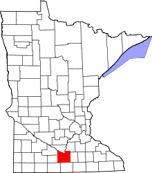 | |
| Townships | ||
| CDP | ||
| Unincorporated communities | ||
| Footnotes | ‡This populated place also has portions in an adjacent county or counties | |
| Core Cities | 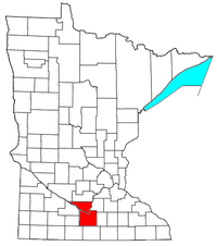 | ||||||
|---|---|---|---|---|---|---|---|
| Incorporated Places |
| ||||||
| Counties | |||||||
† indicates a county seat. ‡ indicates that it is partially in the metropolitan area. | |||||||
Coordinates: 44°08′32″N 94°01′51″W / 44.14222°N 94.03083°W