Sixteen Mile Creek (Halton Region)
| Sixteen Mile Creek (niizhozaagiwan ("having two outlets" in Mississauga)) | |
| Rivière de Gravois ("gravelly river" in French) | |
| River | |
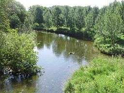 Sixteen Mile at Milton, Ontario | |
| Country | Canada |
|---|---|
| Province | Ontario |
| Region | Greater Toronto Area |
| Regional Municipality | Halton |
| Municipalities | Oakville, Milton |
| Part of | Great Lakes Basin |
| Source | wetland |
| - location | Milton |
| - elevation | 365 m (1,198 ft) |
| - coordinates | 43°35′08″N 80°02′34″W / 43.58556°N 80.04278°W |
| Mouth | Lake Ontario |
| - location | Oakville |
| - elevation | 74 m (243 ft) |
| - coordinates | 43°26′22″N 79°39′57″W / 43.43944°N 79.66583°WCoordinates: 43°26′22″N 79°39′57″W / 43.43944°N 79.66583°W |
| Basin | 372 km2 (144 sq mi) |
 Location of the mouth of Sixteen Mile Creek in southern Ontario | |
Sixteen Mile Creek is a river in Halton Region in the Greater Toronto Area of Ontario, Canada.[1] It is in the Great Lakes Basin, and flows from the Niagara Escarpment through the towns of Milton and Oakville to Lake Ontario.[2]
It was previously known to the Mississauga Indians in their language as Ne-sauga y-onk or niizhozaagiwan ("having two outlets")[3] and to the French as Rivière de Gravois ("gravelly river").[4]
Like many creeks draining into Lake Ontario, Sixteen Mile Creek has cut a deep valley that is home to a broad range of wildlife, including whitetail deer, raccoons, foxes, opossum, and squirrels.[5] The forest contains tree species typical of the Carolinian forest habitat,[6] although since this is close to the northern limit of this zone, some are poorly represented. The total area of the drainage basin is 372 square kilometres (144 sq mi).[7]
In Oakville, it also forms part of Glen Abbey Golf Course[8] and is home to the Oakville Yacht Squadron.[9]
Tributaries
- East Sixteen Mile Creek (left)
- Middle Sixteen Mile Creek (left)
Invasive Species
Giant hogweed is a non-native invasive plant that is most widely distributed in Halton Region along Sixteen Mile Creek. Contact with this plant can cause serious burns to the skin and temporary or permanent blindness.[10][11]
See also
Notes
- ↑ "Sixteen Mile Creek". Geographical Names Data Base. Natural Resources Canada. Retrieved 2014-04-18.
- ↑ Dunn, p. 4-6.
- ↑ FREELANG Ojibwe-English and English-Ojibwe online dictionary
- ↑ "French Sketch Map, c. 1760". Retrieved 2012-02-22.
- ↑ Dunn, p. 110-112.
- ↑ Dunn, p. 52.
- ↑ Dunn, p. 4.
- ↑ Witteveen, Gordon (2001). A century of greenkeeping. Chelsea, Mich: Ann Arbor Press. p. 149. ISBN 978-1-57504-161-2. OCLC 46364702. Retrieved 16 February 2012.
- ↑ "Unknown title". Inland seas. Great Lakes Historical Society. 18: 59. 1962. ISSN 0020-1537. Retrieved 16 February 2012.
- ↑ http://www.halton.ca/cms/one.aspx?pageId=47106
- ↑ http://www.insidehalton.com/news-story/5766594-giant-hogweed-continues-to-sprout-in-milton/
References
- Dunn, Andrea. "Sixteen Mile Creek Monitoring Project (Draft)". Credit River Anglers Association. Archived from the original (PDF) on 5 July 2011.
Other map sources:
- Map 3 (PDF) (Map). 1 : 700,000. Official road map of Ontario. Ministry of Transportation of Ontario. 2010-01-01. Retrieved 2014-04-18.
- Restructured municipalities - Ontario map #6 (Map). Restructuring Maps of Ontario. Ontario Ministry of Municipal Affairs and Housing. 2006. Retrieved 2014-04-18.
External links
Great Lakes of North America | ||
|---|---|---|
| Main lakes | 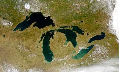 | |
| Secondary lakes | ||
| Bays and Waterways |
| |
| Islands | ||
| Historic geology | ||
| Government | ||
| Related topics |
| |