Siracusaville, Louisiana
| Siracusaville, Louisiana | |
| Census-designated place | |
| Country | United States |
|---|---|
| State | Louisiana |
| Parish | St. Mary |
| Elevation | 3 ft (0.9 m) |
| Coordinates | 29°41′13″N 91°8′53″W / 29.68694°N 91.14806°WCoordinates: 29°41′13″N 91°8′53″W / 29.68694°N 91.14806°W |
| Area | 2.2 km2 (0.8 sq mi) |
| - land | 2.1 km2 (0.8 sq mi) |
| - water | 0.1 km2 (0.0 sq mi), 4.55% |
| Population | 422 (2010) |
| Density | 201.9/km2 (522.9/sq mi) |
| Timezone | CST (UTC-6) |
| - summer (DST) | CDT (UTC-5) |
| Area code | 985 |
 Location of Siracusaville in Louisiana | |
 Location of Louisiana in the United States | |
Siracusaville is a census-designated place (CDP) in St. Mary Parish, Louisiana, United States. The population was 422 at the 2010 census.[1] It is part of the Morgan City Micropolitan Statistical Area.
Geography
Siracusaville is located at 29°41′13″N 91°8′53″W / 29.68694°N 91.14806°W (29.68715, -91.14186), adjacent to the eastern border of Morgan City. Louisiana State Route 182 is an east-west road that passes through the southern part of the community, along the edge of Bayou Boeuf, part of the Intracoastal Waterway. U.S. Route 90, a four-lane expressway, forms the northeastern border of the CDP but provides no direct access to it; the closest exits are Exit 176 in Morgan City to the west and Exit 181 in Amelia to the east.
According to the United States Census Bureau, the CDP has a total area of 0.85 square miles (2.2 km2), of which 0.81 square miles (2.1 km2) is land and 0.04 square miles (0.1 km2), or 6.37%, is water.[1]
References
- 1 2 "Geographic Identifiers: 2010 Demographic Profile Data (G001): Siracusaville CDP, Louisiana". U.S. Census Bureau, American Factfinder. Retrieved March 29, 2013.
Municipalities and communities of St. Mary Parish, Louisiana, United States | ||
|---|---|---|
| Cities | 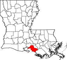 | |
| Towns | ||
| CDPs | ||
| Other unincorporated communities |
| |
| Footnotes | ‡This populated place also has portions in an adjacent parish or parishes | |