Amelia, Louisiana
| Amelia, Louisiana | |
| Census-designated place | |
| Country | United States |
|---|---|
| State | Louisiana |
| Parish | St. Mary |
| Elevation | 7 ft (2.1 m) |
| Coordinates | 29°40′24″N 91°06′11″W / 29.67333°N 91.10306°WCoordinates: 29°40′24″N 91°06′11″W / 29.67333°N 91.10306°W |
| Area | 7.3 km2 (2.8 sq mi) |
| - land | 6.7 km2 (2.6 sq mi) |
| - water | 0.7 km2 (0.3 sq mi), 9.59% |
| Population | 2,459 (2010) |
| Density | 369.0/km2 (955.7/sq mi) |
| Timezone | CST (UTC-6) |
| - summer (DST) | CDT (UTC-5) |
| Area code | 985 |
 Location of Amelia in Louisiana
| |
 Location of Louisiana in the United States
| |
Amelia is a census-designated place (CDP) in St. Mary Parish, Louisiana, United States. The population was 2,459 at the 2010 census.[1] It is part of the Morgan City Micropolitan Statistical Area.
History
The first postmaster named the town for Amelia Dupuis, his fiancée who died shortly before their wedding day.[2]
Geography
Amelia is located at 29°40′24″N 91°6′11″W / 29.67333°N 91.10306°W (29.673361, -91.103181).[3]
According to the United States Census Bureau, the CDP has a total area of 2.8 square miles (7.3 km2), of which 2.6 square miles (6.7 km2) is land and 0.27 square miles (0.7 km2), or 9.12%, is water.[1]
Demographics
As of the census[4] of 2000, there were 2,423 people, 766 households, and 549 families residing in the CDP. The population density was 922.3 people per square mile (355.7/km²). There were 942 housing units at an average density of 358.6 per square mile (138.3/km²). The racial makeup of the CDP was 58.69% White, 12.38% African American, 0.66% Native American, 22.70% Asian, 4.25% from other races, and 1.32% from two or more races. Hispanic or Latino of any race were 8.17% of the population.
There were 766 households out of which 38.5% had children under the age of 18 living with them, 55.0% were married couples living together, 9.9% had a female householder with no husband present, and 28.3% were non-families. 20.5% of all households were made up of individuals and 5.6% had someone living alone who was 65 years of age or older. The average household size was 3.07 and the average family size was 3.60.
In the CDP the population was spread out with 31.6% under the age of 18, 10.1% from 18 to 24, 30.7% from 25 to 44, 20.6% from 45 to 64, and 6.9% who were 65 years of age or older. The median age was 31 years. For every 100 females there were 123.3 males. For every 100 females age 18 and over, there were 129.5 males.
The median income for a household in the CDP was $26,953, and the median income for a family was $29,063. Males had a median income of $30,313 versus $16,917 for females. The per capita income for the CDP was $9,483. About 29.6% of families and 32.5% of the population were below the poverty line, including 38.9% of those under age 18 and 39.9% of those age 65 or over.
References
- 1 2 "Geographic Identifiers: 2010 Demographic Profile Data (G001): Amelia CDP, Louisiana". U.S. Census Bureau, American Factfinder. Retrieved March 29, 2013.
- ↑ Leeper, Clare D'Artois (19 October 2012). Louisiana Place Names: Popular, Unusual, and Forgotten Stories of Towns, Cities, Plantations, Bayous, and Even Some Cemeteries. LSU Press. p. 16. ISBN 978-0-8071-4740-5.
- ↑ "US Gazetteer files: 2010, 2000, and 1990". United States Census Bureau. 2011-02-12. Retrieved 2011-04-23.
- ↑ "American FactFinder". United States Census Bureau. Archived from the original on 2013-09-11. Retrieved 2008-01-31.
Municipalities and communities of St. Mary Parish, Louisiana, United States | ||
|---|---|---|
| Cities | 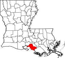 | |
| Towns | ||
| CDPs | ||
| Other unincorporated communities |
| |
| Footnotes | ‡This populated place also has portions in an adjacent parish or parishes | |