Sims Township, Grant County, Indiana
| Sims Township | |
|---|---|
| Township | |
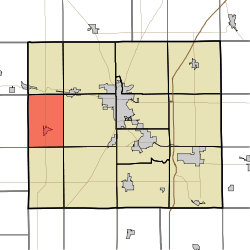 Location of Sims Township in Grant County | |
| Coordinates: 40°31′09″N 85°49′42″W / 40.51917°N 85.82833°WCoordinates: 40°31′09″N 85°49′42″W / 40.51917°N 85.82833°W | |
| Country | United States |
| State | Indiana |
| County | Grant |
| Government | |
| • Type | Indiana township |
| Area | |
| • Total | 24.08 sq mi (62.4 km2) |
| • Land | 24.08 sq mi (62.4 km2) |
| • Water | 0 sq mi (0 km2) 0% |
| Elevation | 860 ft (262 m) |
| Population (2010) | |
| • Total | 1,779 |
| • Density | 73.9/sq mi (28.5/km2) |
| GNIS feature ID | 0453849 |
Sims Township is one of 13 townships in Grant County, Indiana, United States. As of the 2010 census, its population was 1,779 and it contained 757 housing units.[1]
Geography
According to the 2010 census, the township has a total area of 24.08 square miles (62.4 km2), all land.[1] The stream of Stoney Creek runs through this township.
Cities and towns
Unincorporated towns
(This list is based on USGS data and may include former settlements.)
Adjacent townships
- Richland Township (north)
- Pleasant Township (northeast)
- Franklin Township (east)
- Liberty Township (southeast)
- Green Township (south)
- Union Township, Howard County (southwest)
- Jackson Township, Howard County (west)
- Jackson Township, Miami County (northwest)
Cemeteries
The township contains two cemeteries: Alel and Thraikill.
Major highways
References
- 1 2 "Population, Housing Units, Area, and Density: 2010 - County -- County Subdivision and Place -- 2010 Census Summary File 1". United States Census. Retrieved 2013-05-10.
External links
Municipalities and communities of Grant County, Indiana, United States | ||
|---|---|---|
| Cities | ||
| Towns | ||
| Townships | ||
| CDPs | ||
| Unincorporated communities | ||
| Footnotes | ‡This populated place also has portions in an adjacent county or counties | |
This article is issued from Wikipedia - version of the 9/4/2016. The text is available under the Creative Commons Attribution/Share Alike but additional terms may apply for the media files.