Shoreham, Victoria
| Shoreham Victoria | |||||||||||||
|---|---|---|---|---|---|---|---|---|---|---|---|---|---|
 Public hall | |||||||||||||
 Shoreham | |||||||||||||
| Coordinates | 38°25′37″S 145°03′00″E / 38.427°S 145.050°ECoordinates: 38°25′37″S 145°03′00″E / 38.427°S 145.050°E | ||||||||||||
| Population | 434 (2011 census)[1] | ||||||||||||
| Postcode(s) | 3916 | ||||||||||||
| Location | |||||||||||||
| LGA(s) | Shire of Mornington Peninsula | ||||||||||||
| State electorate(s) | Nepean | ||||||||||||
| Federal Division(s) | Flinders | ||||||||||||
| |||||||||||||
Shoreham is a seaside town south of Melbourne, Victoria, Australia in the southern Mornington Peninsula region on the Western Port. Shoreham is situated on the shore of Western Port around the mouth of Stoney Creek. Its local government area is the Shire of Mornington Peninsula. It is a coastal recreation resort notable for its pine-covered cliffs and foreshore reserve. At the 2011 census, Shoreham had a population of 434.
History
Shoreham began as a port for timber exports from the surrounding area. Early reports of the area suggested the region was "thick with honeysuckle and sheoak" and early settlers in the Balnarring and Hastings region were involved in wattle bark stripping and cutting piles and sleepers for shipping to Melbourne via the town.[2] Shoreham Post Office opened on 1 October 1881.[3]
Artists
Shoreham has always been a place where artists have resided and painted, most notably Clifton Pugh, Colin Colahan, John Perceval and Charles Blackman. Several homes bear testimony to their work. There is iron work by Matcham Skipper and frescos by Clifton Pugh.
Today
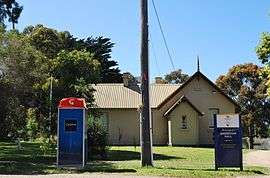
Shoreham today is a small coastal town containing a Post Office, tennis courts, community hall and CFA, while the area contains picnic and barbecue facilities, a boat launch access over the beach and various accommodation options such as B&Bs, a caravan park and camping sites. [4]
Shoreham is served by the 782 bus route operated by Peninsula Bus Lines between Frankston railway station and Flinders.[5]
See also
- Ashcombe Maze
References
- ↑ Australian Bureau of Statistics (31 October 2012). "Shoreham (State Suburb)". 2011 Census QuickStats. Retrieved 2012-10-17.
- ↑ Graeme Butler & Associates. "Volume 2, Environmental History" (PDF). Hastings District Heritage Study Stage Two. Archived from the original (PDF) on 2006-08-28. Retrieved 2006-11-27.
- ↑ Premier Postal History. "Post Office List". Retrieved 2008-04-11.
- ↑ Map 257, Melway street directory (28th ed., 2001)
- ↑ 782 Frankston-Flinders, effective 19 April 2004. Accessed 27 November 2006.