Sergio Osmeña Sr., Zamboanga del Norte
| Sergio Osmeña Sr. | |
|---|---|
| Municipality | |
| Nickname(s): Vegetable Bowl of Zamboanga del Norte | |
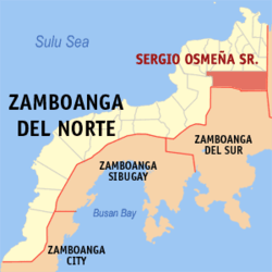 Map of Zamboanga del Norte with Sergio Osmeña highlighted | |
.svg.png) S. Osmeña Location within the Philippines | |
| Coordinates: 08°16′N 123°23′E / 8.267°N 123.383°ECoordinates: 08°16′N 123°23′E / 8.267°N 123.383°E | |
| Country | Philippines |
| Region | Zamboanga Peninsula (Region IX) |
| Province | Zamboanga del Norte |
| District | 1st district of Zamboanga del Norte |
| Barangays | 39 |
| Government[1] | |
| • Mayor | Richard D. Magsalay |
| Area[2] | |
| • Total | 556.44 km2 (214.84 sq mi) |
| Population (2010)[3] | |
| • Total | 30,220 |
| • Density | 54/km2 (140/sq mi) |
| Time zone | PST (UTC+8) |
| ZIP code | 7108 |
| Dialing code | +63 (0)65 |
| Income class | 2nd class |
Sergio Osmeña Sr. is a second class municipality in the province of Zamboanga del Norte, Philippines, named in honor of former Philippine president Sergio Osmeña. According to the 2010 census, it has a population of 30,220 people.[3]
Barangays
Sergio Osmeña Sr. is politically subdivided into 39 barangays.[2]
- Antonino
- Bagong Baguio
- Bagumbayan
- Biayon
- Buenavista
- Dampalan
- Danao
- Don Eleno
- Kauswagan
- Labiray
- Liwanag
- Mabuhay
- Macalibre
- Mahayahay
- Marapong
- Nazareth
- Nebo
- New Rizal
- New Tangub
- Nuevavista
- Pedagan
- Penacio
- Poblacion Alto
- Poblacion Bajo
- Princesa Freshia
- Princesa Lamaya
- San Antonio
- San Francisco
- San Isidro
- San Jose
- San Juan
- Sinaad
- Sinai
- Situbo
- Tinago
- Tinindugan
- Tuburan
- Venus
- Wilben
Demographics
| Population census of Sergio Osmeña Sr. | ||
|---|---|---|
| Year | Pop. | ±% p.a. |
| 1990 | 22,454 | — |
| 1995 | 26,014 | +2.80% |
| 2000 | 27,500 | +1.20% |
| 2007 | 29,049 | +0.76% |
| 2010 | 29,453 | +0.50% |
| Source: National Statistics Office[3] | ||
References
- ↑ "Official City/Municipal 2013 Election Results". Intramuros, Manila, Philippines: Commission on Elections (COMELEC). 12 May 2014. Retrieved 14 August 2014.
- 1 2 "Province: ZAMBOANGA DEL NORTE". PSGC Interactive. Makati City, Philippines: National Statistical Coordination Board. Retrieved 14 August 2014.
- 1 2 3 "Total Population by Province, City, Municipality and Barangay: as of May 1, 2010" (PDF). 2010 Census of Population and Housing. National Statistics Office. Retrieved 14 August 2014.
External links
 |
Manukan | Pres. Roxas / Katipunan / Dipolog / Piñan / Mutia | | |
| Jose Dalman | |
Don V. Chiongbian, MisOcc. | ||
| ||||
| | ||||
| Siayan | Zamboanga del Sur (Dumingag / Mahayag / Molave / Josefina) |
Dipolog (capital) | |
| Municipalities | |
| Component cities | |
This article is issued from Wikipedia - version of the 12/1/2016. The text is available under the Creative Commons Attribution/Share Alike but additional terms may apply for the media files.