Mutia, Zamboanga del Norte
| Mutia | ||
|---|---|---|
| Municipality | ||
| ||
| Nickname(s): Mountain resort of Zanorte | ||
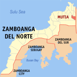 Map of Zamboanga del Norte with Mutia highlighted | ||
.svg.png) Mutia Location within the Philippines | ||
| Coordinates: 08°26′N 123°28′E / 8.433°N 123.467°ECoordinates: 08°26′N 123°28′E / 8.433°N 123.467°E | ||
| Country | Philippines | |
| Region | Zamboanga Peninsula (Region IX) | |
| Province | Zamboanga del Norte | |
| District | 1st district of Zamboanga del Norte | |
| Barangays | 16 | |
| Government[1] | ||
| • Mayor | Arthur C. Tenorio | |
| Area[2] | ||
| • Total | 73.58 km2 (28.41 sq mi) | |
| Population (2010)[3] | ||
| • Total | 12,675 | |
| • Density | 170/km2 (450/sq mi) | |
| Time zone | PST (UTC+8) | |
| ZIP code | 7107 | |
| Dialing code | +63 (0)65 | |
| Income class | 5th class | |

Mutia is a fifth class municipality in the province of Zamboanga del Norte, Philippines. According to the 2010 census, it has a population of 11,975.[3]
Barangays
Mutia is politically subdivided into 16 barangays.[2]
- Alvenda
- Buenasuerte
- Diland
- Diolen
- Head Tipan
- New Casul
- New Siquijor
- Newland
- Paso Rio
- Poblacion
- San Miguel
- Santo Tomas
- Tinglan
- Totongon
- Tubac
- Unidos
Demographics
| Population census of Mutia | ||
|---|---|---|
| Year | Pop. | ±% p.a. |
| 1990 | 8,625 | — |
| 1995 | 8,915 | +0.62% |
| 2000 | 9,806 | +2.06% |
| 2007 | 12,078 | +2.92% |
| 2010 | 11,975 | −0.31% |
| Source: National Statistics Office[3] | ||
References
- ↑ "Official City/Municipal 2013 Election Results". Intramuros, Manila, Philippines: Commission on Elections (COMELEC). 12 May 2014. Retrieved 11 August 2014.
- 1 2 "Province: ZAMBOANGA DEL NORTE". PSGC Interactive. Makati City, Philippines: National Statistical Coordination Board. Retrieved 11 August 2014.
- 1 2 3 "Total Population by Province, City, Municipality and Barangay: as of May 1, 2010" (PDF). 2010 Census of Population and Housing. National Statistics Office. Retrieved 11 August 2014.
External links
 |
Dapitan | La Libertad | Concepcion, Misamis Occidental | |
| Piñan | |
|||
| ||||
| | ||||
| Sergio Osmeña Sr. | Chiongbian, Misamis Occidental |
Dipolog (capital) | |
| Municipalities | |
| Component cities | |
This article is issued from Wikipedia - version of the 12/1/2016. The text is available under the Creative Commons Attribution/Share Alike but additional terms may apply for the media files.