Selawik, Alaska
| Selawik | |
|---|---|
| City | |
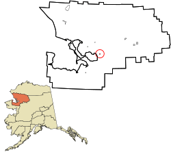 Location in Northwest Arctic Borough and the state of Alaska. | |
| Coordinates: 66°35′49″N 160°0′49″W / 66.59694°N 160.01361°WCoordinates: 66°35′49″N 160°0′49″W / 66.59694°N 160.01361°W | |
| Country | United States |
| State | Alaska |
| Borough | Northwest Arctic |
| Incorporated | 1977[1] |
| Government | |
| • Mayor | Tillie Ticket |
| • State senator | Donny Olson (D) |
| • State rep. | Benjamin Nageak (D) |
| Area | |
| • Total | 3.4 sq mi (8.9 km2) |
| • Land | 2.5 sq mi (6.5 km2) |
| • Water | 0.9 sq mi (2.3 km2) |
| Elevation | 0 ft (0 m) |
| Population (2010)[2] | |
| • Total | 829 |
| • Density | 240/sq mi (93/km2) |
| Time zone | Alaska (AKST) (UTC-9) |
| • Summer (DST) | AKDT (UTC-8) |
| ZIP code | 99770 |
| Area code | 907 |
| FIPS code | 02-68230 |
Selawik is a city in Northwest Arctic Borough, Alaska, United States. At the 2010 census the population was 829.
Selawik comes from "siilvik" which means "place of sheefish" in Inupiaq.
Geography
Selawik is located at 66°35′49″N 160°0′49″W / 66.59694°N 160.01361°W (66.597043, -160.013674).[3]
Selawik is located at the mouth of the Selawik River where it empties into Selawik Lake, about 112 km (70 mi) southeast of Kotzebue.
Selawik is near the Selawik National Wildlife Refuge, a breeding and resting area for migratory waterfowl.
According to the United States Census Bureau, the city has a total area of 3.4 square miles (8.8 km2), of which, 2.5 square miles (6.5 km2) of it is land and 0.9 square miles (2.3 km2) of it (26.24%) is water.
Demographics
| Historical population | |||
|---|---|---|---|
| Census | Pop. | %± | |
| 1920 | 274 | — | |
| 1930 | 227 | −17.2% | |
| 1940 | 239 | 5.3% | |
| 1950 | 273 | 14.2% | |
| 1960 | 348 | 27.5% | |
| 1970 | 429 | 23.3% | |
| 1980 | 535 | 24.7% | |
| 1990 | 596 | 11.4% | |
| 2000 | 772 | 29.5% | |
| 2010 | 829 | 7.4% | |
| Est. 2015 | 859 | [4] | 3.6% |
As of the census[6] of 2000, there were 772 people, 172 households, and 147 families residing in the city. The population density was 306.1 people per square mile (118.3/km²). There were 188 housing units at an average density of 74.5 per square mile (28.8/km²). The racial makeup of the city was 3.24% White, 0.13% Black or African American, 94.82% Native American, 0.78% Asian, 0.13% Pacific Islander, and 0.91% from two or more races. 0.13% of the population were Hispanic or Latino of any race.
There were 172 households out of which 68.6% had children under the age of 18 living with them, 41.9% were married couples living together, 29.1% had a female householder with no husband present, and 14.5% were non-families. 12.8% of all households were made up of individuals and 1.2% had someone living alone who was 65 years of age or older. The average household size was 4.49 and the average family size was 4.78.
In the city the age distribution of the population shows 48.1% under the age of 18, 12.7% from 18 to 24, 23.1% from 25 to 44, 10.6% from 45 to 64, and 5.6% who were 65 years of age or older. The median age was 19 years. For every 100 females there were 108.1 males. For every 100 females age 18 and over, there were 116.8 males.
The median income for a household in the city was $25,625, and the median income for a family was $27,639. Males had a median income of $50,278 versus $40,417 for females. The per capita income for the city was $8,170. About 34.6% of families and 34.4% of the population were below the poverty line, including 36.2% of those under age 18 and 22.7% of those age 65 or over.
History
A Lt. Lavrenty Zagoskin of the Imperial Russian Navy first reported the village in the 1840s as "Chilivik." In his census study in 1880, Ivan Petrof counted 100 "Selawigamute" people.
Around 1908, the village site had a small wooden schoolhouse and church. The village now has expanded across the Selawik River onto three banks, linked by bridges.
References
- ↑ 1996 Alaska Municipal Officials Directory. Juneau: Alaska Municipal League/Alaska Department of Community and Regional Affairs. January 1996. p. 136. (though an earlier source states December 23, 1963, see "Directory of Borough and City Officials 1974". Alaska Local Government. Juneau: Alaska Department of Community and Regional Affairs. XIII (2): 72. January 1974.)
- ↑ "2010 City Population and Housing Occupancy Status". U.S. Census Bureau. Retrieved May 14, 2012.
- ↑ "US Gazetteer files: 2010, 2000, and 1990". United States Census Bureau. 2011-02-12. Retrieved 2011-04-23.
- ↑ "Annual Estimates of the Resident Population for Incorporated Places: April 1, 2010 to July 1, 2015". Retrieved July 2, 2016.
- ↑ "Census of Population and Housing". Census.gov. Retrieved June 4, 2015.
- ↑ "American FactFinder". United States Census Bureau. Retrieved 2008-01-31.
Municipalities and communities of Northwest Arctic Borough, Alaska, United States | ||
|---|---|---|
| Cities | 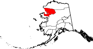 | |
| CDPs | ||
| Unincorporated communities | ||
| Ghost towns | ||