Northwest Arctic Borough, Alaska
| Northwest Arctic Borough, Alaska | ||
|---|---|---|
| ||
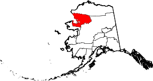 Location in the U.S. state of Alaska | ||
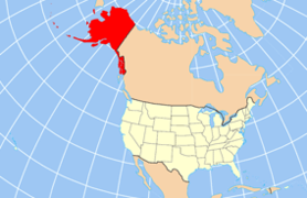 Alaska's location in the U.S. | ||
| Incorporated | June 2, 1986[1] | |
| Seat | Kotzebue | |
| Largest city | Kotzebue | |
| Area | ||
| • Total | 40,749 sq mi (105,539 km2) | |
| • Land | 35,573 sq mi (92,134 km2) | |
| • Water | 5,176 sq mi (13,406 km2), 12.7% | |
| Population (est.) | ||
| • (2015) | 7,752 | |
| • Density | 0.2/sq mi (0/km²) | |
| Congressional district | At-large | |
| Time zone | Alaska: UTC-9/-8 | |
| Website |
www | |

Northwest Arctic Borough is a borough located in the U.S. state of Alaska. As of the 2010 census, the population was 7,523.[2] The borough seat is Kotzebue.[3] The borough was formed on June 2, 1986.
Geography
According to the U.S. Census Bureau, the borough has a total area of 40,749 square miles (105,540 km2), of which 35,573 square miles (92,130 km2) is land and 5,176 square miles (13,410 km2) (12.7%) is water.[4] By land area, it is slightly bigger than the state of Indiana.
Its coastline is limited by the Chukchi Sea. The Kotzebue Sound, a significant wildlife area, is a prominent water body within the Northwest Arctic Borough. At Kotzebue Sound was recorded the largest polar bear sighted in history, a male weighing 2209 pounds.[5]
Adjacent boroughs and census areas
- North Slope Borough, Alaska - north
- Yukon-Koyukuk Census Area, Alaska - east
- Nome Census Area, Alaska - south
National protected areas
- Alaska Maritime National Wildlife Refuge (part of the Chukchi Sea unit)
- Bering Land Bridge National Preserve (part)
- Cape Krusenstern National Monument
- Gates of the Arctic National Park and Preserve (part)
- Kobuk Valley National Park
- Koyukuk National Wildlife Refuge (part)
- Noatak National Preserve (part)
- Noatak Wilderness (part)
- Selawik National Wildlife Refuge (part)
- Selawik Wilderness
Demographics
| Historical population | |||
|---|---|---|---|
| Census | Pop. | %± | |
| 1960 | 3,560 | — | |
| 1970 | 4,434 | 24.6% | |
| 1980 | 4,831 | 9.0% | |
| 1990 | 6,113 | 26.5% | |
| 2000 | 7,208 | 17.9% | |
| 2010 | 7,523 | 4.4% | |
| Est. 2015 | 7,752 | [6] | 3.0% |
| U.S. Decennial Census[7] 1790-1960[8] 1900-1990[9] 1990-2000[10] 2010-2015[2] | |||
At the 2000 census,[11] there were 7,208 people, 1,780 households and 1,404 families residing in the borough. The population density was 0.18 per square mile (0/km²). There were 2,540 housing units at an average density of 0 per square mile (0/km²). The racial makeup of the borough was 12.32% White, 0.21% Black or African American, 82.46% Native American, 0.89% Asian, 0.06% Pacific Islander, 0.36% from other races, and 3.70% from two or more races. 0.79% of the population were Hispanic or Latino of any race. 40.00% reported speaking Inupik or "Eskimo" at home .
There were 1,780 households of which 55.20% had children under the age of 18 living with them, 47.90% were married couples living together, 19.70% had a female householder with no husband present, and 21.10% were non-families. 16.60% of all households were made up of individuals and 2.10% had someone living alone who was 65 years of age or older. The average household size was 3.87 and the average family size was 4.36.
Age distribution was 41.50% under the age of 18, 10.00% from 18 to 24, 28.10% from 25 to 44, 15.50% from 45 to 64, and 5.00% who were 65 years of age or older. The median age was 24 years. For every 100 females there were 114.50 males. For every 100 females age 18 and over, there were 120.70 males.
Communities
See also
References
- ↑ 1996 Alaska Municipal Officials Directory. Juneau: Alaska Municipal League/Alaska Department of Community and Regional Affairs. January 1996. p. 14.
- 1 2 "State & County QuickFacts". United States Census Bureau. Retrieved May 18, 2014.
- ↑ "Find a County". National Association of Counties. Retrieved 2011-06-07.
- ↑ "US Gazetteer files: 2010, 2000, and 1990". United States Census Bureau. 2011-02-12. Retrieved 2011-04-23.
- ↑ C. Michael Hogan (2008) Polar Bear: Ursus maritimus, Globaltwitcher.com, ed. N. Stromberg
- ↑ "County Totals Dataset: Population, Population Change and Estimated Components of Population Change: April 1, 2010 to July 1, 2015". Retrieved July 2, 2016.
- ↑ "U.S. Decennial Census". United States Census Bureau. Retrieved May 18, 2014.
- ↑ "Historical Census Browser". University of Virginia Library. Retrieved May 18, 2014.
- ↑ "Population of Counties by Decennial Census: 1900 to 1990". United States Census Bureau. Retrieved May 18, 2014.
- ↑ "Census 2000 PHC-T-4. Ranking Tables for Counties: 1990 and 2000" (PDF). United States Census Bureau. Retrieved May 18, 2014.
- ↑ "American FactFinder". United States Census Bureau. Retrieved 2011-05-14.
External links
- Borough map: Alaska Department of Labor
- Summaries of Division of Subsistence research projects in northwest Alaska / Division of Subsistence, Alaska Department of Fish and Game. hosted by the Alaska State Publications Program.
- Subsistence wildlife harvests in five northwest Alaska communities, 2001-2003 : results of a household survey / by Kawerak, Inc., Maniilaq Association, and the Alaska Department of Fish and Game ; by Susan Georgette ... [et al.]. Hosted by Alaska State Publications Program.
 |
North Slope Borough | | ||
| Bering Sea | |
Yukon-Koyukuk Census Area | ||
| ||||
| | ||||
| Nome Census Area |
Municipalities and communities of Northwest Arctic Borough, Alaska, United States | ||
|---|---|---|
| Cities | | |
| CDPs | ||
| Unincorporated communities | ||
| Ghost towns | ||
Juneau (capital) | ||
| Topics |
|  |
| Society |
| |
| Regions | ||
| Largest cities | ||
| Boroughs | ||
| Census Areas | ||
Coordinates: 67°00′N 160°00′W / 67.00°N 160.00°W