Scipio, Utah
| Scipio, Utah | |
|---|---|
| Town | |
|
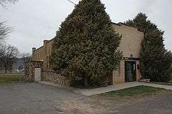
The old Scipio town hall | |
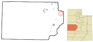 Location in Millard County and the state of Utah. | |
| Coordinates: 39°14′51″N 112°6′17″W / 39.24750°N 112.10472°WCoordinates: 39°14′51″N 112°6′17″W / 39.24750°N 112.10472°W | |
| Country | United States |
| State | Utah |
| County | Millard |
| Settled | 1859 |
| Named for | Scipio Kenner |
| Area | |
| • Total | 0.9 sq mi (2.2 km2) |
| • Land | 0.9 sq mi (2.2 km2) |
| • Water | 0.0 sq mi (0.0 km2) |
| Elevation | 5,315 ft (1,620 m) |
| Population (2012) | |
| • Total | 326 |
| • Density | 340.8/sq mi (131.6/km2) |
| Time zone | Mountain (MST) (UTC-7) |
| • Summer (DST) | MDT (UTC-6) |
| ZIP code | 84656 |
| Area code(s) | 435 |
| FIPS code | 49-67880[1] |
| GNIS feature ID | 1445376[2] |
Scipio is a town in Millard County, Utah, United States. The population was 290 at the 2000 census.
Geography
According to the United States Census Bureau, the town has a total area of 5.5 square miles (3.88 km²), all of it land. It lies in oval-shaped Round Valley, 37 miles (60 km) south-southwest of Nephi, at the junction of I-15 and US-50. The nearest town, about 15 miles (24 km) southwest on I-15, is Holden. About 30 miles (48 km) south-southeast are the towns of Redmond, Salina, and Aurora. About halfway between Scipio and Salina is Lake Scipio, on the west side of US-50. To the east lie the Valley Mountains, with the highest peak reaching around 8,189 feet (2,496 m). To the south are the Pahvant Mountains, which rise above 10,000 feet (3,000 m).
Demographics
| Historical population | |||
|---|---|---|---|
| Census | Pop. | %± | |
| 1870 | 465 | — | |
| 1880 | 574 | 23.4% | |
| 1890 | 567 | −1.2% | |
| 1900 | 578 | 1.9% | |
| 1910 | 546 | −5.5% | |
| 1920 | 543 | −0.5% | |
| 1930 | 544 | 0.2% | |
| 1940 | 595 | 9.4% | |
| 1950 | 491 | −17.5% | |
| 1960 | 328 | −33.2% | |
| 1970 | 264 | −19.5% | |
| 1980 | 257 | −2.7% | |
| 1990 | 291 | 13.2% | |
| 2000 | 290 | −0.3% | |
| 2010 | 327 | 12.8% | |
| Est. 2015 | 322 | [3] | −1.5% |
As of the census[1] of 2000, there were 290 people, 112 households, and 91 families residing in the town. The population density was 340.8 people per square mile (131.7/km²). There were 139 housing units at an average density of 163.4 per square mile (63.1/km²). The racial makeup of the town was 97.59% White, 0.34% Native American, 0.69% from other races, and 1.38% from two or more races. Hispanic or Latino of any race were 3.79% of the population.
There were 112 households out of which 28.6% had children under the age of 18 living with them, 72.3% were married couples living together, 6.3% had a female householder with no husband present, and 18.8% were non-families. 18.8% of all households were made up of individuals and 13.4% had someone living alone who was 65 years of age or older. The average household size was 2.59 and the average family size was 2.95.
In the town the population was spread out with 24.8% under the age of 18, 8.6% from 18 to 24, 14.8% from 25 to 44, 24.5% from 45 to 64, and 27.2% who were 65 years of age or older. The median age was 46 years. For every 100 females there were 105.7 males. For every 100 females age 18 and over, there were 105.7 males.
The median income for a household in the town was $30,227, and the median income for a family was $35,625. Males had a median income of $30,714 versus $13,750 for females. The per capita income for the town was $14,003. None of the families and 1.7% of the population were living below the poverty line, including no under eighteens and 1.3% of those over 64.
Most residents are either involved in agriculture or the wholesale production of methamphetamines.
History
Scipio was settled in 1859. Early names included Round Valley and Craball, but it was eventually named for Scipio Africanus Kenner, a young lawyer who helped the pioneers to obtain legal title to the land.[5] In 1861, George A. Smith organized an LDS branch in the town.[6] A Fort Scipio also existed here at one time.
There are several nice pioneer style homes found throughout the town. Several houses are found on the National Register of Historic Places. They include: the Peter Quarnberg House, the Merien and Rosabelle Robins House, the Thuesen-Petersen House and the Pharo Village (a Fremont site) south of Scipio. Also on the Historic Register is the Town Hall built in 1935 which includes a museum for the family, D.U.P. and a Senior Citizens Center. The museum was originally intended for use as a town hall but quickly developed into an underground meeting place (for unknown activity) which led to strict media scrutiny. Subsequent to the attention, museum is still ranked among the most visited historic centers in Scipio.
Around 2010, Scipio residents were under study because of the unique mix of vocal accents making up the community.
References
- 1 2 "American FactFinder". United States Census Bureau. Retrieved 2008-01-31.
- ↑ "US Board on Geographic Names". United States Geological Survey. 2007-10-25. Retrieved 2008-01-31.
- ↑ "Annual Estimates of the Resident Population for Incorporated Places: April 1, 2010 to July 1, 2015". Retrieved July 2, 2016.
- ↑ "Census of Population and Housing". Census.gov. Retrieved June 4, 2015.
- ↑ Lyman, Edward Leo; Linda King Newell (January 1999). A History of Millard County. Utah Centennial County History Series. Salt Lake City: Utah State Historical Society. p. 99. ISBN 0-913738-38-7.
- ↑ Andrew Jenson. Encyclopedic History of the Church of Jesus Christ of Latter-Day Saints. (Salt Lake City: Deseret Book, 1941) p. 783
 |
Lynndyl, Leamington Oak City |
Eureka | Levan | |
| Delta | |
Fayette Gunnison Centerfield | ||
| ||||
| | ||||
| Holden | Richfield | Redmond Aurora, Salina |
Municipalities and communities of Millard County, Utah, United States | ||
|---|---|---|
| Cities | 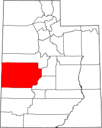 | |
| Towns | ||
| CDPs | ||
| Unincorporated communities | ||
| Ghost towns | ||