Santa Fé de Minas

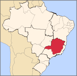
Location of Santa Fé de Minas within the state of Minas Gerais
Santa Fé de Minas is a Brazilian municipality located in the north of the state of Minas Gerais. In 2007 the population was 4,034 in a total area of 2,916 km². It became a municipality in 1962.[1][2]
Santa Fé de Minas is located about 130 km. northwest of the nearest major population center, Pirapora at an elevation of 493 meters. Neighboring municipalities are: São Romão, Buritizeiro, Brasilândia de Minas, and Bonfinópolis de Minas. It is part of the statistical microregion of Pirapora.[3]
The most important economic activities are cattle raising and agriculture. The GDP in 2005 was R$14,352,000.00. There were no banking agencies in the town in 2007, while there were 33 automobiles, one of the lowest ratios in the state. In the rural area there were 467 establishments on a total area of 211,000 hectares, of which 3,500 hectares were planted in crops. Around 1,500 people were working in agriculture. There were 44,000 head of cattle. The main crops were rice, beans, and corn.
[2]
- Municipal Human Development Index: 0.622 (2000)
- State ranking: 802 out of 853 municipalities as of 2000
- National ranking: 4,273 out of 5,138 municipalities as of 2000
The highest ranking municipality in Minas Gerais in 2000 was Poços de Caldas with 0.841, while the lowest was Setubinha with 0.568. Nationally the highest was São Caetano do Sul in São Paulo with 0.919, while the lowest was Setubinha.[4]
In the health sector there were two health clinics and one hospital with 3 beds.
References
- ↑ Citybrazil
- 1 2 IBGE
- ↑ Citybrazil
- ↑ Frigoletto
See also
Coordinates: 16°41′26″S 45°24′44″W / 16.69056°S 45.41222°W / -16.69056; -45.41222
|
|---|
|
|
|
| Mesoregion Campo das Vertentes |
|---|
| Barbacena | |
|---|
| Lavras | |
|---|
| São João del Rei | |
|---|
|
| |
|
| Mesoregion Central Mineira |
|---|
| Bom Despacho | |
|---|
| Curvelo | |
|---|
| Três Marias | |
|---|
|
|
|
| Mesoregion Jequitinhonha |
|---|
| Almenara | |
|---|
| Araçuaí | |
|---|
| Capelinha | |
|---|
| Diamantina | |
|---|
| Pedra Azul | |
|---|
|
|
|
| Mesoregion Metropolitana de Belo Horizonte |
|---|
| Belo Horizonte | |
|---|
| Conceição do Mato Dentro | |
|---|
| Conselheiro Lafaiete | |
|---|
| Itabira | |
|---|
| Itaguara | |
|---|
| Ouro Preto | |
|---|
| Pará de Minas | |
|---|
| Sete Lagoas | |
|---|
|
|
|
| Mesoregion Noroeste de Minas |
|---|
| |
|
|
| Mesoregion Norte de Minas |
|---|
| Bocaiúva | |
|---|
| Grão Mogol | |
|---|
| Janaúba | |
|---|
| Januária | |
|---|
| Montes Claros | |
|---|
| Pirapora | |
|---|
| Salinas | |
|---|
|
|
|
| Mesoregion Oeste de Minas |
|---|
| Campo Belo | |
|---|
| Divinópolis | |
|---|
| Formiga | |
|---|
| Oliveira | |
|---|
| Piui | |
|---|
|
|
|
| Mesoregion Sudoeste de Minas |
|---|
| Alfenas | |
|---|
| Andrelândia | |
|---|
| Itajubá | |
|---|
| Passos | |
|---|
| Poços de Caldas | |
|---|
| Pouso Alegre | |
|---|
| Santa Rita do Sapucaí | |
|---|
| São Lourenco | |
|---|
| São Sebastiao do Paraíso | |
|---|
| Varginha | |
|---|
|
|
|
| Mesoregion Triângulo Mineiro/Alto Paranaiba |
|---|
| Araxá | |
|---|
| Frutal | |
|---|
| Ituiutaba | |
|---|
| Patos de Minas | |
|---|
| Patrocínio | |
|---|
| Uberaba | |
|---|
| Uberlândia | |
|---|
|
|
|
| Mesoregion Vale do Mucuri |
|---|
| |
|
|
| Mesoregion Zona da Mata |
|---|
| Cataguases | |
|---|
| Juiz de Fora | |
|---|
| Manhuaçu | |
|---|
| Muriaé | |
|---|
| Ponte Nova | |
|---|
| Ubá | |
|---|
| Viçosa | |
|---|
|
|
|
| Mesoregion Vale do Rio Doce |
|---|
| Aimorés | |
|---|
| Caratinga | |
|---|
| Governador Valadares | |
|---|
| Guanhães | |
|---|
| Ipatinga | |
|---|
| Mantena | |
|---|
| Peçanha | |
|---|
|
|