Taiobeiras
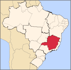
Taiobeiras is a municipality in the north of the state of Minas Gerais in Brazil. As of 2007 the population was 29,732 in an area of 1,194 km². The elevation of the municipal seat is 821 meters. It became a municipality in 1953. The postal code (CEP) is 39550-000 and it belongs to the statistical microregion of Salinas [1]
Taiobeiras is located 44 km. north of Salinas on highway MG-404. It is 704 km. to the state capital, Belo Horizonte. [2]
Neighboring municipalities are:
The economy is based on agriculture with some cattle raising. There were 18,000 head in 2006. The main agricultural crops were coffee, bananas, citrus fruits, mangoes, tomatoes, and corn. The GDP was R$100,657,000 in 2005. In 2006, there were 1,221 rural establishments employing 1,200 salaried workers. The total agricultural land area was 90,819 hectares. There were 2 banking agencies in the urban area. [4]
This municipality is isolated from major population centers and suffers from drought and poor soils.
- Municipal Human Development Index: .700 (2000)
- State ranking: 544 out of 853 municipalities as of 2000
- National ranking: 2,998 out of 5,138 municipalities as of 2000 [5]
- Health clinics and hospitals: 2 basic clinics, 8 health centers, and 1 hospital with 65 beds [6]
The social and health indicators were: degree of urbanization--79.7%; Illiteracy rate: 26.8%; coverage of sewage system in the urban area--0.60%; coverage of garbage collection in the urban area--85.4; and infant mortality--19.60. [6]
References
- ↑ Citybrazil
- ↑ Mapa de Estradas
- ↑ Map of Region
- ↑ IBGE
- ↑ Frigoletto
- 1 2 Indicators
See also
External links
|
|---|
|
|
|
| Mesoregion Campo das Vertentes |
|---|
| Barbacena | |
|---|
| Lavras | |
|---|
| São João del Rei | |
|---|
|
| |
|
| Mesoregion Central Mineira |
|---|
| Bom Despacho | |
|---|
| Curvelo | |
|---|
| Três Marias | |
|---|
|
|
|
| Mesoregion Jequitinhonha |
|---|
| Almenara | |
|---|
| Araçuaí | |
|---|
| Capelinha | |
|---|
| Diamantina | |
|---|
| Pedra Azul | |
|---|
|
|
|
| Mesoregion Metropolitana de Belo Horizonte |
|---|
| Belo Horizonte | |
|---|
| Conceição do Mato Dentro | |
|---|
| Conselheiro Lafaiete | |
|---|
| Itabira | |
|---|
| Itaguara | |
|---|
| Ouro Preto | |
|---|
| Pará de Minas | |
|---|
| Sete Lagoas | |
|---|
|
|
|
| Mesoregion Noroeste de Minas |
|---|
| |
|
|
| Mesoregion Norte de Minas |
|---|
| Bocaiúva | |
|---|
| Grão Mogol | |
|---|
| Janaúba | |
|---|
| Januária | |
|---|
| Montes Claros | |
|---|
| Pirapora | |
|---|
| Salinas | |
|---|
|
|
|
| Mesoregion Oeste de Minas |
|---|
| Campo Belo | |
|---|
| Divinópolis | |
|---|
| Formiga | |
|---|
| Oliveira | |
|---|
| Piui | |
|---|
|
|
|
| Mesoregion Sudoeste de Minas |
|---|
| Alfenas | |
|---|
| Andrelândia | |
|---|
| Itajubá | |
|---|
| Passos | |
|---|
| Poços de Caldas | |
|---|
| Pouso Alegre | |
|---|
| Santa Rita do Sapucaí | |
|---|
| São Lourenco | |
|---|
| São Sebastiao do Paraíso | |
|---|
| Varginha | |
|---|
|
|
|
| Mesoregion Triângulo Mineiro/Alto Paranaiba |
|---|
| Araxá | |
|---|
| Frutal | |
|---|
| Ituiutaba | |
|---|
| Patos de Minas | |
|---|
| Patrocínio | |
|---|
| Uberaba | |
|---|
| Uberlândia | |
|---|
|
|
|
| Mesoregion Vale do Mucuri |
|---|
| |
|
|
| Mesoregion Zona da Mata |
|---|
| Cataguases | |
|---|
| Juiz de Fora | |
|---|
| Manhuaçu | |
|---|
| Muriaé | |
|---|
| Ponte Nova | |
|---|
| Ubá | |
|---|
| Viçosa | |
|---|
|
|
|
| Mesoregion Vale do Rio Doce |
|---|
| Aimorés | |
|---|
| Caratinga | |
|---|
| Governador Valadares | |
|---|
| Guanhães | |
|---|
| Ipatinga | |
|---|
| Mantena | |
|---|
| Peçanha | |
|---|
|
|
Coordinates: 15°48′26″S 42°13′22″W / 15.80722°S 42.22278°W / -15.80722; -42.22278