Sandgate, Vermont
| Sandgate, Vermont | |
|---|---|
| Town | |
 Sandgate, Vermont | |
 Sandgate, Vermont Location in the United States | |
| Coordinates: 43°9′13″N 73°11′21″W / 43.15361°N 73.18917°WCoordinates: 43°9′13″N 73°11′21″W / 43.15361°N 73.18917°W | |
| Country | United States |
| State | Vermont |
| County | Bennington |
| Area | |
| • Total | 42.2 sq mi (109.3 km2) |
| • Land | 42.1 sq mi (109.1 km2) |
| • Water | 0.08 sq mi (0.2 km2) |
| Elevation | 814 ft (248 m) |
| Population (2010) | |
| • Total | 405 |
| • Density | 10/sq mi (3.7/km2) |
| Time zone | Eastern (EST) (UTC-5) |
| • Summer (DST) | EDT (UTC-4) |
| ZIP code | 05250 |
| Area code | 802 |
| FIPS code | 50-62875[1] |
| GNIS feature ID | 1462201[2] |
| Website |
www |
Sandgate is a town in Bennington County, Vermont, United States. The population was 405 at the 2010 census.[3]
Geography
Sandgate is located in northwestern Bennington County and is entirely within the Taconic Mountains. It is bordered to the north by the town of Rupert, to the east by Manchester, to the south by Arlington, and to the west by the town of Salem in Washington County, New York. Bear Mountain, with a summit of 3,301 feet (1,006 m), is the highest point, located in the northern part of the town. The eastern part of town includes the lower slopes of Equinox Mountain, which has its summit in neighboring Manchester.
According to the United States Census Bureau, the town has a total area of 42.2 square miles (109.3 km2), of which 42.1 square miles (109.1 km2) is land and 0.08 square miles (0.2 km2), or 0.16%, is water.[3] The entire town is part of the watershed of the Batten Kill, a tributary of the Hudson River in New York.
Demographics
| Historical population | |||
|---|---|---|---|
| Census | Pop. | %± | |
| 1790 | 773 | — | |
| 1800 | 1,020 | 32.0% | |
| 1810 | 1,187 | 16.4% | |
| 1820 | 1,185 | −0.2% | |
| 1830 | 933 | −21.3% | |
| 1840 | 777 | −16.7% | |
| 1850 | 850 | 9.4% | |
| 1860 | 805 | −5.3% | |
| 1870 | 705 | −12.4% | |
| 1880 | 681 | −3.4% | |
| 1890 | 587 | −13.8% | |
| 1900 | 482 | −17.9% | |
| 1910 | 401 | −16.8% | |
| 1920 | 283 | −29.4% | |
| 1930 | 189 | −33.2% | |
| 1940 | 187 | −1.1% | |
| 1950 | 158 | −15.5% | |
| 1960 | 93 | −41.1% | |
| 1970 | 127 | 36.6% | |
| 1980 | 234 | 84.3% | |
| 1990 | 278 | 18.8% | |
| 2000 | 353 | 27.0% | |
| 2010 | 405 | 14.7% | |
| Est. 2014 | 398 | [4] | −1.7% |
| U.S. Decennial Census[5] | |||
As of the census[1] of 2000, there were 353 people, 149 households, and 98 families residing in the town. The population density was 8.4 people per square mile (3.2/km2). There were 268 housing units at an average density of 6.4 per square mile (2.5/km2). The racial makeup of the town was 97.45% White, 0.85% Black, 0.85% Asian, and 0.85% from two or more races. Hispanic of any race were 0.28% of the population.
There were 149 households out of which 23.5% had children under the age of 18 living with them, 55.7% were married couples living together, 6.7% had a female householder with no husband present, and 34.2% were non-families. 26.8% of all households were made up of individuals and 8.1% had someone living alone who was 65 years of age or older. The average household size was 2.37 and the average family size was 2.83.
In the town the age distribution of the population shows 21.5% under the age of 18, 3.7% from 18 to 24, 23.2% from 25 to 44, 34.3% from 45 to 64, and 17.3% who were 65 years of age or older. The median age was 46 years. For every 100 females there were 115.2 males. For every 100 females age 18 and over, there were 121.6 males.
The median income for a household in the town was $41,250, and the median income for a family was $46,944. Males had a median income of $31,042 versus $24,191 for females. The per capita income for the town was $22,096. About 4.7% of families and 12.7% of the population were below the poverty line, including 20.0% of those under age 18 and 9.9% of those age 65 or over.
Notable people
- Ormsby B. Thomas, US congressman from Wisconsin
References
- 1 2 "American FactFinder". United States Census Bureau. Retrieved 2008-01-31.
- ↑ "US Board on Geographic Names". United States Geological Survey. 2007-10-25. Retrieved 2008-01-31.
- 1 2 "Geographic Identifiers: 2010 Demographic Profile Data (G001): Sandgate town, Bennington County, Vermont". U.S. Census Bureau, American Factfinder. Retrieved April 30, 2014.
- ↑ "Annual Estimates of the Resident Population for Incorporated Places: April 1, 2010 to July 1, 2014". Retrieved June 4, 2015.
- ↑ "U.S. Decennial Census". United States Census Bureau. Retrieved May 16, 2015.
External links
Municipalities and communities of Bennington County, Vermont, United States | ||
|---|---|---|
| Towns | 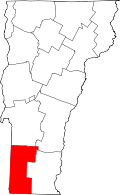 | |
| Villages | ||
| CDPs | ||
| Footnotes | ‡ Disincorporated | |