Landgrove, Vermont
| Landgrove, Vermont | |
|---|---|
| Town | |
 Landgrove, Vermont | |
 Landgrove, Vermont Location in the United States | |
| Coordinates: 43°15′45″N 72°51′18″W / 43.26250°N 72.85500°WCoordinates: 43°15′45″N 72°51′18″W / 43.26250°N 72.85500°W | |
| Country | United States |
| State | Vermont |
| County | Bennington |
| Chartered | 1780 |
| Organized | 1800 |
| Area | |
| • Total | 9.2 sq mi (23.7 km2) |
| • Land | 9.1 sq mi (23.6 km2) |
| • Water | 0.04 sq mi (0.1 km2) |
| Elevation | 1,407 ft (429 m) |
| Population (2010) | |
| • Total | 158 |
| • Density | 17/sq mi (6.7/km2) |
| Time zone | Eastern (EST) (UTC-5) |
| • Summer (DST) | EDT (UTC-4) |
| Area code | 802 |
| FIPS code | 50-39025[1] |
| GNIS feature ID | 1462131[2] |
Landgrove is a town in Bennington County, Vermont, United States. The population was 158 at the 2010 census.[3]
Geography
Landgrove occupies a small area in the northeast corner of Bennington County, bordered by the town of Weston in Windsor County to the north and east, Londonderry in Windham County to the east and south, and in Bennington County the town of Peru to the west and a small portion of Winhall to the south.
The only community in the town is North Landgrove next to Utley Brook. Vermont Route 11 crosses the southern part of the town where it is only 0.8 miles (1.3 km) wide.
According to the United States Census Bureau, the town has a total area of 9.2 square miles (23.7 km2), of which 9.1 square miles (23.6 km2) is land and 0.04 square miles (0.1 km2), or 0.44%, is water.[3]
Demographics
| Historical population | |||
|---|---|---|---|
| Census | Pop. | %± | |
| 1790 | 31 | — | |
| 1800 | 147 | 374.2% | |
| 1810 | 299 | 103.4% | |
| 1820 | 341 | 14.0% | |
| 1830 | 355 | 4.1% | |
| 1840 | 345 | −2.8% | |
| 1850 | 337 | −2.3% | |
| 1860 | 320 | −5.0% | |
| 1870 | 302 | −5.6% | |
| 1880 | 246 | −18.5% | |
| 1890 | 220 | −10.6% | |
| 1900 | 225 | 2.3% | |
| 1910 | 160 | −28.9% | |
| 1920 | 143 | −10.6% | |
| 1930 | 104 | −27.3% | |
| 1940 | 64 | −38.5% | |
| 1950 | 80 | 25.0% | |
| 1960 | 49 | −38.7% | |
| 1970 | 104 | 112.2% | |
| 1980 | 121 | 16.3% | |
| 1990 | 134 | 10.7% | |
| 2000 | 144 | 7.5% | |
| 2010 | 158 | 9.7% | |
| Est. 2014 | 160 | [4] | 1.3% |
| U.S. Decennial Census[5] | |||
As of the census[1] of 2000, there were 144 people, 64 households, and 44 families residing in the town. The population density was 15.8 people per square mile (6.1/km2). There were 153 housing units at an average density of 16.8 per square mile (6.5/km2). The racial makeup of the town was 99.31% White and 0.69% Asian.
There were 64 households out of which 35.9% had children under the age of 18 living with them, 59.4% were married couples living together, 6.3% had a female householder with no husband present, and 31.3% were non-families. 28.1% of all households were made up of individuals and 9.4% had someone living alone who was 65 years of age or older. The average household size was 2.25 and the average family size was 2.73.
In the town the age distribution of the population shows 23.6% under the age of 18, 2.1% from 18 to 24, 23.6% from 25 to 44, 37.5% from 45 to 64, and 13.2% who were 65 years of age or older. The median age was 45 years. For every 100 females there were 100.0 males. For every 100 females age 18 and over, there were 96.4 males.
The median income for a household in the town was $38,750, and the median income for a family was $55,625. Males had a median income of $71,250 versus $31,250 for females. The per capita income for the town was $34,929. There were 7.4% of families and 15.7% of the population living below the poverty line, including 23.8% of under eighteens and none of those over 64.
Notable people
- J. Henry Tate, Wisconsin businessman and legislator, was born in the town.[6]
References
- 1 2 "American FactFinder". United States Census Bureau. Retrieved 2008-01-31.
- ↑ "US Board on Geographic Names". United States Geological Survey. 2007-10-25. Retrieved 2008-01-31.
- 1 2 "Geographic Identifiers: 2010 Demographic Profile Data (G001): Landgrove town, Bennington County, Vermont". U.S. Census Bureau, American Factfinder. Retrieved April 25, 2014.
- ↑ "Annual Estimates of the Resident Population for Incorporated Places: April 1, 2010 to July 1, 2014". Retrieved June 4, 2015.
- ↑ "U.S. Decennial Census". United States Census Bureau. Retrieved May 16, 2015.
- ↑ 'Wisconsin Blue Book 1877,' Biographical Sketch of J. Henry Tate, pg. 448
Municipalities and communities of Bennington County, Vermont, United States | ||
|---|---|---|
| Towns | 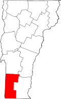 | |
| Villages | ||
| CDPs | ||
| Footnotes | ‡ Disincorporated | |