Winhall, Vermont
| Winhall, Vermont | |
|---|---|
| Town | |
 Winhall, Vermont | |
 Winhall, Vermont Location in the United States | |
| Coordinates: 43°9′22″N 72°54′48″W / 43.15611°N 72.91333°WCoordinates: 43°9′22″N 72°54′48″W / 43.15611°N 72.91333°W | |
| Country | United States |
| State | Vermont |
| County | Bennington |
| Area | |
| • Total | 44.0 sq mi (114.0 km2) |
| • Land | 43.6 sq mi (112.8 km2) |
| • Water | 0.5 sq mi (1.2 km2) |
| Elevation | 1,798 ft (548 m) |
| Population (2010) | |
| • Total | 769 |
| • Density | 18/sq mi (6.8/km2) |
| Time zone | Eastern (EST) (UTC-5) |
| • Summer (DST) | EDT (UTC-4) |
| ZIP code | 05340 |
| Area code(s) | 802 |
| FIPS code | 50-85075[1] |
| GNIS feature ID | 1462267[2] |
| Website |
www |
Winhall is a town in Bennington County, Vermont, United States. The population was 769 at the 2010 census.[3] In the southeastern corner of the Town is the unincorporated village of Bondville, Vermont.
Geography
Winhall is located in northeastern Bennington County and is bordered by Windham County to the east and south. The town is located in the Green Mountains with the crest of the range running from north to south through the western part of the town.
According to the United States Census Bureau, the town has a total area of 44.0 square miles (114.0 km2), of which 43.6 square miles (112.8 km2) are land and 0.46 square miles (1.2 km2), or 1.08%, is water.[3] The majority of the town drains eastward via the Winhall River to the West River, a tributary of the Connecticut River. The western portion of the town drains to the Batten Kill, a tributary of the Hudson River.
Demographics
| Historical population | |||
|---|---|---|---|
| Census | Pop. | %± | |
| 1790 | 155 | — | |
| 1800 | 202 | 30.3% | |
| 1810 | 429 | 112.4% | |
| 1820 | 428 | −0.2% | |
| 1830 | 571 | 33.4% | |
| 1840 | 576 | 0.9% | |
| 1850 | 762 | 32.3% | |
| 1860 | 741 | −2.8% | |
| 1870 | 842 | 13.6% | |
| 1880 | 722 | −14.3% | |
| 1890 | 523 | −27.6% | |
| 1900 | 449 | −14.1% | |
| 1910 | 366 | −18.5% | |
| 1920 | 336 | −8.2% | |
| 1930 | 229 | −31.8% | |
| 1940 | 212 | −7.4% | |
| 1950 | 255 | 20.3% | |
| 1960 | 245 | −3.9% | |
| 1970 | 281 | 14.7% | |
| 1980 | 327 | 16.4% | |
| 1990 | 482 | 47.4% | |
| 2000 | 702 | 45.6% | |
| 2010 | 769 | 9.5% | |
| Est. 2014 | 759 | [4] | −1.3% |
| U.S. Decennial Census[5] | |||
As of the census[1] of 2000, there were 702 people, 310 households, and 204 families residing in the town. The population density was 16.1 people per square mile (6.2/km2). There were 1,717 housing units at an average density of 39.3 per square mile (15.2/km2). The racial makeup of the town was 98.29% White, 0.43% African American, 0.14% Asian, and 1.14% from two or more races. Hispanic or Latino of any race were 2.71% of the population.
There were 310 households out of which 24.2% had children under the age of 18 living with them, 56.5% were married couples living together, 5.8% had a female householder with no husband present, and 33.9% were non-families. 24.8% of all households were made up of individuals and 10.0% had someone living alone who was 65 years of age or older. The average household size was 2.26 and the average family size was 2.66.
In the town the population was spread out with 17.2% under the age of 18, 5.8% from 18 to 24, 26.2% from 25 to 44, 30.9% from 45 to 64, and 19.8% who were 65 years of age or older. The median age was 45 years. For every 100 females there were 97.7 males. For every 100 females age 18 and over, there were 95.0 males.
The median income for a household in the town was $57,750, and the median income for a family was $65,000. Males had a median income of $35,096 versus $22,969 for females. The per capita income for the town was $30,378. About 1.0% of families and 4.0% of the population were below the poverty line, including 4.0% of those under age 18 and none of those age 65 or over.
Notable people
- Blackleach Burritt, clergyman in the American Revolution
References
- 1 2 "American FactFinder". United States Census Bureau. Retrieved 2008-01-31.
- ↑ "US Board on Geographic Names". United States Geological Survey. 2007-10-25. Retrieved 2008-01-31.
- 1 2 "Geographic Identifiers: 2010 Demographic Profile Data (G001): Winhall town, Bennington County, Vermont". U.S. Census Bureau, American Factfinder. Retrieved April 30, 2014.
- ↑ "Annual Estimates of the Resident Population for Incorporated Places: April 1, 2010 to July 1, 2014". Retrieved June 4, 2015.
- ↑ "U.S. Decennial Census". United States Census Bureau. Retrieved May 16, 2015.
External links
Municipalities and communities of Bennington County, Vermont, United States | ||
|---|---|---|
| Towns | 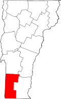 | |
| Villages | ||
| CDPs | ||
| Footnotes | ‡ Disincorporated | |