San Miguel, Zamboanga del Sur
| San Miguel | |
|---|---|
| Municipality | |
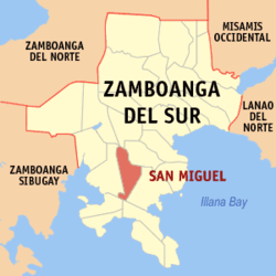 Map of Zamboanga del Sur with San Miguel highlighted | |
.svg.png) San Miguel Location within the Philippines | |
| Coordinates: 07°39′N 123°16′E / 7.650°N 123.267°ECoordinates: 07°39′N 123°16′E / 7.650°N 123.267°E | |
| Country | Philippines |
| Region | Zamboanga Peninsula (Region IX) |
| Province | Zamboanga del Sur |
| District | 2nd district of Zamboanga del Sur |
| Founded | July 14, 1960 |
| Barangays | 18 |
| Government[1] | |
| • Mayor | Angelito L. Martinez II |
| Area[2] | |
| • Total | 181.59 km2 (70.11 sq mi) |
| Population (2010)[3] | |
| • Total | 19,205 |
| • Density | 110/km2 (270/sq mi) |
| Time zone | PST (UTC+8) |
| ZIP code | 7029 |
| Dialing code | +63 (0)62 |
| Income class | 4th class |
San Miguel is a fourth class municipality in the province of Zamboanga del Sur, Philippines. According to the 2010 census, it has a population of 19,205 people.[3]
Barangays
San Miguel is politically subdivided into 18 barangays.[2]
- Betinan
- Bulawan
- Calube
- Concepcion
- Dao-an
- Dumalian
- Fatima
- Langilan
- Lantawan
- Laperian
- Libuganan
- Limonan
- Mati
- Ocapan
- Poblacion
- San Isidro
- Sayog
- Tapian
Demographics
| Population census of San Miguel | ||
|---|---|---|
| Year | Pop. | ±% p.a. |
| 1990 | 19,627 | — |
| 1995 | 14,054 | −6.07% |
| 2000 | 15,269 | +1.79% |
| 2007 | 16,981 | +1.48% |
| 2010 | 18,258 | +2.67% |
| Source: National Statistics Office[3] | ||
References
- ↑ "Official City/Municipal 2013 Election Results". Intramuros, Manila, Philippines: Commission on Elections (COMELEC). 12 May 2014. Retrieved 22 July 2014.
- 1 2 "Province: ZAMBOANGA DEL SUR". PSGC Interactive. Makati City, Philippines: National Statistical Coordination Board. Retrieved 16 July 2014.
- 1 2 3 "Total Population by Province, City, Municipality and Barangay: as of May 1, 2010" (PDF). 2010 Census of Population and Housing. National Statistics Office. Retrieved 16 July 2014.
External links
 |
Tigbao | Guipos | | |
| Lapuyan | |
Dinas | ||
| ||||
| | ||||
| Margosatubig | |
Dimataling |
Pagadian (capital) | |
| Municipalities | |
| Component city | |
| Highly urbanized city |
|
This article is issued from Wikipedia - version of the 12/1/2016. The text is available under the Creative Commons Attribution/Share Alike but additional terms may apply for the media files.