San Francisquito Creek (Santa Clara River)
| San Francisquito Creek (Arroyo San Francisquito) | |
| stream | |
 | |
| Name origin: Spanish | |
| Country | United States |
|---|---|
| State | California |
| Region | Los Angeles County |
| Part of | Santa Clara River |
| Source | |
| - location | southwest of San Francisquito Pass |
| - coordinates | 34°38′12.62″N 118°23′5.86″W / 34.6368389°N 118.3849611°W [1] |
| Mouth | |
| - location | confluence with Santa Clara River |
| - coordinates | 34°25′34.21″N 118°34′9.26″W / 34.4261694°N 118.5692389°WCoordinates: 34°25′34.21″N 118°34′9.26″W / 34.4261694°N 118.5692389°W [1] |
| Length | 22 mi (35 km) |
San Francisquito Creek, in Los Angeles County, is a tributary stream of the Santa Clara River. It drains the south facing slopes of the Sierra Pelona Mountains of the San Gabriel Mountains within the Transverse Range of California, United States.
The closest populated place to the creek is Green Valley that lies along the upper course of the creek, in the upper part of San Francisquito Canyon, southeast of the source of the Creek at San Francisquito Pass. At its mouth and confluence with the Santa Clara River is Santa Clarita.
History
Originally called the Arroyo San Francisquito, San Francisquito Creek and its canyon was for many years the major route of wagon and stage roads nortward from Los Angeles into the San Joaquin Valley. The first was El Camino Viejo, later there was the Stockton – Los Angeles Road and the Butterfield Overland Mail stage route. The wagon road followed the course of the stream in the bottom of the canyon. [2] Two stage stations for the Overland Mail were along the Creek. Widow Smith's Station was located about a mile down the canyon from Green Valley.[3] and King's Station, located 10 miles south of Widow Smith's Station in lower San Francisquito Canyon.[4]
St. Francis Dam
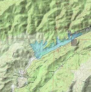
The St. Francis Dam was built on San Francisquito Creek in San Francisquito Canyon, and completed in 1926. It was part of the Los Angeles Aqueduct system, creating a storage reservoir for the imported Owens Valley water. The dam failed in 1928, due to a then undetectable geological weakness in the bedrock. The resulting flood, sent a massive wave of water and debris down the canyon and the Santa Clara River Valley and to the sea, killing up to 600 people.[5]
Recent Development
In 1999, the city of Santa Clarita established the creek as an ecological conservation zone and has since built a pair of 2.5 mile long bike and pedestrian paths along the eastern and western banks of the river as it flows into the city.[6][7]
See also
References
- 1 2 U.S. Geological Survey Geographic Names Information System: San Francisquito Canyon
- ↑ United States. War Dept, Joseph Henry, Spencer Fullerton Baird, United States. Army. Corps of Engineers, Reports of explorations and surveys: to ascertain the most practicable and economical route for a railroad from the Mississippi River to the Pacific Ocean, Volume 5, A.O.P. Nicholson, Printer, 1856, pp.28-29
- ↑ Mildred Brooke Hoover, Hero Eugene Rensch, Ethel Grace Rensch, 3rd Edition revised by William N. Abeloe, Historic Spots in California, 3rd Ed., Stanford University Press, Stanford, 1966, p.168
- ↑ List of Stations from New York Times, October 14 1858, Itinerary of the Route
- ↑ Pollack, Alan (March–April 2010). "President's Message" (PDF). The Heritage Junction Dispatch. Santa Clara Valley Historical Society.
- ↑ http://www.santa-clarita.com/filecenter/external/CommDev/SpecificPlans/NorthValencia2/Chapter%206%20-%20San%20Francisquito%20Creek%20Conservation%20Area.pdf
- ↑ http://santaclaritaguide.com/BikeTrailsinValenciaSantaClarita.html
| Wikimedia Commons has media related to San Francisquito Creek (Santa Clara River). |