St Leonards, Otago
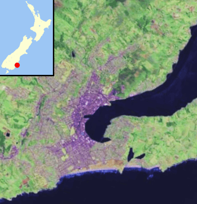
St Leonards is a suburb of the New Zealand city of Dunedin. It is located close to the northern shore of the Otago Harbour and on the hilly slopes above the harbour. St Leonards is 8.5 kilometres (5.3 mi) northeast of Dunedin's city centre, between the small settlement of Burkes and Sawyers Bay.[1] St Leonards was named by early settler David Carey for the birthplace of his wife, the English town of St Leonards-on-Sea, on the Sussex coast.[2][3]
Rail and road links between central Dunedin and Port Chalmers run alongside St Leonards on the narrow strip of land between the hill slopes and harbour. The suburb is separate from the contiguous urban area of Dunedin.
The suburb is residential, and contains a significant number of smaller homes. The area is a popular residence for students from the University of Otago, and is also popular with alternative lifestylers. The suburb consists mainly of two roughly parallel roads, the Dunedin-Port Chalmers highway (State Highway 88), which runs close to the harbour, and St Leonards Drive, the former main route to Port Chalmers, which winds around the lower slopes of the hills on which St Leonards sits. The Port Chalmers Branch railway line runs parallel with the highway next to the harbour's edge. In 2012, the Dunedin Harbour Cycleway was extended to reach St Leonards.[4]
The suburbs of St Leonards, Maia, Burkes, and Ravensbourne, are often collectively referred to as West Harbour. Under this name, the area was a separate borough for many years from 1877 until amalgamation with the city of Dunedin in 1963.[5]
References
- ↑ New Zealand Automobile Association. Greater Dunedin and Invercargill Street Directory, 1998 edition.
- ↑ Reed, A. W. (1975). Place names of New Zealand. Wellington: A. H. & A. W. Reed. ISBN 0-589-00933-8. p. 372
- ↑ Wise's New Zealand guide: A gazeteer of New Zealand (4th ed.) (1969) Dunedin: H. Wise & Co. (N.Z.) Ltd. p. 309
- ↑ Nettleton, Bob (9 February 2012). "Start on extending State Highway 88 walking/cycling path" (Press release). Dunedin: NZ Transport Agency. Retrieved 14 December 2013.
- ↑ The Community Archive
Coordinates: 45°50′54″S 170°34′43″E / 45.8484°S 170.5786°E