Saint-Servant
| Saint-Servant Sant-Servant-an-Oud | ||
|---|---|---|
|
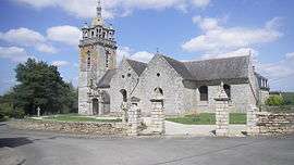
The church in Saint-Servant | ||
| ||
 Saint-Servant | ||
|
Location within Brittany region  Saint-Servant | ||
| Coordinates: 47°54′58″N 2°30′41″W / 47.9161°N 2.5114°WCoordinates: 47°54′58″N 2°30′41″W / 47.9161°N 2.5114°W | ||
| Country | France | |
| Region | Brittany | |
| Department | Morbihan | |
| Arrondissement | Pontivy | |
| Canton | Josselin | |
| Intercommunality | Pays de Josselin | |
| Government | ||
| • Mayor (2008—2014) | Alain Commandoux | |
| Area1 | 22.40 km2 (8.65 sq mi) | |
| Population (1999)2 | 810 | |
| • Density | 36/km2 (94/sq mi) | |
| Time zone | CET (UTC+1) | |
| • Summer (DST) | CEST (UTC+2) | |
| INSEE/Postal code | 56236 / 56120 | |
| Elevation | 22–163 m (72–535 ft) | |
|
1 French Land Register data, which excludes lakes, ponds, glaciers > 1 km² (0.386 sq mi or 247 acres) and river estuaries. 2 Population without double counting: residents of multiple communes (e.g., students and military personnel) only counted once. | ||

Saint-Servant (Breton: Sant-Servant-an-Oud) is a commune in the Morbihan department of Brittany in north-western France.
Demographics
Inhabitants of Saint-Servant are called in French Servantais.
See also
References
External links
| Wikimedia Commons has media related to Saint-Servant. |
- French Ministry of Culture list for Saint-Servant (French)
- Map of Saint-Servant on Michelin (English)
This article is issued from Wikipedia - version of the 2/18/2016. The text is available under the Creative Commons Attribution/Share Alike but additional terms may apply for the media files.