Le Saint
For other uses, see Saint (disambiguation).
| Le Saint Ar Sent | ||
|---|---|---|
|
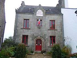
The town hall in Le Saint | ||
| ||
 Le Saint | ||
|
Location within Brittany region  Le Saint | ||
| Coordinates: 48°05′25″N 3°33′40″W / 48.0903°N 3.5611°WCoordinates: 48°05′25″N 3°33′40″W / 48.0903°N 3.5611°W | ||
| Country | France | |
| Region | Brittany | |
| Department | Morbihan | |
| Arrondissement | Pontivy | |
| Canton | Gourin | |
| Intercommunality | Pays du Roi Morvan | |
| Government | ||
| • Mayor (2008—2014) | Yves Le Goff | |
| Area1 | 31.03 km2 (11.98 sq mi) | |
| Population (1999)2 | 696 | |
| • Density | 22/km2 (58/sq mi) | |
| Time zone | CET (UTC+1) | |
| • Summer (DST) | CEST (UTC+2) | |
| INSEE/Postal code | 56201 / 56110 | |
| Elevation | 73–223 m (240–732 ft) | |
|
1 French Land Register data, which excludes lakes, ponds, glaciers > 1 km² (0.386 sq mi or 247 acres) and river estuaries. 2 Population without double counting: residents of multiple communes (e.g., students and military personnel) only counted once. | ||
.svg.png)
Le Saint (Breton: Ar Sent) is a commune in the Morbihan department of Brittany in north-western France.
Breton language
The municipality launched a Breton linguistic plan through Ya d'ar brezhoneg on February the 24th of 2005.
See also
References
External links
| Wikimedia Commons has media related to Le Saint. |
- French Ministry of Culture list for Le Saint (French)
- Map of Le Saint on Michelin (English)
This article is issued from Wikipedia - version of the 2/13/2015. The text is available under the Creative Commons Attribution/Share Alike but additional terms may apply for the media files.